![](/images/other/stat-length.png)
![Tour Wandern Esquelbecq - Des chênes au château - Esquelbecq - Photo](https://media.geolcdn.com/t/1900/400/ext.pjpeg?maxdim=2&url=https%3A%2F%2Fservices.sitytrail.com%2FGeolivesWS%2FDownloadMedia.ashx%3FTrailID%3D109098%26Media%3D3151_6.jpg)
Des chênes au château - Esquelbecq
tracegps
Benutzer
![Länge](/images/other/stat-length.png)
Länge
11,6 km
![Maximale Höhe](https://static1.geolcdn.com/siteimages/upload/files/1508320355ic_sort_altitude_max_24dp.png)
Maximale Höhe
24 m
![Positive Höhendifferenz](https://static1.geolcdn.com/siteimages/upload/files/1508320355ic_sort_den_pos_24dp.png)
Positive Höhendifferenz
55 m
![Km-Effort](/images/other/stat-length.png)
Km-Effort
12,4 km
![Min. Höhe](https://static1.geolcdn.com/siteimages/upload/files/1508320355ic_sort_altitude_min_24dp.png)
Min. Höhe
11 m
![Negative Höhendifferenz](https://static1.geolcdn.com/siteimages/upload/files/1508320355ic_sort_den_neg_24dp.png)
Negative Höhendifferenz
54 m
![Boucle](https://static1.geolcdn.com/siteimages/upload/files/16400158638029165_repeat_loop_refresh_sync_direction_icon.png)
Boucle
Ja
Erstellungsdatum :
2014-12-10 00:00:00.0
Letzte Änderung :
2014-12-10 00:00:00.0
![Wandern](https://static1.geolcdn.com/sitytour/trail-icons/101.png)
3h00
Schwierigkeit : Medium
![Scannen Sie diesen QR-Code, um die Tour in der SityTrail-Anwendung zu öffnen](https://capi.geolives.com/qq0zvz2zws4bq2lad0pu/sitytour/trails/109098/qr.png?size=200)
Kostenlosegpshiking-Anwendung
Über SityTrail
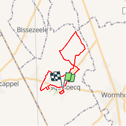
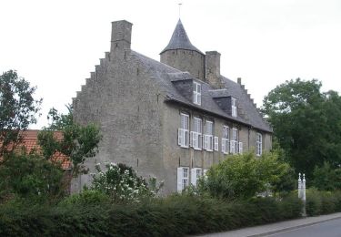
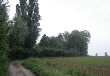
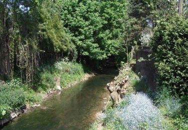
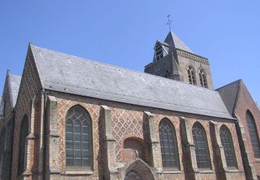
Tour Wandern von 11,6 km verfügbar auf Nordfrankreich, Nord, Esquelbecq. Diese Tour wird von tracegps vorgeschlagen.
Beschreibung
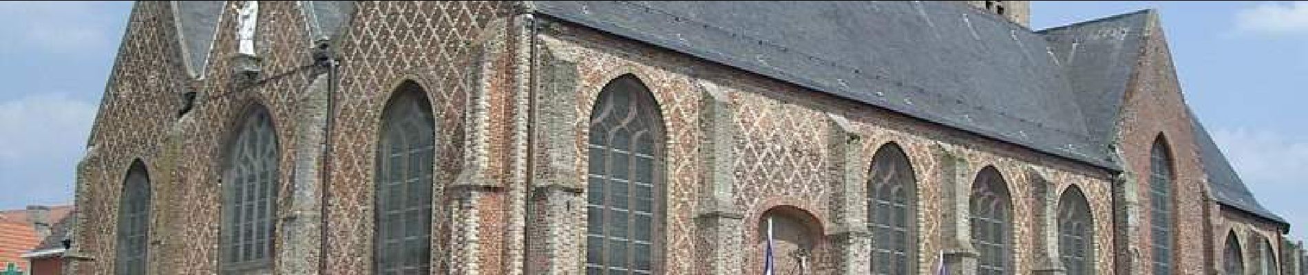
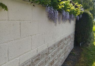
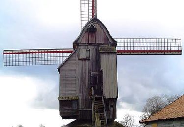
Départ de l’office de Tourisme d’Esquelbecq. Au cœur d'un paysage agricole marqué, la vallée de l'Yser présente des reliquats de bocage traditionnel. Retrouvez cette randonnée sur le site du Comité Départemental du Tourisme du Nord.
Ort
Land:
France
Region :
Nordfrankreich
Abteilung/Provinz :
Nord
Kommune :
Esquelbecq
Standort:
Unknown
Gehen Sie:(Dec)
Gehen Sie:(UTM)
459967 ; 5637284 (31U) N.
Kommentare
Touren in der Umgebung
![Tour Fahrrad Esquelbecq - Boucle d'Esquelbecq - Photo](https://media.geolcdn.com/t/375/260/ext.jpg?maxdim=2&url=https%3A%2F%2Fservices.sitytrail.com%2FGeolivesWS%2FDownloadMedia.ashx%3FTrailID%3D118733%26Media%3D12926_6.jpg)
![Fahrrad Fahrrad](https://static1.geolcdn.com/sitytour/trail-icons/200.png)
Boucle d'Esquelbecq
Fahrrad
Medium
Esquelbecq,
Nordfrankreich,
Nord,
France
![](/images/other/stat-length.png)
28 km | 30 km-effort
1h 30min
![](https://static1.geolcdn.com/siteimages/upload/files/16400158638029165_repeat_loop_refresh_sync_direction_icon.png)
Ja
![Tour Wandern Wormhout - La Plaine au Bois (Massacre du 28 mai 1940) - Wormhout - Photo](https://media.geolcdn.com/t/375/260/ext.jpg?maxdim=2&url=https%3A%2F%2Fservices.sitytrail.com%2FGeolivesWS%2FDownloadMedia.ashx%3FTrailID%3D111841%26Media%3D8598_6.jpg)
![Wandern Wandern](https://static1.geolcdn.com/sitytour/trail-icons/101.png)
La Plaine au Bois (Massacre du 28 mai 1940) - Wormhout
Wandern
Einfach
Wormhout,
Nordfrankreich,
Nord,
France
![](/images/other/stat-length.png)
7,4 km | 7,9 km-effort
2h 0min
![](https://static1.geolcdn.com/siteimages/upload/files/16400158638029165_repeat_loop_refresh_sync_direction_icon.png)
Ja
![Tour Wandern Zegerscappel - Circuit du Rijssel Berg - Zegerscappel - Photo](https://media.geolcdn.com/t/375/260/ext.jpg?maxdim=2&url=https%3A%2F%2Fservices.sitytrail.com%2FGeolivesWS%2FDownloadMedia.ashx%3FTrailID%3D110281%26Media%3D5676_6.jpg)
![Wandern Wandern](https://static1.geolcdn.com/sitytour/trail-icons/101.png)
Circuit du Rijssel Berg - Zegerscappel
Wandern
Medium
Zegerscappel,
Nordfrankreich,
Nord,
France
![](/images/other/stat-length.png)
9,4 km | 10,2 km-effort
2h 25min
![](https://static1.geolcdn.com/siteimages/upload/files/16400158638029165_repeat_loop_refresh_sync_direction_icon.png)
Ja
![Tour Wandern Wylder - Circuit GPS du Château de la Briarde - Wylder - Photo](https://media.geolcdn.com/t/375/260/ext.jpg?maxdim=2&url=https%3A%2F%2Fservices.sitytrail.com%2FGeolivesWS%2FDownloadMedia.ashx%3FTrailID%3D109199%26Media%3D3269_6.jpg)
![Wandern Wandern](https://static1.geolcdn.com/sitytour/trail-icons/101.png)
Circuit GPS du Château de la Briarde - Wylder
Wandern
Medium
Wylder,
Nordfrankreich,
Nord,
France
![](/images/other/stat-length.png)
11,2 km | 11,9 km-effort
2h 49min
![](https://static1.geolcdn.com/siteimages/upload/files/16400158638029165_repeat_loop_refresh_sync_direction_icon.png)
Ja
![Tour Wandern Wormhout - Circuit du moulin de la Briarde - Wormhout - Photo](https://media.geolcdn.com/t/375/260/ext.jpg?maxdim=2&url=https%3A%2F%2Fservices.sitytrail.com%2FGeolivesWS%2FDownloadMedia.ashx%3FTrailID%3D109092%26Media%3D3142_6.jpg)
![Wandern Wandern](https://static1.geolcdn.com/sitytour/trail-icons/101.png)
Circuit du moulin de la Briarde - Wormhout
Wandern
Schwierig
Wormhout,
Nordfrankreich,
Nord,
France
![](/images/other/stat-length.png)
13,8 km | 14,6 km-effort
3h 30min
![](https://static1.geolcdn.com/siteimages/upload/files/16400158638029165_repeat_loop_refresh_sync_direction_icon.png)
Ja
![Tour Wandern Esquelbecq - La plaine au Bois - Photo](https://media.geolcdn.com/t/375/260/ext.jpg?maxdim=2&url=https%3A%2F%2Fservices.sitytrail.com%2FGeolivesWS%2FDownloadMedia.ashx%3FTrailID%3D108133%26Media%3D155_6.jpg)
![Wandern Wandern](https://static1.geolcdn.com/sitytour/trail-icons/101.png)
La plaine au Bois
Wandern
Medium
(1)
Esquelbecq,
Nordfrankreich,
Nord,
France
![](/images/other/stat-length.png)
16,2 km | 17,1 km-effort
3h 30min
![](https://static1.geolcdn.com/siteimages/upload/files/16400158638029165_repeat_loop_refresh_sync_direction_icon.png)
Ja
![Tour Wandern Ledringhem - ledringhem - Photo](https://media.geolcdn.com/t/375/260/4047c3bb-bba6-44a6-9ae1-01caf73dddcd.jpg&format=jpg&maxdim=2)
![Wandern Wandern](https://static1.geolcdn.com/sitytour/trail-icons/101.png)
ledringhem
Wandern
Medium
Ledringhem,
Nordfrankreich,
Nord,
France
![](/images/other/stat-length.png)
14,4 km | 15,2 km-effort
3h 11min
![](https://static1.geolcdn.com/siteimages/upload/files/16400158638029165_repeat_loop_refresh_sync_direction_icon.png)
Ja
![Tour Fahrrad Wormhout - Les Rives de l'Yser 2 - Wormhout - Photo](https://media.geolcdn.com/t/375/260/ext.jpg?maxdim=2&url=https%3A%2F%2Fservices.sitytrail.com%2FGeolivesWS%2FDownloadMedia.ashx%3FTrailID%3D109524%26Media%3D4103_1.jpg)
![Fahrrad Fahrrad](https://static1.geolcdn.com/sitytour/trail-icons/200.png)
Les Rives de l'Yser 2 - Wormhout
Fahrrad
Medium
Wormhout,
Nordfrankreich,
Nord,
France
![](/images/other/stat-length.png)
37 km | 39 km-effort
2h 30min
![](https://static1.geolcdn.com/siteimages/upload/files/16400158638029165_repeat_loop_refresh_sync_direction_icon.png)
Ja
![Tour Wandern Wormhout - moulin de la Briarde - Photo](https://media.geolcdn.com/t/375/260/ext.jpg?maxdim=2&url=https%3A%2F%2Fstatic1.geolcdn.com%2Fsiteimages%2Fupload%2Ffiles%2F1553511878bg_sport_marche.png)
![Wandern Wandern](https://static1.geolcdn.com/sitytour/trail-icons/101.png)
moulin de la Briarde
Wandern
Einfach
Wormhout,
Nordfrankreich,
Nord,
France
![](/images/other/stat-length.png)
6,8 km | 7,3 km-effort
2h 0min
![](https://static1.geolcdn.com/siteimages/upload/files/16400158638029165_repeat_loop_refresh_sync_direction_icon.png)
Ja