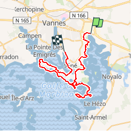
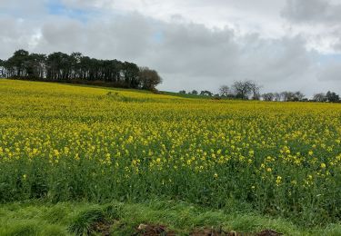
![](/images/other/stat-length.png)
![Tour Wandern Theix-Noyalo - Tour du Golfe du Morbihan - 06 - Séné - Photo](https://media.geolcdn.com/t/1900/400/ext.pjpeg?maxdim=2&url=https%3A%2F%2Fservices.sitytrail.com%2FGeolivesWS%2FDownloadMedia.ashx%3FTrailID%3D109036%26Media%3D3002_2.jpg)
Tour du Golfe du Morbihan - 06 - Séné
tracegps
Benutzer
![Länge](/images/other/stat-length.png)
![Maximale Höhe](https://static1.geolcdn.com/siteimages/upload/files/1508320355ic_sort_altitude_max_24dp.png)
![Positive Höhendifferenz](https://static1.geolcdn.com/siteimages/upload/files/1508320355ic_sort_den_pos_24dp.png)
![Km-Effort](/images/other/stat-length.png)
![Min. Höhe](https://static1.geolcdn.com/siteimages/upload/files/1508320355ic_sort_altitude_min_24dp.png)
![Negative Höhendifferenz](https://static1.geolcdn.com/siteimages/upload/files/1508320355ic_sort_den_neg_24dp.png)
![Boucle](https://static1.geolcdn.com/siteimages/upload/files/16400158638029165_repeat_loop_refresh_sync_direction_icon.png)
![Wandern](https://static1.geolcdn.com/sitytour/trail-icons/101.png)
6h00
Schwierigkeit : Schwierig
![Scannen Sie diesen QR-Code, um die Tour in der SityTrail-Anwendung zu öffnen](https://capi.geolives.com/qq0zvz2zws4bq2lad0pu/sitytour/trails/109036/qr.png?size=200)
Kostenlosegpshiking-Anwendung
Über SityTrail
Tour Wandern von 32 km verfügbar auf Bretagne, Morbihan, Theix-Noyalo. Diese Tour wird von tracegps vorgeschlagen.
Beschreibung
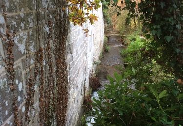
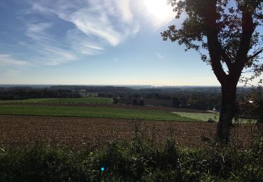
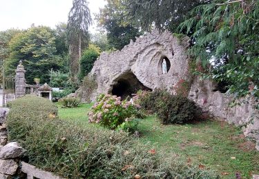
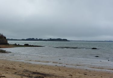
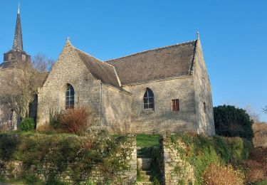
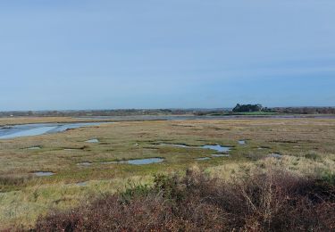
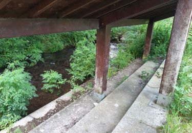
Tour du Golfe du Morbihan - 06 – Séné TOUS LES VISAGES DU GOLFE En faisant le tour de cette commune par les sentiers balisés, on découvre une mosaïque de paysages propres au Golfe du Morbihan : bocages agricoles, landes et bois, marais littoraux et prairies humides, ports de pêche et chantiers ostréicoles, îles et îlots, vasières, petites falaises, criques, plages… Séné a donné naissance à l’appellation sinagot, qui désigne aussi bien ses habitants que les bateaux de pêche traditionnels du golfe, comme si la robustesse et l’élégance des uns reflétaient le caractère des autres. Quelques sinagots naviguent encore, que l’on reconnaît aisément à leurs coques noires et à leurs voiles tannées sur deux mâts inclinés vers l’arrière. La pêche se concentre aujourd’hui à Port Anna. Le printemps donne le départ de la pêche aux «morgates», nom local des seiches… La suite et beaucoup d’autres informations à propos du Tour du Golfe du Morbihan sur le site Bretagne – Rando.com. Crédit photos : © J.Y. Thiebault - T. Hair - Thomas & Thomas / Droits réservés CG 56
Ort
Kommentare
Touren in der Umgebung
![Tour Wandern Saint-Avé - St Ave moulin - Photo](https://media.geolcdn.com/t/375/260/ext.jpg?maxdim=2&url=https%3A%2F%2Fservices.sitytrail.com%2FGeolivesWS%2FDownloadMedia.ashx%3FTrailID%3D366703%26Media%3D20141201092230.jpg)
![Wandern Wandern](https://static1.geolcdn.com/sitytour/trail-icons/101.png)
Wandern
![](/images/other/stat-length.png)
![](https://static1.geolcdn.com/siteimages/upload/files/16400158638029165_repeat_loop_refresh_sync_direction_icon.png)
![Tour Wandern Treffléan - Bizole - Photo](https://media.geolcdn.com/t/375/260/ext.jpg?maxdim=2&url=https%3A%2F%2Fservices.sitytrail.com%2FGeolivesWS%2FDownloadMedia.ashx%3FTrailID%3D191920%26Media%3Dfb5fe928-9f5d-4af5-aad3-ccb04a0144c1.JPG)
![Wandern Wandern](https://static1.geolcdn.com/sitytour/trail-icons/101.png)
![Tour Wandern Séné - PR_56_Sene_IA_09_Circuit1b_Sentier-Des-Gabelous_20240311 - Photo](https://media.geolcdn.com/t/375/260/ext.jpg?maxdim=2&url=https%3A%2F%2Fmedia.geolcdn.com%2Ff%2Fc2ea644e-e03f-4409-ac55-71c5dee67584.jpg)
![Wandern Wandern](https://static1.geolcdn.com/sitytour/trail-icons/101.png)
Wandern
![](/images/other/stat-length.png)
![](https://static1.geolcdn.com/siteimages/upload/files/16400158638029165_repeat_loop_refresh_sync_direction_icon.png)
![Tour Wandern Treffléan - PR_56_Trefflean_AA_01_Circuit1b_De-La-Chapelle-De-Bizole_20240111 - Photo](https://media.geolcdn.com/t/375/260/ext.jpg?maxdim=2&url=https%3A%2F%2Fmedia.geolcdn.com%2Ff%2F33cdd34a-a9e1-478f-975c-2bd4facddb06.jpg)
![Wandern Wandern](https://static1.geolcdn.com/sitytour/trail-icons/101.png)
Wandern
![](/images/other/stat-length.png)
![](https://static1.geolcdn.com/siteimages/upload/files/16400158638029165_repeat_loop_refresh_sync_direction_icon.png)
![Tour Wandern Séné - PR_56_Sene_GA_07_Circuit3b_Entre-Bocage-Et-Marais_20231115 - Photo](https://media.geolcdn.com/t/375/260/ext.jpg?maxdim=2&url=https%3A%2F%2Fmedia.geolcdn.com%2Ff%2F90de986c-3b14-49b7-b42b-f41416db033a.jpg)
![Wandern Wandern](https://static1.geolcdn.com/sitytour/trail-icons/101.png)
Wandern
![](/images/other/stat-length.png)
![](https://static1.geolcdn.com/siteimages/upload/files/16400158638029165_repeat_loop_refresh_sync_direction_icon.png)
![Tour Wandern Saint-Avé - St Avé le circuit des moulins - Photo](https://media.geolcdn.com/t/375/260/ext.jpg?maxdim=2&url=https%3A%2F%2Fmedia.geolcdn.com%2Ff%2F2045fceb-7a39-4d1b-afed-6f7232655847.jpg)
![Wandern Wandern](https://static1.geolcdn.com/sitytour/trail-icons/101.png)
Wandern
![](/images/other/stat-length.png)
![](https://static1.geolcdn.com/siteimages/upload/files/16400158638029165_repeat_loop_refresh_sync_direction_icon.png)
![Tour Wandern Theix-Noyalo - PR_56_Theix-Noyalo_AA_01_Circuit3b_Vers-Corn-Er-Hoet_20230401 - Photo](https://media.geolcdn.com/t/375/260/ext.jpg?maxdim=2&url=https%3A%2F%2Fmedia.geolcdn.com%2Ff%2F53a27219-59ef-468a-9654-2c8ca963d998.jpg)
![Wandern Wandern](https://static1.geolcdn.com/sitytour/trail-icons/101.png)
Wandern
![](/images/other/stat-length.png)
![](https://static1.geolcdn.com/siteimages/upload/files/16400158638029165_repeat_loop_refresh_sync_direction_icon.png)
![Tour Wandern Séné - PR_56_Sene_FA_06_Circuit3b_Le-Bourg-Et-Ses-Rivages_20230206 - Photo](https://media.geolcdn.com/t/375/260/ext.jpg?maxdim=2&url=https%3A%2F%2Fmedia.geolcdn.com%2Ff%2F169b12f8-5799-478a-8a15-2ebf012a9c5c.jpg)
![Wandern Wandern](https://static1.geolcdn.com/sitytour/trail-icons/101.png)
Wandern
![](/images/other/stat-length.png)
![](https://static1.geolcdn.com/siteimages/upload/files/16400158638029165_repeat_loop_refresh_sync_direction_icon.png)
![Tour Wandern Séné - PR_56_Sene_EA_05_Circuit3b_Des-Voiles-Rouges_20230206 - Photo](https://media.geolcdn.com/t/375/260/ext.jpg?maxdim=2&url=https%3A%2F%2Fmedia.geolcdn.com%2Ff%2F8bdcd2eb-63db-4496-af6b-fc64377581ff.jpg)
![Wandern Wandern](https://static1.geolcdn.com/sitytour/trail-icons/101.png)
Wandern
![](/images/other/stat-length.png)
![](https://static1.geolcdn.com/siteimages/upload/files/16400158638029165_repeat_loop_refresh_sync_direction_icon.png)