![](/images/other/stat-length.png)
![Tour Wandern Pontarlier - Montagne du Larmont (1323 m) - Photo](https://media.geolcdn.com/t/1900/400/ext.pjpeg?maxdim=2&url=https%3A%2F%2Fservices.sitytrail.com%2FGeolivesWS%2FDownloadMedia.ashx%3FTrailID%3D108781%26Media%3D1923_2.jpg)
Montagne du Larmont (1323 m)
tracegps
Benutzer
![Länge](/images/other/stat-length.png)
![Maximale Höhe](https://static1.geolcdn.com/siteimages/upload/files/1508320355ic_sort_altitude_max_24dp.png)
![Positive Höhendifferenz](https://static1.geolcdn.com/siteimages/upload/files/1508320355ic_sort_den_pos_24dp.png)
![Km-Effort](/images/other/stat-length.png)
![Min. Höhe](https://static1.geolcdn.com/siteimages/upload/files/1508320355ic_sort_altitude_min_24dp.png)
![Negative Höhendifferenz](https://static1.geolcdn.com/siteimages/upload/files/1508320355ic_sort_den_neg_24dp.png)
![Boucle](https://static1.geolcdn.com/siteimages/upload/files/16400158638029165_repeat_loop_refresh_sync_direction_icon.png)
![Wandern](https://static1.geolcdn.com/sitytour/trail-icons/101.png)
4h30
Schwierigkeit : Schwierig
![Scannen Sie diesen QR-Code, um die Tour in der SityTrail-Anwendung zu öffnen](https://capi.geolives.com/qq0zvz2zws4bq2lad0pu/sitytour/trails/108781/qr.png?size=200)
Kostenlosegpshiking-Anwendung
Über SityTrail
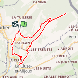
Tour Wandern von 18,3 km verfügbar auf Burgund und Freigrafschaft, Doubs, Pontarlier. Diese Tour wird von tracegps vorgeschlagen.
Beschreibung
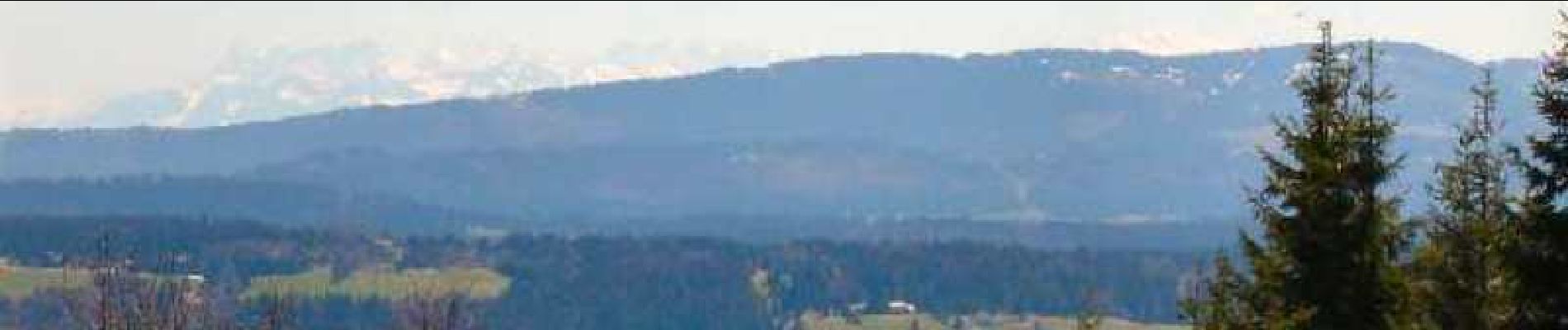
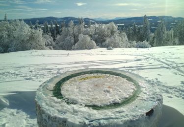
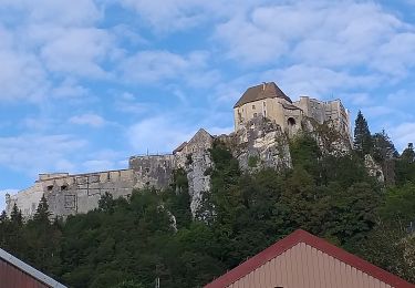
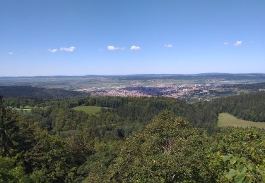
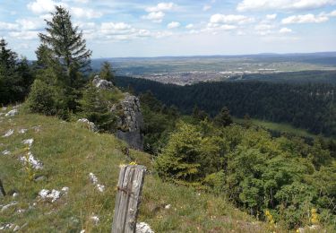
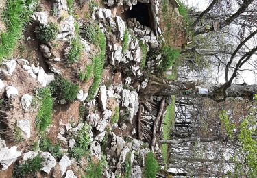
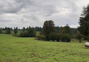
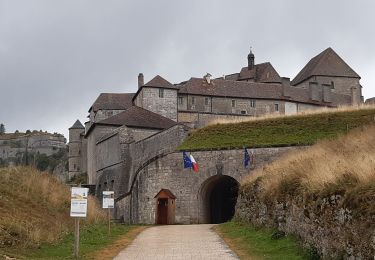
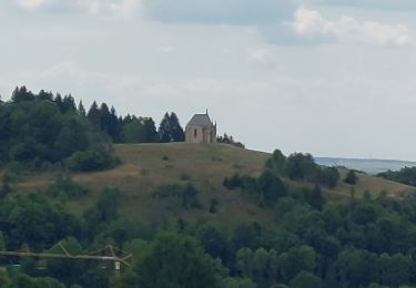
Très belle randonnée à travers des alpages jurassiens typiques. Belle récompense au sommet, avec par temps clair vue sur les Alpes bernoises et vaudoises, le Mont-Blanc, les sommets du Chasseron et du Suchet, le lac Saint-Point. Rencontre fréquente avec des chamois et magnifiques parterres bleus de gentianes printanières début mai. Ce parcours emprunte entre les deux forts du Larmont de nombreuses pâtures hors sentiers balisés. Merci de les respecter et de les éviter durant la saison de pacage ou de fenaison. Une variante est proposée en fin de descriptif. La suite avec d’autres informations et photos est ICI
Ort
Kommentare
Touren in der Umgebung
![Tour Mountainbike Pontarlier - favrotte 2013 - Photo](https://media.geolcdn.com/t/375/260/ext.jpg?maxdim=2&url=https%3A%2F%2Fstatic1.geolcdn.com%2Fsiteimages%2Fupload%2Ffiles%2F1524743154velo.jpg)
![Mountainbike Mountainbike](https://static1.geolcdn.com/sitytour/trail-icons/202.png)
Mountainbike
![](/images/other/stat-length.png)
![](https://static1.geolcdn.com/siteimages/upload/files/16400158638029165_repeat_loop_refresh_sync_direction_icon.png)
![Tour Schneeschuhwandern Pontarlier - Pontarlier Gounfay Grand Taureau 2021-01-19 CAF - Photo](https://media.geolcdn.com/t/375/260/6d3d4614-7fee-4759-a4c2-7b058386012d.jpg&format=jpg&maxdim=2)
![Schneeschuhwandern Schneeschuhwandern](https://static1.geolcdn.com/sitytour/trail-icons/504.png)
Schneeschuhwandern
![](/images/other/stat-length.png)
![](https://static1.geolcdn.com/siteimages/upload/files/16400158638029165_repeat_loop_refresh_sync_direction_icon.png)
![Tour Wandern La Cluse-et-Mijoux - le grand taureau, la Cluse et Mijoux - Photo](https://media.geolcdn.com/t/375/260/0cb61e11-ae8c-43af-9765-5d7fbec9633a.jpg&format=jpg&maxdim=2)
![Wandern Wandern](https://static1.geolcdn.com/sitytour/trail-icons/101.png)
Wandern
![](/images/other/stat-length.png)
![](https://static1.geolcdn.com/siteimages/upload/files/16400158638029165_repeat_loop_refresh_sync_direction_icon.png)
![Tour Wandern Pontarlier - le grand taureau, Pontarlier - Photo](https://media.geolcdn.com/t/375/260/d15871e2-3d8a-47b8-b9b7-cb07d343a2f0.jpg&format=jpg&maxdim=2)
![Wandern Wandern](https://static1.geolcdn.com/sitytour/trail-icons/101.png)
Wandern
![](/images/other/stat-length.png)
![](https://static1.geolcdn.com/siteimages/upload/files/16400158638029165_repeat_loop_refresh_sync_direction_icon.png)
![Tour Wandern Pontarlier - le grand taureau - Photo](https://media.geolcdn.com/t/375/260/c493226f-a63a-474e-b09f-e012657de2cb.jpg&format=jpg&maxdim=2)
![Wandern Wandern](https://static1.geolcdn.com/sitytour/trail-icons/101.png)
Wandern
![](/images/other/stat-length.png)
![](https://static1.geolcdn.com/siteimages/upload/files/16400158638029165_repeat_loop_refresh_sync_direction_icon.png)
![Tour Wandern Pontarlier - Le Grand Taureau 19.3 km D+661 m 20240512 - Photo](https://media.geolcdn.com/t/375/260/cb93b4ef-1227-4efa-ae03-315ee0ca5b8b.jpg&format=jpg&maxdim=2)
![Wandern Wandern](https://static1.geolcdn.com/sitytour/trail-icons/101.png)
Wandern
![](/images/other/stat-length.png)
![](https://static1.geolcdn.com/siteimages/upload/files/16400158638029165_repeat_loop_refresh_sync_direction_icon.png)
![Tour Wandern La Cluse-et-Mijoux - GTJ 2 La Cluse et Mijoux, Metabief - Photo](https://media.geolcdn.com/t/375/260/7d9920e8-a7cf-43a6-9d76-a34068b88805.jpg&format=jpg&maxdim=2)
![Wandern Wandern](https://static1.geolcdn.com/sitytour/trail-icons/101.png)
Wandern
![](/images/other/stat-length.png)
![](https://static1.geolcdn.com/siteimages/upload/files/16400158638029165_repeat_loop_refresh_sync_direction_icon.png)
![Tour Wandern Pontarlier - GTJ 1 Pontarlier, La Cluse et Mijoux - Photo](https://media.geolcdn.com/t/375/260/efd36da2-9ee9-4b66-84f3-28ba542eecaf.jpg&format=jpg&maxdim=2)
![Wandern Wandern](https://static1.geolcdn.com/sitytour/trail-icons/101.png)
Wandern
![](/images/other/stat-length.png)
![](https://static1.geolcdn.com/siteimages/upload/files/16400158638029165_repeat_loop_refresh_sync_direction_icon.png)
![Tour Wandern Pontarlier - FORT MALHER DEPUIS LE CAMPING DU LARMONT - Photo](https://media.geolcdn.com/t/375/260/fcd3995e-a5cd-4fa5-b475-d58fca508406.jpg&format=jpg&maxdim=2)
![Wandern Wandern](https://static1.geolcdn.com/sitytour/trail-icons/101.png)
Wandern
![](/images/other/stat-length.png)
![](https://static1.geolcdn.com/siteimages/upload/files/16400158638029165_repeat_loop_refresh_sync_direction_icon.png)
inutilisable