Tour Pferd Iffendic - Témelin - Paimpont - Equibreizh - Photo

Témelin - Paimpont - Equibreizh

 tracegps
tracegps

Benutzer

© OpenStreetMap contributors
Länge
Länge
40 km
Maximale Höhe
Maximale Höhe
177 m
Positive Höhendifferenz
515 m
Km-Effort
Km-Effort  
47 km
Min. Höhe
Min. Höhe
58 m
Negative Höhendifferenz
450 m
Boucle
Boucle
Nein
Erstellungsdatum :
2014-12-10 00:00:00.0
Letzte Änderung :
2014-12-10 00:00:00.0

(0 Nachricht)

Pferd
Pferd
4h00
Schwierigkeit : Sehr schwierig

Scannen Sie diesen QR-Code, um die Tour in der SityTrail-Anwendung zu öffnen

Kostenlosegpshiking-Anwendung

Logo SityTrail SityTrail

IGN / Geografische Institute

SityTrail aus dem App Store herunterladen SityTrail von Google Play herunterladen

Logo SityTrail SityTrail World

Die Welt öffnet sich für Sie

SityTrail aus dem App Store herunterladen SityTrail von Google Play herunterladen SityTrail auf Huawei AppGallery herunterladen

Über SityTrail

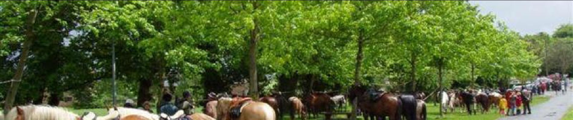
Tour Pferd von 40 km verfügbar auf Bretagne, Ille-et-Vilaine, Iffendic. Diese Tour wird von tracegps vorgeschlagen.

Beschreibung

Balade présentée par l’Association des Amis du Cheval d'Ille et Vilaine D’autres informations sont disponibles sur le site de l’Equibreizh L’utilisation de ce tracé reste de la responsabilité des randonneurs équestres, c'est-à-dire qu'il appartient à ceux-ci de vérifier qu'au moment de leur utilisation, les circuits sont toujours corrects même si nous veillons à ce qu'ils le soient en permanence, et de plus notre responsabilité ne serait pas engagée si l'un des circuits était non praticable ou bouché, ou si l'utilisation était différente de celle que nous avons validée, à savoir équestre.

Höhenprofil

Foto-Galerie

Ort

Land:
France
Region :
Bretagne
Abteilung/Provinz :
Ille-et-Vilaine
Kommune :
Iffendic
Standort:
Unknown
Gehen Sie:(Dec)
Gehen Sie:(UTM)
570633 ; 5325298 (30U) N.

Touren in der Umgebung

Tour Wandern Saint-Malon-sur-Mel - La basse forêt de Brocéliande - Photo
Wandern
neoroll44

Wandern

Schwierig
(2)
Saint-Malon-sur-Mel, Bretagne, Ille-et-Vilaine, France
22 km | 25 km-effort
5h 35min
Ja
Tour Zu Fuß Saint-Malon-sur-Mel - A la mémoire de Merlin - Photo
Zu Fuß
GUIDE+

Zu Fuß

Einfach
Saint-Malon-sur-Mel, Bretagne, Ille-et-Vilaine, France
12,9 km | 15 km-effort
3h 25min
Ja
Tour Zu Fuß Iffendic - Lac et landiers de Trémelin - Photo
Zu Fuß
GUIDE+

Zu Fuß

Einfach
Iffendic, Bretagne, Ille-et-Vilaine, France
9,9 km | 11,4 km-effort
2h 34min
Ja
Tour Zu Fuß Iffendic - La Pierre Longue - Photo
Zu Fuß
GUIDE+

Zu Fuß

Einfach
Iffendic, Bretagne, Ille-et-Vilaine, France
8,3 km | 9,9 km-effort
2h 15min
Ja
Tour Zu Fuß Iffendic - Le Tour du Lac de Trémelin - Photo
Zu Fuß
GUIDE+

Zu Fuß

Einfach
Iffendic, Bretagne, Ille-et-Vilaine, France
5 km | 5,5 km-effort
1h 15min
Ja
Tour Wandern Saint-Malon-sur-Mel - Merlin 12.8 ip - Photo
Wandern
MichelRando7656

Wandern

Schwierig
Saint-Malon-sur-Mel, Bretagne, Ille-et-Vilaine, France
13,8 km | 15,9 km-effort
4h 1min
Ja
Tour Wandern Iffendic - GR_37_CC_37_Iffendic_Plelan-le-Grand_20220821 - Photo
Wandern
patrickdanilo

Wandern

Einfach
Iffendic, Bretagne, Ille-et-Vilaine, France
22 km | 25 km-effort
5h 25min
Nein
Tour Zu Fuß Saint-Gonlay - Circuit de Lorinou - Photo
Zu Fuß
GUIDE+

Zu Fuß

Einfach
Saint-Gonlay, Bretagne, Ille-et-Vilaine, France
9,2 km | 11 km-effort
2h 29min
Ja
Tour Zu Fuß Saint-Gonlay - Chemin des Moulins - Photo
Zu Fuß
GUIDE+

Zu Fuß

Einfach
Saint-Gonlay, Bretagne, Ille-et-Vilaine, France
7,9 km | 9,1 km-effort
2h 3min
Ja


Schließen
Meine Abonnements