![](/images/other/stat-length.png)
![Tour Wandern Mérey-sous-Montrond - Merey Sous Montrond CAF - Photo](https://media.geolcdn.com/t/1900/400/ext.pjpeg?maxdim=2&url=https%3A%2F%2Fservices.sitytrail.com%2FGeolivesWS%2FDownloadMedia.ashx%3FTrailID%3D1086383%26Media%3Dfix__20181218091016.jpg)
Merey Sous Montrond CAF
TRIMAILLE
Benutzer
![Länge](/images/other/stat-length.png)
Länge
21 km
![Maximale Höhe](https://static1.geolcdn.com/siteimages/upload/files/1508320355ic_sort_altitude_max_24dp.png)
Maximale Höhe
529 m
![Positive Höhendifferenz](https://static1.geolcdn.com/siteimages/upload/files/1508320355ic_sort_den_pos_24dp.png)
Positive Höhendifferenz
288 m
![Km-Effort](/images/other/stat-length.png)
Km-Effort
25 km
![Min. Höhe](https://static1.geolcdn.com/siteimages/upload/files/1508320355ic_sort_altitude_min_24dp.png)
Min. Höhe
416 m
![Negative Höhendifferenz](https://static1.geolcdn.com/siteimages/upload/files/1508320355ic_sort_den_neg_24dp.png)
Negative Höhendifferenz
284 m
![Boucle](https://static1.geolcdn.com/siteimages/upload/files/16400158638029165_repeat_loop_refresh_sync_direction_icon.png)
Boucle
Ja
Erstellungsdatum :
2019-04-26 14:10:21.08
Letzte Änderung :
2019-12-16 17:03:27.383
![Wandern](https://static1.geolcdn.com/sitytour/trail-icons/101.png)
7h24
Schwierigkeit : Schwierig
![Scannen Sie diesen QR-Code, um die Tour in der SityTrail-Anwendung zu öffnen](https://capi.geolives.com/qq0zvz2zws4bq2lad0pu/sitytour/trails/1086383/qr.png?size=200)
Kostenlosegpshiking-Anwendung
Über SityTrail
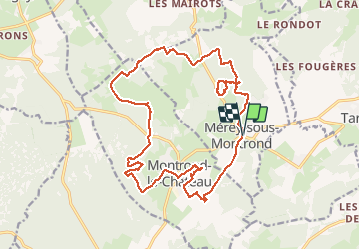
Tour Wandern von 21 km verfügbar auf Burgund und Freigrafschaft, Doubs, Mérey-sous-Montrond. Diese Tour wird von TRIMAILLE vorgeschlagen.
Beschreibung
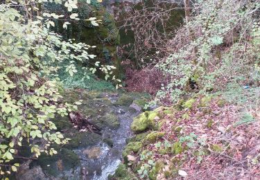
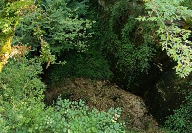
Randonnée karstique.
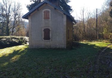
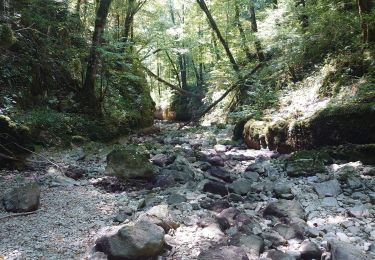
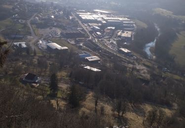
Ort
Land:
France
Region :
Burgund und Freigrafschaft
Abteilung/Provinz :
Doubs
Kommune :
Mérey-sous-Montrond
Standort:
Unknown
Gehen Sie:(Dec)
Gehen Sie:(UTM)
277826 ; 5226181 (32T) N.
Kommentare
Touren in der Umgebung
![Tour Wandern Ornans - Votre-dame du chêne - Photo](https://media.geolcdn.com/t/375/260/ext.jpg?maxdim=2&url=https%3A%2F%2Fmedia.geolcdn.com%2Ff%2Fc7bb9265-b47a-4388-88e0-f95f4287d390.jpg)
![Wandern Wandern](https://static1.geolcdn.com/sitytour/trail-icons/101.png)
Votre-dame du chêne
Wandern
Medium
(1)
Ornans,
Burgund und Freigrafschaft,
Doubs,
France
![](/images/other/stat-length.png)
14,3 km | 19,7 km-effort
2h 57min
![](https://static1.geolcdn.com/siteimages/upload/files/16400158638029165_repeat_loop_refresh_sync_direction_icon.png)
Ja
![Tour Zu Fuß Mamirolle - Sentier du Bois de la Fougère - Photo](https://media.geolcdn.com/t/375/260/ext.jpg?maxdim=2&url=https%3A%2F%2Fmedia.geolcdn.com%2Ff%2Fa8a8f146-f198-41be-852b-9ac1789ecd72.jpeg)
![Zu Fuß Zu Fuß](https://static1.geolcdn.com/sitytour/trail-icons/100.png)
Sentier du Bois de la Fougère
Zu Fuß
Einfach
Mamirolle,
Burgund und Freigrafschaft,
Doubs,
France
![](/images/other/stat-length.png)
7,3 km | 8,7 km-effort
1h 58min
![](https://static1.geolcdn.com/siteimages/upload/files/16400158638029165_repeat_loop_refresh_sync_direction_icon.png)
Ja
![Tour Wandern Ornans - ravin du puits noir - Photo](https://media.geolcdn.com/t/375/260/ext.jpg?maxdim=2&url=https%3A%2F%2Fstatic1.geolcdn.com%2Fsiteimages%2Fupload%2Ffiles%2F1553511878bg_sport_marche.png)
![Wandern Wandern](https://static1.geolcdn.com/sitytour/trail-icons/101.png)
ravin du puits noir
Wandern
Einfach
(1)
Ornans,
Burgund und Freigrafschaft,
Doubs,
France
![](/images/other/stat-length.png)
4,9 km | 6,3 km-effort
1h 32min
![](https://static1.geolcdn.com/siteimages/upload/files/16400158638029165_repeat_loop_refresh_sync_direction_icon.png)
Ja
![Tour Wandern Ornans - bonnevaux le bas - Photo](https://media.geolcdn.com/t/375/260/ext.jpg?maxdim=2&url=https%3A%2F%2Fmedia.geolcdn.com%2Ff%2F5ff62682-efb8-483f-8256-a13a182673fd.jpg)
![Wandern Wandern](https://static1.geolcdn.com/sitytour/trail-icons/101.png)
bonnevaux le bas
Wandern
Einfach
Ornans,
Burgund und Freigrafschaft,
Doubs,
France
![](/images/other/stat-length.png)
11,3 km | 15,3 km-effort
2h 40min
![](https://static1.geolcdn.com/siteimages/upload/files/16400158638029165_repeat_loop_refresh_sync_direction_icon.png)
Ja
![Tour Wandern Ornans - la brème-ornans - Photo](https://media.geolcdn.com/t/375/260/ext.jpg?maxdim=2&url=https%3A%2F%2Fmedia.geolcdn.com%2Ff%2F81308a17-509d-403e-8794-e1193f7b651d.jpg)
![Wandern Wandern](https://static1.geolcdn.com/sitytour/trail-icons/101.png)
la brème-ornans
Wandern
Medium
(1)
Ornans,
Burgund und Freigrafschaft,
Doubs,
France
![](/images/other/stat-length.png)
10 km | 14,7 km-effort
2h 12min
![](https://static1.geolcdn.com/siteimages/upload/files/16400158638029165_repeat_loop_refresh_sync_direction_icon.png)
Ja
![Tour Wandern Montrond-le-Château - montrond le château - Photo](https://media.geolcdn.com/t/375/260/ext.jpg?maxdim=2&url=https%3A%2F%2Fmedia.geolcdn.com%2Ff%2Fa8f869a6-d377-4ba5-83c8-e9c60f0b9066.jpg)
![Wandern Wandern](https://static1.geolcdn.com/sitytour/trail-icons/101.png)
montrond le château
Wandern
Sehr leicht
Montrond-le-Château,
Burgund und Freigrafschaft,
Doubs,
France
![](/images/other/stat-length.png)
8,1 km | 10 km-effort
2h 14min
![](https://static1.geolcdn.com/siteimages/upload/files/16400158638029165_repeat_loop_refresh_sync_direction_icon.png)
Ja
![Tour Nordic Walking Ornans - 12 septembre 2020 - Photo](https://media.geolcdn.com/t/375/260/ext.jpg?maxdim=2&url=https%3A%2F%2Fstatic1.geolcdn.com%2Fsiteimages%2Fupload%2Ffiles%2F1545311037marcheuse_200dpi.jpg)
![Nordic Walking Nordic Walking](https://static1.geolcdn.com/sitytour/trail-icons/102.png)
12 septembre 2020
Nordic Walking
(1)
Ornans,
Burgund und Freigrafschaft,
Doubs,
France
![](/images/other/stat-length.png)
13,1 km | 18,1 km-effort
2h 50min
![](https://static1.geolcdn.com/siteimages/upload/files/16400158638029165_repeat_loop_refresh_sync_direction_icon.png)
Ja
![Tour Wandern Épeugney - EPEUGNEY - Photo](https://media.geolcdn.com/t/375/260/ext.jpg?maxdim=2&url=https%3A%2F%2Fmedia.geolcdn.com%2Ff%2Fd83b687e-82a4-42eb-a250-4e0f6d422aed.jpg)
![Wandern Wandern](https://static1.geolcdn.com/sitytour/trail-icons/101.png)
EPEUGNEY
Wandern
Medium
Épeugney,
Burgund und Freigrafschaft,
Doubs,
France
![](/images/other/stat-length.png)
23 km | 28 km-effort
5h 2min
![](https://static1.geolcdn.com/siteimages/upload/files/16400158638029165_repeat_loop_refresh_sync_direction_icon.png)
Ja
![Tour Wandern Ornans - Château d'Ornans - Photo](https://media.geolcdn.com/t/375/260/ext.jpg?maxdim=2&url=https%3A%2F%2Fmedia.geolcdn.com%2Ff%2Fd09786ba-d225-43e6-accc-b46ba1c808dc.jpg)
![Wandern Wandern](https://static1.geolcdn.com/sitytour/trail-icons/101.png)
Château d'Ornans
Wandern
Sehr leicht
Ornans,
Burgund und Freigrafschaft,
Doubs,
France
![](/images/other/stat-length.png)
15,7 km | 22 km-effort
3h 9min
![](https://static1.geolcdn.com/siteimages/upload/files/16400158638029165_repeat_loop_refresh_sync_direction_icon.png)
Ja