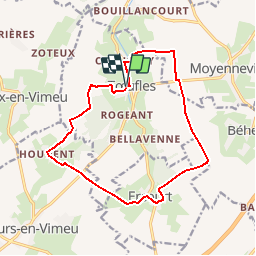
![](/images/other/stat-length.png)
![Tour Wandern Tœufles - Circuit de Toeufles - Photo](https://media.geolcdn.com/t/1900/400/ext.pjpeg?maxdim=2&url=https%3A%2F%2Fservices.sitytrail.com%2FGeolivesWS%2FDownloadMedia.ashx%3FTrailID%3D108618%26Media%3D1528_1.jpg)
Circuit de Toeufles
tracegps
Benutzer
![Länge](/images/other/stat-length.png)
![Maximale Höhe](https://static1.geolcdn.com/siteimages/upload/files/1508320355ic_sort_altitude_max_24dp.png)
![Positive Höhendifferenz](https://static1.geolcdn.com/siteimages/upload/files/1508320355ic_sort_den_pos_24dp.png)
![Km-Effort](/images/other/stat-length.png)
![Min. Höhe](https://static1.geolcdn.com/siteimages/upload/files/1508320355ic_sort_altitude_min_24dp.png)
![Negative Höhendifferenz](https://static1.geolcdn.com/siteimages/upload/files/1508320355ic_sort_den_neg_24dp.png)
![Boucle](https://static1.geolcdn.com/siteimages/upload/files/16400158638029165_repeat_loop_refresh_sync_direction_icon.png)
![Wandern](https://static1.geolcdn.com/sitytour/trail-icons/101.png)
4h40
Schwierigkeit : Sehr schwierig
![Scannen Sie diesen QR-Code, um die Tour in der SityTrail-Anwendung zu öffnen](https://capi.geolives.com/qq0zvz2zws4bq2lad0pu/sitytour/trails/108618/qr.png?size=200)
Kostenlosegpshiking-Anwendung
Über SityTrail
Tour Wandern von 13,6 km verfügbar auf Nordfrankreich, Somme, Tœufles. Diese Tour wird von tracegps vorgeschlagen.
Beschreibung
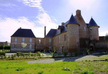
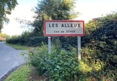
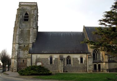
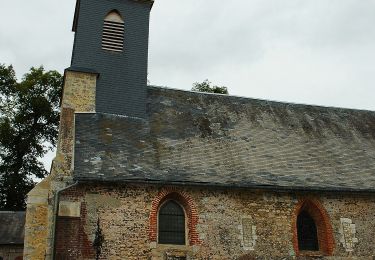
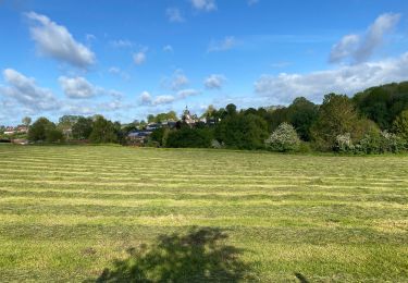
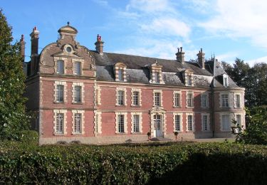
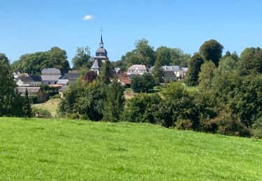
De modestes et charmants villages aux maisons traditionnelles, aux multiples croix et aux nombreuses sources alimentant la Trie, seule rivière du Vimeu vert. Pour télécharger la fiche du circuit en format pdf. Partez à la découverte de la Côte Picarde et de la Baie de Somme à travers 38 promenades et randonnées pédestres.
Ort
Kommentare
Touren in der Umgebung
![Tour Wandern Moyenneville - Le rideau Favery - Moyenneville - Photo](https://media.geolcdn.com/t/375/260/ext.jpg?maxdim=2&url=https%3A%2F%2Fservices.sitytrail.com%2FGeolivesWS%2FDownloadMedia.ashx%3FTrailID%3D108620%26Media%3D1530_1.jpg)
![Wandern Wandern](https://static1.geolcdn.com/sitytour/trail-icons/101.png)
Wandern
![](/images/other/stat-length.png)
![](https://static1.geolcdn.com/siteimages/upload/files/16400158638029165_repeat_loop_refresh_sync_direction_icon.png)
![Tour Wandern Miannay - Les Auteux - Miannay - Photo](https://media.geolcdn.com/t/375/260/ext.jpg?maxdim=2&url=https%3A%2F%2Fservices.sitytrail.com%2FGeolivesWS%2FDownloadMedia.ashx%3FTrailID%3D108619%26Media%3D1529_1.jpg)
![Wandern Wandern](https://static1.geolcdn.com/sitytour/trail-icons/101.png)
Wandern
![](/images/other/stat-length.png)
![](https://static1.geolcdn.com/siteimages/upload/files/16400158638029165_repeat_loop_refresh_sync_direction_icon.png)
![Tour Rennrad Béhen - Béhen Huppy Boëncourt - Photo](https://media.geolcdn.com/t/375/260/63d1e102-e234-4f81-9781-7a4437ef0dd2.jpg&format=jpg&maxdim=2)
![Rennrad Rennrad](https://static1.geolcdn.com/sitytour/trail-icons/201.png)
Rennrad
![](/images/other/stat-length.png)
![](https://static1.geolcdn.com/siteimages/upload/files/16400158638029165_repeat_loop_refresh_sync_direction_icon.png)
![Tour Laufen Béhen - Les Alleux - Photo](https://media.geolcdn.com/t/375/260/0b72ba47-eb3e-48ef-8977-db903cf4990c.jpg&format=jpg&maxdim=2)
![Laufen Laufen](https://static1.geolcdn.com/sitytour/trail-icons/103.png)
![Tour Zu Fuß Béhen - Vallée de Bienfay - Photo](https://media.geolcdn.com/t/375/260/2cb287af-8470-401f-a8b5-1e13f328d58d.jpeg&format=jpg&maxdim=2)
![Zu Fuß Zu Fuß](https://static1.geolcdn.com/sitytour/trail-icons/100.png)
Zu Fuß
![](/images/other/stat-length.png)
![](https://static1.geolcdn.com/siteimages/upload/files/16400158638029165_repeat_loop_refresh_sync_direction_icon.png)
![Tour Zu Fuß Tœufles - Circuit de Toeufles - Photo](https://media.geolcdn.com/t/375/260/eec530c3-4343-43c3-8818-6e9ae2d24108.jpeg&format=jpg&maxdim=2)
![Zu Fuß Zu Fuß](https://static1.geolcdn.com/sitytour/trail-icons/100.png)
Zu Fuß
![](/images/other/stat-length.png)
![](https://static1.geolcdn.com/siteimages/upload/files/16400158638029165_repeat_loop_refresh_sync_direction_icon.png)
![Tour Nordic Walking Acheux-en-Vimeu - Acheux-en-Vimeu - Photo](https://media.geolcdn.com/t/375/260/5cba5944-7338-4101-b9cf-193c4610a920.jpg&format=jpg&maxdim=2)
![Nordic Walking Nordic Walking](https://static1.geolcdn.com/sitytour/trail-icons/102.png)
Nordic Walking
![](/images/other/stat-length.png)
![](https://static1.geolcdn.com/siteimages/upload/files/16400158638029165_repeat_loop_refresh_sync_direction_icon.png)
![Tour Wandern Moyenneville - La Vallée de Bienfay - Photo](https://media.geolcdn.com/t/375/260/ext.jpg?maxdim=2&url=https%3A%2F%2Fservices.sitytrail.com%2FGeolivesWS%2FDownloadMedia.ashx%3FTrailID%3D108621%26Media%3D1531_1.jpg)
![Wandern Wandern](https://static1.geolcdn.com/sitytour/trail-icons/101.png)
Wandern
![](/images/other/stat-length.png)
![](https://static1.geolcdn.com/siteimages/upload/files/16400158638029165_repeat_loop_refresh_sync_direction_icon.png)
![Tour Wandern Tours-en-Vimeu - Tours en Vimeu - Photo](https://media.geolcdn.com/t/375/260/b40ccbf8-b008-474a-93ab-0fa574229a46.jpg&format=jpg&maxdim=2)
![Wandern Wandern](https://static1.geolcdn.com/sitytour/trail-icons/101.png)
Wandern
![](/images/other/stat-length.png)
![](https://static1.geolcdn.com/siteimages/upload/files/16400158638029165_repeat_loop_refresh_sync_direction_icon.png)