![](/images/other/stat-length.png)
![Tour Wandern Maisnières - Le moulin de Visse - Photo](https://media.geolcdn.com/t/1900/400/ext.pjpeg?maxdim=2&url=https%3A%2F%2Fservices.sitytrail.com%2FGeolivesWS%2FDownloadMedia.ashx%3FTrailID%3D108615%26Media%3D1524_1.jpg)
Le moulin de Visse
tracegps
Benutzer
![Länge](/images/other/stat-length.png)
Länge
5,2 km
![Maximale Höhe](https://static1.geolcdn.com/siteimages/upload/files/1508320355ic_sort_altitude_max_24dp.png)
Maximale Höhe
109 m
![Positive Höhendifferenz](https://static1.geolcdn.com/siteimages/upload/files/1508320355ic_sort_den_pos_24dp.png)
Positive Höhendifferenz
65 m
![Km-Effort](/images/other/stat-length.png)
Km-Effort
6,1 km
![Min. Höhe](https://static1.geolcdn.com/siteimages/upload/files/1508320355ic_sort_altitude_min_24dp.png)
Min. Höhe
50 m
![Negative Höhendifferenz](https://static1.geolcdn.com/siteimages/upload/files/1508320355ic_sort_den_neg_24dp.png)
Negative Höhendifferenz
66 m
![Boucle](https://static1.geolcdn.com/siteimages/upload/files/16400158638029165_repeat_loop_refresh_sync_direction_icon.png)
Boucle
Ja
Erstellungsdatum :
2014-12-10 00:00:00.0
Letzte Änderung :
2014-12-10 00:00:00.0
![Wandern](https://static1.geolcdn.com/sitytour/trail-icons/101.png)
1h49
Schwierigkeit : Medium
![Scannen Sie diesen QR-Code, um die Tour in der SityTrail-Anwendung zu öffnen](https://capi.geolives.com/qq0zvz2zws4bq2lad0pu/sitytour/trails/108615/qr.png?size=200)
Kostenlosegpshiking-Anwendung
Über SityTrail
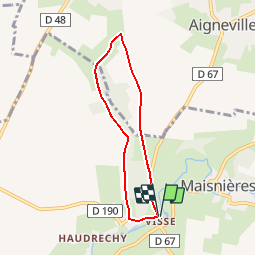
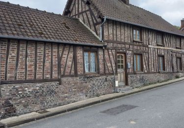
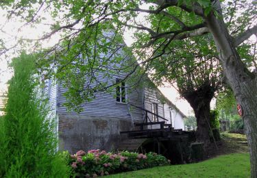
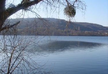
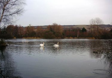
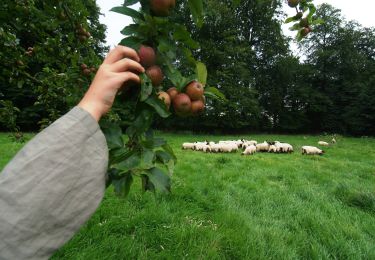
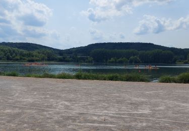
Tour Wandern von 5,2 km verfügbar auf Nordfrankreich, Somme, Maisnières. Diese Tour wird von tracegps vorgeschlagen.
Beschreibung
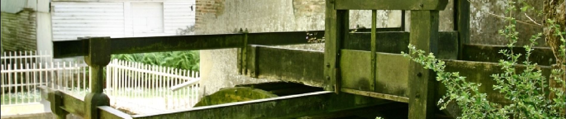
Une balade dans la plaine traversée par la Vimeuse qui, naguère, alimentait un moulin à froment. Pour télécharger la fiche du circuit en format pdf. Partez à la découverte de la Côte Picarde et de la Baie de Somme à travers 38 promenades et randonnées pédestres.
Ort
Land:
France
Region :
Nordfrankreich
Abteilung/Provinz :
Somme
Kommune :
Maisnières
Standort:
Unknown
Gehen Sie:(Dec)
Gehen Sie:(UTM)
400237 ; 5540893 (31U) N.
Kommentare
Touren in der Umgebung
![Tour Zu Fuß Gamaches - L'eau vive - Photo](https://media.geolcdn.com/t/375/260/3c4fa46f-9dc2-4d1a-9161-49027c2a541e.jpeg&format=jpg&maxdim=2)
![Zu Fuß Zu Fuß](https://static1.geolcdn.com/sitytour/trail-icons/100.png)
L'eau vive
Zu Fuß
Einfach
Gamaches,
Nordfrankreich,
Somme,
France
![](/images/other/stat-length.png)
4,8 km | 5,3 km-effort
1h 11min
![](https://static1.geolcdn.com/siteimages/upload/files/16400158638029165_repeat_loop_refresh_sync_direction_icon.png)
Ja
![Tour Zu Fuß Gamaches - Au fil des Étangs - Photo](https://media.geolcdn.com/t/375/260/fbb955a0-b551-4370-8c7b-e1b57583333e.jpeg&format=jpg&maxdim=2)
![Zu Fuß Zu Fuß](https://static1.geolcdn.com/sitytour/trail-icons/100.png)
Au fil des Étangs
Zu Fuß
Einfach
Gamaches,
Nordfrankreich,
Somme,
France
![](/images/other/stat-length.png)
3,1 km | 3,3 km-effort
45min
![](https://static1.geolcdn.com/siteimages/upload/files/16400158638029165_repeat_loop_refresh_sync_direction_icon.png)
Nein
![Tour Wandern Longroy - Longroy - Photo](https://media.geolcdn.com/t/375/260/7ec4c826-5a9d-4fa1-ae36-51fe24f1785e.jpg&format=jpg&maxdim=2)
![Wandern Wandern](https://static1.geolcdn.com/sitytour/trail-icons/101.png)
Longroy
Wandern
Einfach
Longroy,
Normandie,
Seine-Maritime,
France
![](/images/other/stat-length.png)
10,8 km | 13,5 km-effort
2h 32min
![](https://static1.geolcdn.com/siteimages/upload/files/16400158638029165_repeat_loop_refresh_sync_direction_icon.png)
Ja
![Tour Zu Fuß Maisnières - Le Moulin de Visse - Photo](https://media.geolcdn.com/t/375/260/518aeeca-2dd6-428e-8883-2e7cd772f69f.jpeg&format=jpg&maxdim=2)
![Zu Fuß Zu Fuß](https://static1.geolcdn.com/sitytour/trail-icons/100.png)
Le Moulin de Visse
Zu Fuß
Einfach
Maisnières,
Nordfrankreich,
Somme,
France
![](/images/other/stat-length.png)
5,3 km | 6,2 km-effort
1h 23min
![](https://static1.geolcdn.com/siteimages/upload/files/16400158638029165_repeat_loop_refresh_sync_direction_icon.png)
Ja
![Tour Wandern Gamaches - Circuit de La Tuilerie - Longroy - Photo](https://media.geolcdn.com/t/375/260/ext.jpg?maxdim=2&url=https%3A%2F%2Fservices.sitytrail.com%2FGeolivesWS%2FDownloadMedia.ashx%3FTrailID%3D191424%26Media%3D15006_1.jpg)
![Wandern Wandern](https://static1.geolcdn.com/sitytour/trail-icons/101.png)
Circuit de La Tuilerie - Longroy
Wandern
Medium
Gamaches,
Nordfrankreich,
Somme,
France
![](/images/other/stat-length.png)
10,7 km | 13,4 km-effort
2h 40min
![](https://static1.geolcdn.com/siteimages/upload/files/16400158638029165_repeat_loop_refresh_sync_direction_icon.png)
Ja
![Tour Fahrrad Gamaches - Les Croisettes - Gamaches dans le Vimeu - Photo](https://media.geolcdn.com/t/375/260/ext.jpg?maxdim=2&url=https%3A%2F%2Fservices.sitytrail.com%2FGeolivesWS%2FDownloadMedia.ashx%3FTrailID%3D109921%26Media%3D4938_1.jpg)
![Fahrrad Fahrrad](https://static1.geolcdn.com/sitytour/trail-icons/200.png)
Les Croisettes - Gamaches dans le Vimeu
Fahrrad
Schwierig
Gamaches,
Nordfrankreich,
Somme,
France
![](/images/other/stat-length.png)
40 km | 45 km-effort
3h 0min
![](https://static1.geolcdn.com/siteimages/upload/files/16400158638029165_repeat_loop_refresh_sync_direction_icon.png)
Ja
![Tour Wandern Tilloy-Floriville - La Vimeuse - Tilloy Floriville - Photo](https://media.geolcdn.com/t/375/260/ext.jpg?maxdim=2&url=https%3A%2F%2Fservices.sitytrail.com%2FGeolivesWS%2FDownloadMedia.ashx%3FTrailID%3D108617%26Media%3D1527_1.jpg)
![Wandern Wandern](https://static1.geolcdn.com/sitytour/trail-icons/101.png)
La Vimeuse - Tilloy Floriville
Wandern
Medium
Tilloy-Floriville,
Nordfrankreich,
Somme,
France
![](/images/other/stat-length.png)
9 km | 10,5 km-effort
2h 49min
![](https://static1.geolcdn.com/siteimages/upload/files/16400158638029165_repeat_loop_refresh_sync_direction_icon.png)
Ja
![Tour Wandern Gamaches - 20230616 Gamaches - Photo](https://media.geolcdn.com/t/375/260/f59e8ab2-5ee1-4984-aaba-50424a5b486b.jpg&format=jpg&maxdim=2)
![Wandern Wandern](https://static1.geolcdn.com/sitytour/trail-icons/101.png)
20230616 Gamaches
Wandern
Medium
Gamaches,
Nordfrankreich,
Somme,
France
![](/images/other/stat-length.png)
18,8 km | 22 km-effort
5h 37min
![](https://static1.geolcdn.com/siteimages/upload/files/16400158638029165_repeat_loop_refresh_sync_direction_icon.png)
Ja
![Tour Zu Fuß Tilloy-Floriville - Vimeuse - Photo](https://media.geolcdn.com/t/375/260/ext.jpg?maxdim=2&url=https%3A%2F%2Fstatic1.geolcdn.com%2Fsiteimages%2Fupload%2Ffiles%2F1545311037marcheuse_200dpi.jpg)
![Zu Fuß Zu Fuß](https://static1.geolcdn.com/sitytour/trail-icons/100.png)
Vimeuse
Zu Fuß
Einfach
Tilloy-Floriville,
Nordfrankreich,
Somme,
France
![](/images/other/stat-length.png)
8,2 km | 9,6 km-effort
2h 11min
![](https://static1.geolcdn.com/siteimages/upload/files/16400158638029165_repeat_loop_refresh_sync_direction_icon.png)
Nein