![](/images/other/stat-length.png)
![Tour Wandern Vailly-sur-Aisne - Les roches de l'Abondin - Photo](https://media.geolcdn.com/t/1900/400/ext.pjpeg?maxdim=2&url=https%3A%2F%2Fservices.sitytrail.com%2FGeolivesWS%2FDownloadMedia.ashx%3FTrailID%3D108409%26Media%3D1093_2.jpg)
Les roches de l'Abondin
tracegps
Benutzer
![Länge](/images/other/stat-length.png)
Länge
9,8 km
![Maximale Höhe](https://static1.geolcdn.com/siteimages/upload/files/1508320355ic_sort_altitude_max_24dp.png)
Maximale Höhe
182 m
![Positive Höhendifferenz](https://static1.geolcdn.com/siteimages/upload/files/1508320355ic_sort_den_pos_24dp.png)
Positive Höhendifferenz
256 m
![Km-Effort](/images/other/stat-length.png)
Km-Effort
13,2 km
![Min. Höhe](https://static1.geolcdn.com/siteimages/upload/files/1508320355ic_sort_altitude_min_24dp.png)
Min. Höhe
52 m
![Negative Höhendifferenz](https://static1.geolcdn.com/siteimages/upload/files/1508320355ic_sort_den_neg_24dp.png)
Negative Höhendifferenz
259 m
![Boucle](https://static1.geolcdn.com/siteimages/upload/files/16400158638029165_repeat_loop_refresh_sync_direction_icon.png)
Boucle
Ja
Erstellungsdatum :
2014-12-10 00:00:00.0
Letzte Änderung :
2014-12-10 00:00:00.0
![Wandern](https://static1.geolcdn.com/sitytour/trail-icons/101.png)
3h00
Schwierigkeit : Sehr schwierig
![Scannen Sie diesen QR-Code, um die Tour in der SityTrail-Anwendung zu öffnen](https://capi.geolives.com/qq0zvz2zws4bq2lad0pu/sitytour/trails/108409/qr.png?size=200)
Kostenlosegpshiking-Anwendung
Über SityTrail
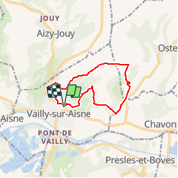
Tour Wandern von 9,8 km verfügbar auf Nordfrankreich, Aisne, Vailly-sur-Aisne. Diese Tour wird von tracegps vorgeschlagen.
Beschreibung
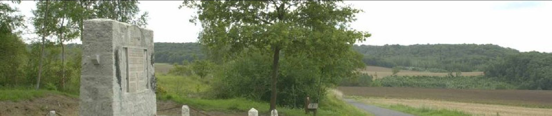
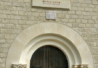
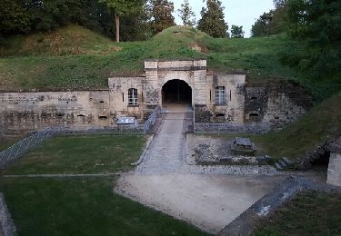
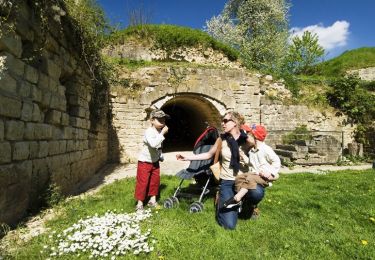
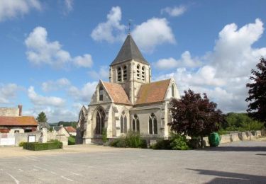
Une balade pour décourvrir la richesse du paysage qui environne Vailly-sur-Aisne, son quartier de Saint-Précord, avec son lavoir et son calvaire, et le monument des aviateurs à Ostel. Toutes les infos sont ICI
Ort
Land:
France
Region :
Nordfrankreich
Abteilung/Provinz :
Aisne
Kommune :
Vailly-sur-Aisne
Standort:
Unknown
Gehen Sie:(Dec)
Gehen Sie:(UTM)
537673 ; 5473245 (31U) N.
Kommentare
Touren in der Umgebung
![Tour Wandern Chivres-Val - Fort de condé - chivres - Photo](https://media.geolcdn.com/t/375/260/ext.jpg?maxdim=2&url=https%3A%2F%2Fstatic1.geolcdn.com%2Fsiteimages%2Fupload%2Ffiles%2F1553511878bg_sport_marche.png)
![Wandern Wandern](https://static1.geolcdn.com/sitytour/trail-icons/101.png)
Fort de condé - chivres
Wandern
Sehr schwierig
(1)
Chivres-Val,
Nordfrankreich,
Aisne,
France
![](/images/other/stat-length.png)
18 km | 22 km-effort
4h 48min
![](https://static1.geolcdn.com/siteimages/upload/files/16400158638029165_repeat_loop_refresh_sync_direction_icon.png)
Ja
![Tour Wandern Aizy-Jouy - grand tour dans la foret derruere chez nous - Photo](https://media.geolcdn.com/t/375/260/20ee00f6-ccfb-4a1e-abc6-b395e26296f8.jpg&format=jpg&maxdim=2)
![Wandern Wandern](https://static1.geolcdn.com/sitytour/trail-icons/101.png)
grand tour dans la foret derruere chez nous
Wandern
Medium
Aizy-Jouy,
Nordfrankreich,
Aisne,
France
![](/images/other/stat-length.png)
4,6 km | 6,1 km-effort
1h 44min
![](https://static1.geolcdn.com/siteimages/upload/files/16400158638029165_repeat_loop_refresh_sync_direction_icon.png)
Ja
![Tour Wandern Aizy-Jouy - l assaut du chemin des dames - Photo](https://media.geolcdn.com/t/375/260/ext.jpg?maxdim=2&url=https%3A%2F%2Fservices.sitytrail.com%2FGeolivesWS%2FDownloadMedia.ashx%3FTrailID%3D810688%26Media%3Dfix__20170815150807.jpg)
![Wandern Wandern](https://static1.geolcdn.com/sitytour/trail-icons/101.png)
l assaut du chemin des dames
Wandern
Medium
Aizy-Jouy,
Nordfrankreich,
Aisne,
France
![](/images/other/stat-length.png)
12,4 km | 15,7 km-effort
2h 53min
![](https://static1.geolcdn.com/siteimages/upload/files/16400158638029165_repeat_loop_refresh_sync_direction_icon.png)
Ja
![Tour Wandern Chivres-Val - 11 la fontaine St ouen - Photo](https://media.geolcdn.com/t/375/260/ext.jpg?maxdim=2&url=https%3A%2F%2Fservices.sitytrail.com%2FGeolivesWS%2FDownloadMedia.ashx%3FTrailID%3D614150%26Media%3Dfix__20160813212301.jpg)
![Wandern Wandern](https://static1.geolcdn.com/sitytour/trail-icons/101.png)
11 la fontaine St ouen
Wandern
Medium
Chivres-Val,
Nordfrankreich,
Aisne,
France
![](/images/other/stat-length.png)
14,1 km | 17,5 km-effort
3h 53min
![](https://static1.geolcdn.com/siteimages/upload/files/16400158638029165_repeat_loop_refresh_sync_direction_icon.png)
Ja
![Tour Wandern Chivres-Val - Autour du fort de Condé - Photo](https://media.geolcdn.com/t/375/260/ext.jpg?maxdim=2&url=https%3A%2F%2Fservices.sitytrail.com%2FGeolivesWS%2FDownloadMedia.ashx%3FTrailID%3D202859%26Media%3Db5d02bae-9164-4123-9db0-2a5cd4d57105.jpg)
![Wandern Wandern](https://static1.geolcdn.com/sitytour/trail-icons/101.png)
Autour du fort de Condé
Wandern
Sehr leicht
Chivres-Val,
Nordfrankreich,
Aisne,
France
![](/images/other/stat-length.png)
939 m | 999 m-effort
Unbekannt
![](https://static1.geolcdn.com/siteimages/upload/files/16400158638029165_repeat_loop_refresh_sync_direction_icon.png)
Ja
![Tour Wandern Chivres-Val - Chivres Val - La Fontaine de St Ouen - Photo](https://media.geolcdn.com/t/375/260/ext.jpg?maxdim=2&url=https%3A%2F%2Fservices.sitytrail.com%2FGeolivesWS%2FDownloadMedia.ashx%3FTrailID%3D110395%26Media%3D5851_1.jpg)
![Wandern Wandern](https://static1.geolcdn.com/sitytour/trail-icons/101.png)
Chivres Val - La Fontaine de St Ouen
Wandern
Medium
Chivres-Val,
Nordfrankreich,
Aisne,
France
![](/images/other/stat-length.png)
12 km | 15,1 km-effort
4h 0min
![](https://static1.geolcdn.com/siteimages/upload/files/16400158638029165_repeat_loop_refresh_sync_direction_icon.png)
Nein
![Tour Wandern Chassemy - Chassemy - Le temps perdu - Photo](https://media.geolcdn.com/t/375/260/ext.jpg?maxdim=2&url=https%3A%2F%2Fservices.sitytrail.com%2FGeolivesWS%2FDownloadMedia.ashx%3FTrailID%3D110394%26Media%3D5850_1.jpg)
![Wandern Wandern](https://static1.geolcdn.com/sitytour/trail-icons/101.png)
Chassemy - Le temps perdu
Wandern
Medium
Chassemy,
Nordfrankreich,
Aisne,
France
![](/images/other/stat-length.png)
14,3 km | 17,5 km-effort
3h 45min
![](https://static1.geolcdn.com/siteimages/upload/files/16400158638029165_repeat_loop_refresh_sync_direction_icon.png)
Ja
![Tour Wandern Aizy-Jouy - A l'assaut du chemin des Dames - Photo](https://media.geolcdn.com/t/375/260/ext.jpg?maxdim=2&url=https%3A%2F%2Fservices.sitytrail.com%2FGeolivesWS%2FDownloadMedia.ashx%3FTrailID%3D108164%26Media%3D564_1.jpg)
![Wandern Wandern](https://static1.geolcdn.com/sitytour/trail-icons/101.png)
A l'assaut du chemin des Dames
Wandern
Schwierig
Aizy-Jouy,
Nordfrankreich,
Aisne,
France
![](/images/other/stat-length.png)
12,1 km | 15,4 km-effort
4h 0min
![](https://static1.geolcdn.com/siteimages/upload/files/16400158638029165_repeat_loop_refresh_sync_direction_icon.png)
Ja
![Tour Wandern Chivres-Val - la fontaine de Saint - Ouen . - Photo](https://media.geolcdn.com/t/375/260/ext.jpg?maxdim=2&url=https%3A%2F%2Fstatic1.geolcdn.com%2Fsiteimages%2Fupload%2Ffiles%2F1553511878bg_sport_marche.png)
![Wandern Wandern](https://static1.geolcdn.com/sitytour/trail-icons/101.png)
la fontaine de Saint - Ouen .
Wandern
Schwierig
Chivres-Val,
Nordfrankreich,
Aisne,
France
![](/images/other/stat-length.png)
12,6 km | 15,7 km-effort
3h 33min
![](https://static1.geolcdn.com/siteimages/upload/files/16400158638029165_repeat_loop_refresh_sync_direction_icon.png)
Ja