![](/images/other/stat-length.png)
![Tour Wandern Parfondeval - Par le fond du val - Photo](https://media.geolcdn.com/t/1900/400/ext.pjpeg?maxdim=2&url=https%3A%2F%2Fservices.sitytrail.com%2FGeolivesWS%2FDownloadMedia.ashx%3FTrailID%3D108375%26Media%3D1059_2.jpg)
Par le fond du val
tracegps
Benutzer
![Länge](/images/other/stat-length.png)
Länge
13 km
![Maximale Höhe](https://static1.geolcdn.com/siteimages/upload/files/1508320355ic_sort_altitude_max_24dp.png)
Maximale Höhe
245 m
![Positive Höhendifferenz](https://static1.geolcdn.com/siteimages/upload/files/1508320355ic_sort_den_pos_24dp.png)
Positive Höhendifferenz
143 m
![Km-Effort](/images/other/stat-length.png)
Km-Effort
14,9 km
![Min. Höhe](https://static1.geolcdn.com/siteimages/upload/files/1508320355ic_sort_altitude_min_24dp.png)
Min. Höhe
173 m
![Negative Höhendifferenz](https://static1.geolcdn.com/siteimages/upload/files/1508320355ic_sort_den_neg_24dp.png)
Negative Höhendifferenz
143 m
![Boucle](https://static1.geolcdn.com/siteimages/upload/files/16400158638029165_repeat_loop_refresh_sync_direction_icon.png)
Boucle
Ja
Erstellungsdatum :
2014-12-10 00:00:00.0
Letzte Änderung :
2014-12-10 00:00:00.0
![Wandern](https://static1.geolcdn.com/sitytour/trail-icons/101.png)
3h30
Schwierigkeit : Sehr schwierig
![Scannen Sie diesen QR-Code, um die Tour in der SityTrail-Anwendung zu öffnen](https://capi.geolives.com/qq0zvz2zws4bq2lad0pu/sitytour/trails/108375/qr.png?size=200)
Kostenlosegpshiking-Anwendung
Über SityTrail
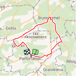
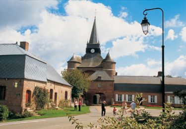
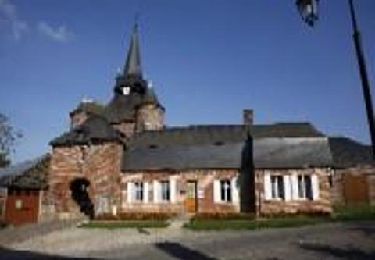
Tour Wandern von 13 km verfügbar auf Nordfrankreich, Aisne, Parfondeval. Diese Tour wird von tracegps vorgeschlagen.
Beschreibung
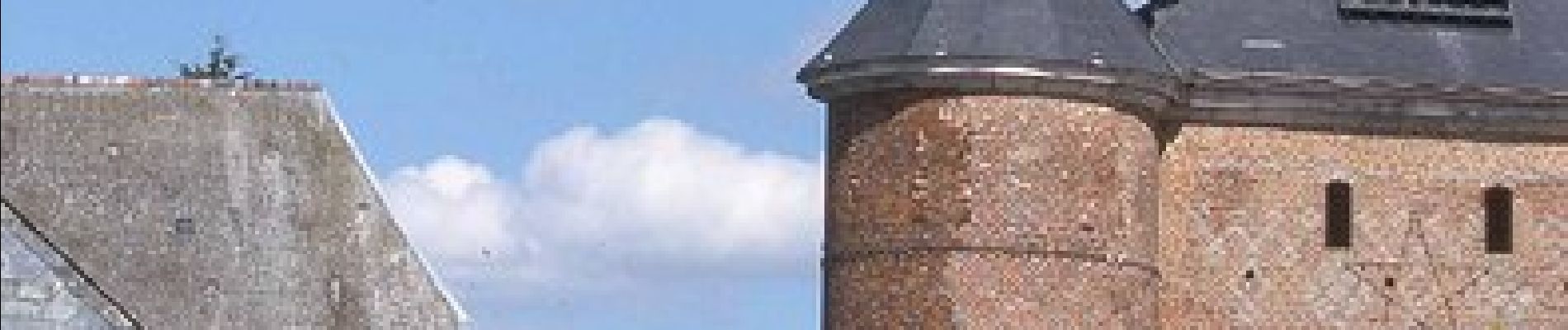
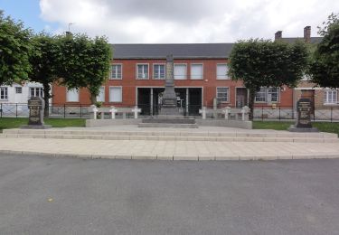
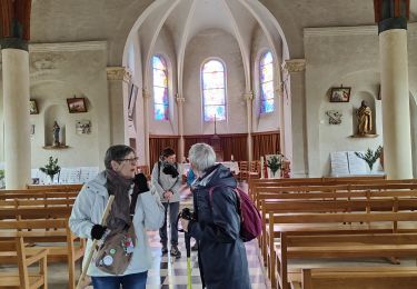
Classé parmi les "plus beaux villages de France", Parfondeval, avec son église fortifiée dominant la Brune et ses maisons de brique ou à colombages, est le point de départ de ce parcours entre vergers de pommiers et petits bois de feuillus. Toutes les infos sont ICI
Ort
Land:
France
Region :
Nordfrankreich
Abteilung/Provinz :
Aisne
Kommune :
Parfondeval
Standort:
Unknown
Gehen Sie:(Dec)
Gehen Sie:(UTM)
583576 ; 5510314 (31U) N.
Kommentare
Touren in der Umgebung
![Tour Zu Fuß Brunehamel - Par le fond du val - Photo](https://media.geolcdn.com/t/375/260/8e3a953d-955c-4c62-a89d-391f5e526a72.jpeg&format=jpg&maxdim=2)
![Zu Fuß Zu Fuß](https://static1.geolcdn.com/sitytour/trail-icons/100.png)
Par le fond du val
Zu Fuß
Einfach
Brunehamel,
Nordfrankreich,
Aisne,
France
![](/images/other/stat-length.png)
12,5 km | 14,2 km-effort
3h 14min
![](https://static1.geolcdn.com/siteimages/upload/files/16400158638029165_repeat_loop_refresh_sync_direction_icon.png)
Ja
![Tour Wandern Brunehamel - 2023_04_23 PARFONDEVAL - Photo](https://media.geolcdn.com/t/375/260/376aed58-e901-440d-acd2-8ccf990f5b65.jpg&format=jpg&maxdim=2)
![Wandern Wandern](https://static1.geolcdn.com/sitytour/trail-icons/101.png)
2023_04_23 PARFONDEVAL
Wandern
Schwierig
Brunehamel,
Nordfrankreich,
Aisne,
France
![](/images/other/stat-length.png)
10,5 km | 12,4 km-effort
2h 49min
![](https://static1.geolcdn.com/siteimages/upload/files/16400158638029165_repeat_loop_refresh_sync_direction_icon.png)
Nein
![Tour Wandern Parfondeval - Le chemin de la brique et du torchis - Photo](https://media.geolcdn.com/t/375/260/ext.jpg?maxdim=2&url=https%3A%2F%2Fservices.sitytrail.com%2FGeolivesWS%2FDownloadMedia.ashx%3FTrailID%3D108963%26Media%3D2852_1.jpg)
![Wandern Wandern](https://static1.geolcdn.com/sitytour/trail-icons/101.png)
Le chemin de la brique et du torchis
Wandern
Einfach
Parfondeval,
Nordfrankreich,
Aisne,
France
![](/images/other/stat-length.png)
1,4 km | 1,7 km-effort
45min
![](https://static1.geolcdn.com/siteimages/upload/files/16400158638029165_repeat_loop_refresh_sync_direction_icon.png)
Ja
![Tour Wandern Résigny - Du chemin de fer au chemin vert - Photo](https://media.geolcdn.com/t/375/260/ext.jpg?maxdim=2&url=https%3A%2F%2Fstatic1.geolcdn.com%2Fsiteimages%2Fupload%2Ffiles%2F1553511878bg_sport_marche.png)
![Wandern Wandern](https://static1.geolcdn.com/sitytour/trail-icons/101.png)
Du chemin de fer au chemin vert
Wandern
Medium
Résigny,
Nordfrankreich,
Aisne,
France
![](/images/other/stat-length.png)
7,6 km | 9,2 km-effort
2h 30min
![](https://static1.geolcdn.com/siteimages/upload/files/16400158638029165_repeat_loop_refresh_sync_direction_icon.png)
Ja
![Tour Wandern Parfondeval - Le chemin de la brique et du torchis - Photo](https://media.geolcdn.com/t/375/260/ext.jpg?maxdim=2&url=https%3A%2F%2Fservices.sitytrail.com%2FGeolivesWS%2FDownloadMedia.ashx%3FTrailID%3D202835%26Media%3D55446afe-e8cc-4c8a-9dd2-8ae97c09a375.jpg)
![Wandern Wandern](https://static1.geolcdn.com/sitytour/trail-icons/101.png)
Le chemin de la brique et du torchis
Wandern
Sehr leicht
Parfondeval,
Nordfrankreich,
Aisne,
France
![](/images/other/stat-length.png)
1,4 km | 1,7 km-effort
Unbekannt
![](https://static1.geolcdn.com/siteimages/upload/files/16400158638029165_repeat_loop_refresh_sync_direction_icon.png)
Ja