![](/images/other/stat-length.png)
![Tour Wandern Saint-Quentin - Le marais d'Isle - Photo](https://media.geolcdn.com/t/1900/400/ext.pjpeg?maxdim=2&url=https%3A%2F%2Fservices.sitytrail.com%2FGeolivesWS%2FDownloadMedia.ashx%3FTrailID%3D108285%26Media%3D956_2.jpg)
Le marais d'Isle
tracegps
Benutzer
![Länge](/images/other/stat-length.png)
![Maximale Höhe](https://static1.geolcdn.com/siteimages/upload/files/1508320355ic_sort_altitude_max_24dp.png)
![Positive Höhendifferenz](https://static1.geolcdn.com/siteimages/upload/files/1508320355ic_sort_den_pos_24dp.png)
![Km-Effort](/images/other/stat-length.png)
![Min. Höhe](https://static1.geolcdn.com/siteimages/upload/files/1508320355ic_sort_altitude_min_24dp.png)
![Negative Höhendifferenz](https://static1.geolcdn.com/siteimages/upload/files/1508320355ic_sort_den_neg_24dp.png)
![Boucle](https://static1.geolcdn.com/siteimages/upload/files/16400158638029165_repeat_loop_refresh_sync_direction_icon.png)
![Wandern](https://static1.geolcdn.com/sitytour/trail-icons/101.png)
1h30
Schwierigkeit : Einfach
![Scannen Sie diesen QR-Code, um die Tour in der SityTrail-Anwendung zu öffnen](https://capi.geolives.com/qq0zvz2zws4bq2lad0pu/sitytour/trails/108285/qr.png?size=200)
Kostenlosegpshiking-Anwendung
Über SityTrail
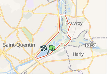
Tour Wandern von 5,4 km verfügbar auf Nordfrankreich, Aisne, Saint-Quentin. Diese Tour wird von tracegps vorgeschlagen.
Beschreibung
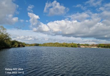
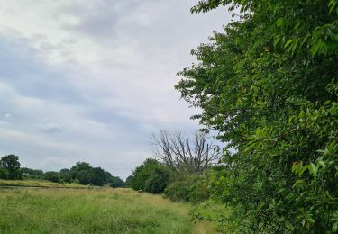
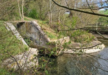
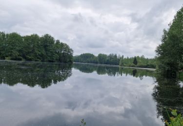
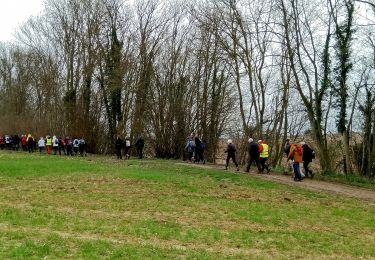
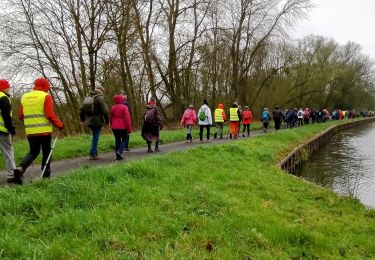
Ce parcours familial (aire de jeux, base de loisirs en saison) autour de la réserve naturelle d'Isle permet d'approcher l'étang et la zone humide des marais, réservoir écologique au cœur de la cité industrieuse. Attention, la variante est ouverte seulement l'après-midi. Toutes les infos sont ICI
Ort
Kommentare
Touren in der Umgebung
![Tour Mountainbike Mesnil-Saint-Laurent - mesnil-fresnoy le grand-montbrehain -lesdits - Photo](https://media.geolcdn.com/t/375/260/921c065c-1c8e-48a6-9b6e-48c09ce62a81.jpg&format=jpg&maxdim=2)
![Mountainbike Mountainbike](https://static1.geolcdn.com/sitytour/trail-icons/202.png)
Mountainbike
![](/images/other/stat-length.png)
![](https://static1.geolcdn.com/siteimages/upload/files/16400158638029165_repeat_loop_refresh_sync_direction_icon.png)
![Tour Mountainbike Dallon - pays de ham - Photo](https://media.geolcdn.com/t/375/260/995bec17-ed2a-487a-95fa-9605ac514751.jpg&format=jpg&maxdim=2)
![Mountainbike Mountainbike](https://static1.geolcdn.com/sitytour/trail-icons/202.png)
Mountainbike
![](/images/other/stat-length.png)
![](https://static1.geolcdn.com/siteimages/upload/files/16400158638029165_repeat_loop_refresh_sync_direction_icon.png)
![Tour Mountainbike Mesnil-Saint-Laurent - parcours mesnil thenelles- beautor- Mennessis - Photo](https://media.geolcdn.com/t/375/260/70ed0656-c563-4ffb-b89a-fd24f69ca65a.jpg&format=jpg&maxdim=2)
![Mountainbike Mountainbike](https://static1.geolcdn.com/sitytour/trail-icons/202.png)
Mountainbike
![](/images/other/stat-length.png)
![](https://static1.geolcdn.com/siteimages/upload/files/16400158638029165_repeat_loop_refresh_sync_direction_icon.png)
![Tour Wandern Rouvroy - circuit rouvroy fonsomme croix fonsommes - Photo](https://media.geolcdn.com/t/375/260/5e50172e-7db2-4492-8abc-36f32572f710.jpg&format=jpg&maxdim=2)
![Wandern Wandern](https://static1.geolcdn.com/sitytour/trail-icons/101.png)
Wandern
![](/images/other/stat-length.png)
![](https://static1.geolcdn.com/siteimages/upload/files/16400158638029165_repeat_loop_refresh_sync_direction_icon.png)
![Tour Wandern Homblières - homblières Fonsomme - Photo](https://media.geolcdn.com/t/375/260/70887b79-816c-4f1e-8bca-6acf631404c6.jpg&format=jpg&maxdim=2)
![Wandern Wandern](https://static1.geolcdn.com/sitytour/trail-icons/101.png)
Wandern
![](/images/other/stat-length.png)
![](https://static1.geolcdn.com/siteimages/upload/files/16400158638029165_repeat_loop_refresh_sync_direction_icon.png)
![Tour Wandern Saint-Quentin - Le marais d'Isle - Photo](https://media.geolcdn.com/t/375/260/ext.jpg?maxdim=2&url=https%3A%2F%2Fservices.sitytrail.com%2FGeolivesWS%2FDownloadMedia.ashx%3FTrailID%3D202837%26Media%3D6430a4b8-690f-47d6-9bb9-9c084dd5e5b9.jpg)
![Wandern Wandern](https://static1.geolcdn.com/sitytour/trail-icons/101.png)
Wandern
![](/images/other/stat-length.png)
![](https://static1.geolcdn.com/siteimages/upload/files/16400158638029165_repeat_loop_refresh_sync_direction_icon.png)
![Tour Mountainbike Mesnil-Saint-Laurent - mesnil - Vendeuil - Photo](https://media.geolcdn.com/t/375/260/acf1356d-e8bd-45d7-a575-aeb25f0ccc16.jpg&format=jpg&maxdim=2)
![Mountainbike Mountainbike](https://static1.geolcdn.com/sitytour/trail-icons/202.png)
Mountainbike
![](/images/other/stat-length.png)
![](https://static1.geolcdn.com/siteimages/upload/files/16400158638029165_repeat_loop_refresh_sync_direction_icon.png)
![Tour Wandern Castres - Castres du 02-04-2023 après midi - Photo](https://media.geolcdn.com/t/375/260/2c9aff69-d2ff-40ee-aa65-6a110533a96b.jpg&format=jpg&maxdim=2)
![Wandern Wandern](https://static1.geolcdn.com/sitytour/trail-icons/101.png)
Wandern
![](/images/other/stat-length.png)
![](https://static1.geolcdn.com/siteimages/upload/files/16400158638029165_repeat_loop_refresh_sync_direction_icon.png)
![Tour Wandern Castres - Castres du 02-04-2023 le matin - Photo](https://media.geolcdn.com/t/375/260/dc3c9b9d-7f93-490d-87f5-88d7a975468d.jpg&format=jpg&maxdim=2)
![Wandern Wandern](https://static1.geolcdn.com/sitytour/trail-icons/101.png)
Wandern
![](/images/other/stat-length.png)
![](https://static1.geolcdn.com/siteimages/upload/files/16400158638029165_repeat_loop_refresh_sync_direction_icon.png)