![](/images/other/stat-length.png)
![Tour Wandern Nans-les-Pins - La Croix des Glacières, Sainte-Baume - Photo](https://media.geolcdn.com/t/1900/400/ext.pjpeg?maxdim=2&url=https%3A%2F%2Fservices.sitytrail.com%2FGeolivesWS%2FDownloadMedia.ashx%3FTrailID%3D107654%26Media%3D12647_1.jpg)
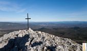
La Croix des Glacières, Sainte-Baume
tracegps
Benutzer
![Länge](/images/other/stat-length.png)
![Maximale Höhe](https://static1.geolcdn.com/siteimages/upload/files/1508320355ic_sort_altitude_max_24dp.png)
![Positive Höhendifferenz](https://static1.geolcdn.com/siteimages/upload/files/1508320355ic_sort_den_pos_24dp.png)
![Km-Effort](/images/other/stat-length.png)
![Min. Höhe](https://static1.geolcdn.com/siteimages/upload/files/1508320355ic_sort_altitude_min_24dp.png)
![Negative Höhendifferenz](https://static1.geolcdn.com/siteimages/upload/files/1508320355ic_sort_den_neg_24dp.png)
![Boucle](https://static1.geolcdn.com/siteimages/upload/files/16400158638029165_repeat_loop_refresh_sync_direction_icon.png)
![Wandern](https://static1.geolcdn.com/sitytour/trail-icons/101.png)
3h19
Schwierigkeit : Medium
![Scannen Sie diesen QR-Code, um die Tour in der SityTrail-Anwendung zu öffnen](https://capi.geolives.com/qq0zvz2zws4bq2lad0pu/sitytour/trails/107654/qr.png?size=200)
Kostenlosegpshiking-Anwendung
Über SityTrail
Tour Wandern von 7,2 km verfügbar auf Provence-Alpes-Côte d'Azur, Var, Nans-les-Pins. Diese Tour wird von tracegps vorgeschlagen.
Beschreibung
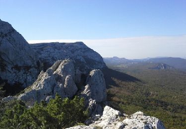
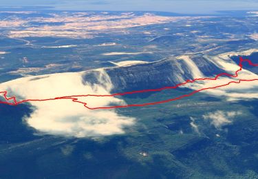
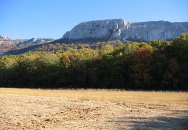
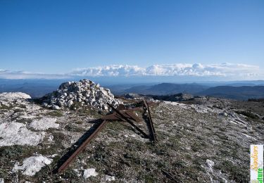
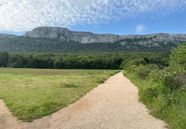
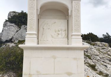
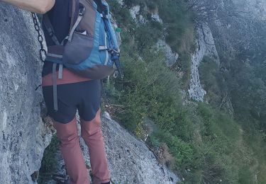
Massif de la Sainte-Baume. L'itinéraire choisi, monte depuis la route CD95 de Plan-d'Aups-Sainte-Baume retrouver le chemin du Pas de l'Aï au Carrefour du Hêtre. Traversant la Gorge de Saint-Cassien puis le Paradis, un bon sentier conduit à la brèche au pied du ressaut rocheux qui porte la Croix des Glacières. Du Baù des Glacières, la descente emprunte un raide couloir en bas duquel, une vieille piste d'abord, puis une sente ramène par le Nord au Carrefour du Hêtre pour retrouver l'itinéraire d'ascension. Une variante agréable, retrouve la draille du départ. Description complète sur sentier-nature.com : La Croix des Glacières, Sainte-Baume Avertissement [Franchissement 2/3 ; Exposition 1/3]. Certains passages de cet itinéraire de montagne sont escarpés et/ou très exposés, il est déconseillé aux enfants non accompagnés et aux personnes sujettes au vertige. Pour votre sécurité, nous vous invitons à respecter les règles suivantes : être bien chaussé, ne pas s'engager par mauvais temps ni par vent fort, ne pas s'écarter de l'itinéraire ni des sentiers. Pour assurer les moins expérimentés, une corde d'une vingtaine de mètres peut être utile.
Ort
Kommentare
Touren in der Umgebung
![Tour Wandern Plan-d'Aups-Sainte-Baume - Sainte Baume 8,5 km - Photo](https://media.geolcdn.com/t/375/260/02bfd54c-87ac-472a-9dd7-603e289d99c6.jpeg&format=jpg&maxdim=2)
![Wandern Wandern](https://static1.geolcdn.com/sitytour/trail-icons/101.png)
Wandern
![](/images/other/stat-length.png)
![](https://static1.geolcdn.com/siteimages/upload/files/16400158638029165_repeat_loop_refresh_sync_direction_icon.png)
![Tour Wandern Nans-les-Pins - Le baou des glacières - Photo](https://media.geolcdn.com/t/375/260/ext.jpg?maxdim=2&url=https%3A%2F%2Fservices.sitytrail.com%2FGeolivesWS%2FDownloadMedia.ashx%3FTrailID%3D356935%26Media%3Dfix__20141025130409.jpg)
![Wandern Wandern](https://static1.geolcdn.com/sitytour/trail-icons/101.png)
Wandern
![](/images/other/stat-length.png)
![](https://static1.geolcdn.com/siteimages/upload/files/16400158638029165_repeat_loop_refresh_sync_direction_icon.png)
![Tour Wandern Plan-d'Aups-Sainte-Baume - SityTrail - Sentier merveilleux - La Ste baume - Le Plan d'aups - Photo](https://media.geolcdn.com/t/375/260/e69b33b5-1427-482e-bef6-59e868e7cd87.jpg&format=jpg&maxdim=2)
![Wandern Wandern](https://static1.geolcdn.com/sitytour/trail-icons/101.png)
Wandern
![](/images/other/stat-length.png)
![](https://static1.geolcdn.com/siteimages/upload/files/16400158638029165_repeat_loop_refresh_sync_direction_icon.png)
![Tour Wandern Plan-d'Aups-Sainte-Baume - Crêts de la Ste Baume - Photo](https://media.geolcdn.com/t/375/260/ext.jpg?maxdim=2&url=https%3A%2F%2Fservices.sitytrail.com%2FGeolivesWS%2FDownloadMedia.ashx%3FTrailID%3D214866%26Media%3D15409_2.jpg)
![Wandern Wandern](https://static1.geolcdn.com/sitytour/trail-icons/101.png)
Wandern
![](/images/other/stat-length.png)
![](https://static1.geolcdn.com/siteimages/upload/files/16400158638029165_repeat_loop_refresh_sync_direction_icon.png)
![Tour Wandern Plan-d'Aups-Sainte-Baume - Du Col du Saint-Pilon au Pas de l'Aï, Sainte Baume - Photo](https://media.geolcdn.com/t/375/260/ext.jpg?maxdim=2&url=https%3A%2F%2Fservices.sitytrail.com%2FGeolivesWS%2FDownloadMedia.ashx%3FTrailID%3D107608%26Media%3D12576_1.jpg)
![Wandern Wandern](https://static1.geolcdn.com/sitytour/trail-icons/101.png)
Wandern
![](/images/other/stat-length.png)
![](https://static1.geolcdn.com/siteimages/upload/files/16400158638029165_repeat_loop_refresh_sync_direction_icon.png)
![Tour Wandern Riboux - Riboux - Forêt de Malaucène - Photo](https://media.geolcdn.com/t/375/260/ext.jpg?maxdim=2&url=https%3A%2F%2Fservices.sitytrail.com%2FGeolivesWS%2FDownloadMedia.ashx%3FTrailID%3D103921%26Media%3D6772_2.jpg)
![Wandern Wandern](https://static1.geolcdn.com/sitytour/trail-icons/101.png)
Wandern
![](/images/other/stat-length.png)
![](https://static1.geolcdn.com/siteimages/upload/files/16400158638029165_repeat_loop_refresh_sync_direction_icon.png)
![Tour Zu Fuß Plan-d'Aups-Sainte-Baume - Massif Sainte Baume et pas de l’Aï 15 km - Photo](https://media.geolcdn.com/t/375/260/54842a9c-9634-48d7-ac63-66e02dee4ec6.jpg&format=jpg&maxdim=2)
![Zu Fuß Zu Fuß](https://static1.geolcdn.com/sitytour/trail-icons/100.png)
Zu Fuß
![](/images/other/stat-length.png)
![](https://static1.geolcdn.com/siteimages/upload/files/16400158638029165_repeat_loop_refresh_sync_direction_icon.png)
![Tour Wandern Plan-d'Aups-Sainte-Baume - Sainte Baume par le sentier Marcel d'Estruch - Photo](https://media.geolcdn.com/t/375/260/39d64878-6331-46dd-a0a2-1e73bc67147d.jpg&format=jpg&maxdim=2)
![Wandern Wandern](https://static1.geolcdn.com/sitytour/trail-icons/101.png)
Wandern
![](/images/other/stat-length.png)
![](https://static1.geolcdn.com/siteimages/upload/files/16400158638029165_repeat_loop_refresh_sync_direction_icon.png)
![Tour Wandern Plan-d'Aups-Sainte-Baume - Marcel estruche - Photo](https://media.geolcdn.com/t/375/260/cd96c828-8909-494f-85c8-96787c0e1fdc.jpg&format=jpg&maxdim=2)
![Wandern Wandern](https://static1.geolcdn.com/sitytour/trail-icons/101.png)
Wandern
![](/images/other/stat-length.png)
![](https://static1.geolcdn.com/siteimages/upload/files/16400158638029165_repeat_loop_refresh_sync_direction_icon.png)
très belle randonnée qui nous a servi de base pour notre sortie du 25/10/2014; nous n'avons pas effectué le tour du baou.merci