![](/images/other/stat-length.png)
![Tour Wandern Bourg-Saint-Maurice - Chalet Robert Blanc - Les Chapieux - Photo](https://media.geolcdn.com/t/1900/400/ext.pjpeg?maxdim=2&url=https%3A%2F%2Fservices.sitytrail.com%2FGeolivesWS%2FDownloadMedia.ashx%3FTrailID%3D107646%26Media%3D12638_5.jpg)
Chalet Robert Blanc - Les Chapieux
tracegps
Benutzer
![Länge](/images/other/stat-length.png)
![Maximale Höhe](https://static1.geolcdn.com/siteimages/upload/files/1508320355ic_sort_altitude_max_24dp.png)
![Positive Höhendifferenz](https://static1.geolcdn.com/siteimages/upload/files/1508320355ic_sort_den_pos_24dp.png)
![Km-Effort](/images/other/stat-length.png)
![Min. Höhe](https://static1.geolcdn.com/siteimages/upload/files/1508320355ic_sort_altitude_min_24dp.png)
![Negative Höhendifferenz](https://static1.geolcdn.com/siteimages/upload/files/1508320355ic_sort_den_neg_24dp.png)
![Boucle](https://static1.geolcdn.com/siteimages/upload/files/16400158638029165_repeat_loop_refresh_sync_direction_icon.png)
![Wandern](https://static1.geolcdn.com/sitytour/trail-icons/101.png)
5h00
Schwierigkeit : Schwierig
![Scannen Sie diesen QR-Code, um die Tour in der SityTrail-Anwendung zu öffnen](https://capi.geolives.com/qq0zvz2zws4bq2lad0pu/sitytour/trails/107646/qr.png?size=200)
Kostenlosegpshiking-Anwendung
Über SityTrail
Tour Wandern von 15 km verfügbar auf Auvergne-Rhone-Alpen, Savoyen, Bourg-Saint-Maurice. Diese Tour wird von tracegps vorgeschlagen.
Beschreibung
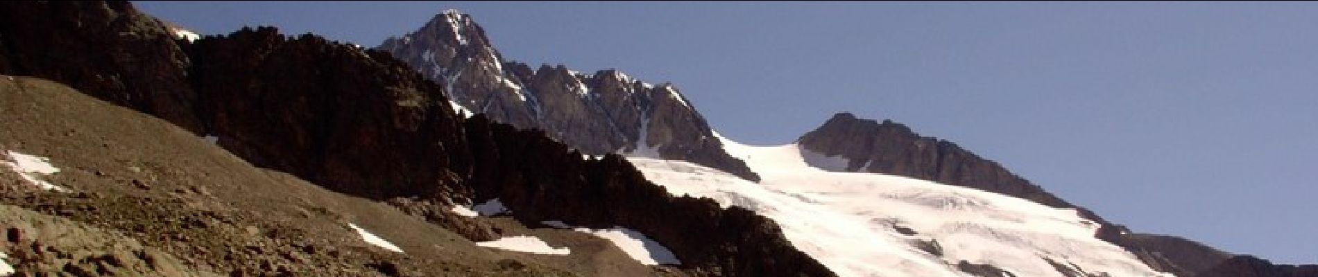
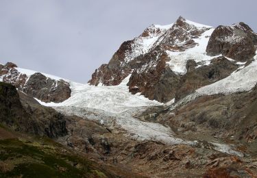
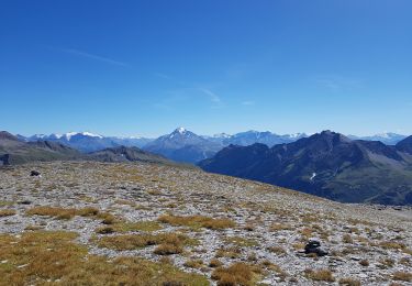
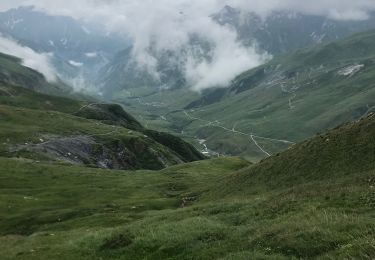
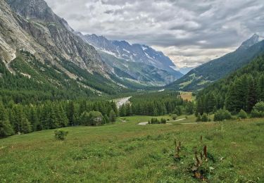
Départ du parking les Lanchettes commune des Chapieux (73). Ascension des 4 premiers kilomètres assez difficiles, notamment de dernier kilomètre avant d'arriver au chalet Robert Blanc (plusieurs petits rochers à escalader par l'itinéraire des "rochers rouges"). Belle vue sur la vallée et sur la petite aiguille des glaciers, passage près du glacier "glacier des glaciers".Se diriger ensuite sur le col de la Seigne 4 kilomètres de dificulté moyenne, table d'orientation. Du col de la seigne descente sans difficulté jusqu'au point d'arrivée. A noter: Parking pour campings cars et caravanes aux Chapieux. Des navettes sont prévues toutes les 1/2 heures pour se rendre au parking des lanchettes également prévues pour les retours aux Chapieux.
Ort
Kommentare
Touren in der Umgebung
![Tour Wandern Bourg-Saint-Maurice - suuntoapp-Hiking-2024-09-10T06-18-18Z - Photo](https://media.geolcdn.com/t/375/260/2ffa221c-2b68-468e-ba02-fb43d145165a.jpg&format=jpg&maxdim=2)
![Wandern Wandern](https://static1.geolcdn.com/sitytour/trail-icons/101.png)
Wandern
![](/images/other/stat-length.png)
![](https://static1.geolcdn.com/siteimages/upload/files/16400158638029165_repeat_loop_refresh_sync_direction_icon.png)
![Tour Skiwanderen Bourg-Saint-Maurice - autour du lac de Mya - Photo](https://media.geolcdn.com/t/375/260/4ac04904-2253-423b-b6ac-3f3b6564cfe2.jpg&format=jpg&maxdim=2)
![Skiwanderen Skiwanderen](https://static1.geolcdn.com/sitytour/trail-icons/503.png)
Skiwanderen
![](/images/other/stat-length.png)
![](https://static1.geolcdn.com/siteimages/upload/files/16400158638029165_repeat_loop_refresh_sync_direction_icon.png)
![Tour Zu Fuß Courmayeur - Alta Via n. 2 della Valle d'Aosta - Tappa 2 - Photo](https://media.geolcdn.com/t/375/260/1a96e093-87d3-42ba-8bbf-a0f169e367d1.jpeg&format=jpg&maxdim=2)
![Zu Fuß Zu Fuß](https://static1.geolcdn.com/sitytour/trail-icons/100.png)
Zu Fuß
![](/images/other/stat-length.png)
![](https://static1.geolcdn.com/siteimages/upload/files/16400158638029165_repeat_loop_refresh_sync_direction_icon.png)
![Tour Zu Fuß Courmayeur - (SI F07) Rifugio Elisabetta - Courmayeur - Photo](https://media.geolcdn.com/t/375/260/08d2089a-21fe-43f9-b227-bb1850f9ac87.jpeg&format=jpg&maxdim=2)
![Zu Fuß Zu Fuß](https://static1.geolcdn.com/sitytour/trail-icons/100.png)
Zu Fuß
![](/images/other/stat-length.png)
![](https://static1.geolcdn.com/siteimages/upload/files/16400158638029165_repeat_loop_refresh_sync_direction_icon.png)
![Tour Wandern Bourg-Saint-Maurice - le lac de Mya, le col des Fours et la tête sud des Fours - Photo](https://media.geolcdn.com/t/375/260/24e734a8-cdba-440c-a390-09e59e7aa7ec.jpg&format=jpg&maxdim=2)
![Wandern Wandern](https://static1.geolcdn.com/sitytour/trail-icons/101.png)
Wandern
![](/images/other/stat-length.png)
![](https://static1.geolcdn.com/siteimages/upload/files/16400158638029165_repeat_loop_refresh_sync_direction_icon.png)
![Tour Wandern Bourg-Saint-Maurice - Le refuge de La Croix du bonhomme Elisabetta soldoni - Photo](https://media.geolcdn.com/t/375/260/178659b1-34e1-4857-a5f1-0282bf0768cc.jpg&format=jpg&maxdim=2)
![Wandern Wandern](https://static1.geolcdn.com/sitytour/trail-icons/101.png)
Wandern
![](/images/other/stat-length.png)
![](https://static1.geolcdn.com/siteimages/upload/files/16400158638029165_repeat_loop_refresh_sync_direction_icon.png)
![Tour Zu Fuß Courmayeur - IT-14 - Photo](https://media.geolcdn.com/t/375/260/80f72700-2fda-487a-9270-867a97225db3.jpeg&format=jpg&maxdim=2)
![Zu Fuß Zu Fuß](https://static1.geolcdn.com/sitytour/trail-icons/100.png)
![Tour Wandern Les Contamines-Montjoie - Beaufortain: Autour de La Pierra Menta: J4 - Ref du Col du Bonhomme - Gite de Plan Mya - Photo](https://media.geolcdn.com/t/375/260/8679ea84-1934-4c7b-a278-c54407d8c5c5.jpg&format=jpg&maxdim=2)
![Wandern Wandern](https://static1.geolcdn.com/sitytour/trail-icons/101.png)
Wandern
![](/images/other/stat-length.png)
![](https://static1.geolcdn.com/siteimages/upload/files/16400158638029165_repeat_loop_refresh_sync_direction_icon.png)
![Tour Wandern Bourg-Saint-Maurice - Col de Seigne - Photo](https://media.geolcdn.com/t/375/260/63610327-66f4-46b0-9c2e-7a86da45bce8.jpg&format=jpg&maxdim=2)
![Wandern Wandern](https://static1.geolcdn.com/sitytour/trail-icons/101.png)
Wandern
![](/images/other/stat-length.png)
![](https://static1.geolcdn.com/siteimages/upload/files/16400158638029165_repeat_loop_refresh_sync_direction_icon.png)