


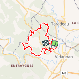

13 km | 14,9 km-effort


Benutzer


Kostenlosegpshiking-Anwendung
 SityTrail
IGN / Geografische Institute
SityTrail World
Die Welt öffnet sich für Sie
Tour Wandern von 18 km verfügbar auf Provence-Alpes-Côte d'Azur, Var, Vidauban. Diese Tour wird von Sugg vorgeschlagen.
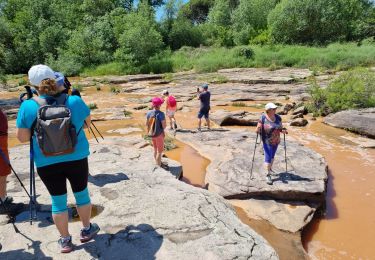
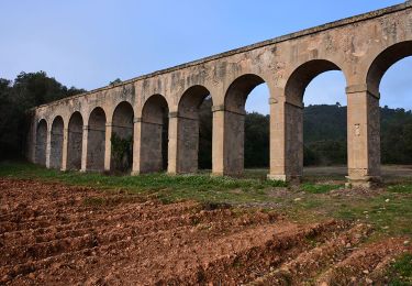
Reco avec Jacques, avec l'aimable autorisation des responsables du château qui est un domaine privé.
Rando RF à réaliser dès que la météo le permettra.
La montée au Deffenson ne sera pas effectuée.


Wandern

Fahrrad
Wandern
Wandern
Wandern
Wandern
Wandern
Wandern
Wandern