![](/images/other/stat-length.png)
![Tour Wandern Isserpent - Promenade des Veyles - Isserpent - Photo](https://media.geolcdn.com/t/1900/400/ext.pjpeg?maxdim=2&url=https%3A%2F%2Fservices.sitytrail.com%2FGeolivesWS%2FDownloadMedia.ashx%3FTrailID%3D107294%26Media%3D12181_6.jpg)
Promenade des Veyles - Isserpent
tracegps
Benutzer
![Länge](/images/other/stat-length.png)
Länge
6 km
![Maximale Höhe](https://static1.geolcdn.com/siteimages/upload/files/1508320355ic_sort_altitude_max_24dp.png)
Maximale Höhe
390 m
![Positive Höhendifferenz](https://static1.geolcdn.com/siteimages/upload/files/1508320355ic_sort_den_pos_24dp.png)
Positive Höhendifferenz
107 m
![Km-Effort](/images/other/stat-length.png)
Km-Effort
7,4 km
![Min. Höhe](https://static1.geolcdn.com/siteimages/upload/files/1508320355ic_sort_altitude_min_24dp.png)
Min. Höhe
320 m
![Negative Höhendifferenz](https://static1.geolcdn.com/siteimages/upload/files/1508320355ic_sort_den_neg_24dp.png)
Negative Höhendifferenz
108 m
![Boucle](https://static1.geolcdn.com/siteimages/upload/files/16400158638029165_repeat_loop_refresh_sync_direction_icon.png)
Boucle
Ja
Erstellungsdatum :
2014-12-10 00:00:00.0
Letzte Änderung :
2014-12-10 00:00:00.0
![Wandern](https://static1.geolcdn.com/sitytour/trail-icons/101.png)
1h30
Schwierigkeit : Einfach
![Scannen Sie diesen QR-Code, um die Tour in der SityTrail-Anwendung zu öffnen](https://capi.geolives.com/qq0zvz2zws4bq2lad0pu/sitytour/trails/107294/qr.png?size=200)
Kostenlosegpshiking-Anwendung
Über SityTrail
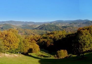
Tour Wandern von 6 km verfügbar auf Auvergne-Rhone-Alpen, Allier, Isserpent. Diese Tour wird von tracegps vorgeschlagen.
Beschreibung
Ce circuit vous est proposé par la la commune d'Isserpent. Départ du centre d'Isserpent. Retrouvez le circuit sur le site de la commune d'Isserpent.
Ort
Land:
France
Region :
Auvergne-Rhone-Alpen
Abteilung/Provinz :
Allier
Kommune :
Isserpent
Standort:
Unknown
Gehen Sie:(Dec)
Gehen Sie:(UTM)
547079 ; 5112338 (31T) N.
Kommentare
Touren in der Umgebung
![Tour Mountainbike Isserpent - VTT à Isserpent - Photo](https://media.geolcdn.com/t/375/260/ext.jpg?maxdim=2&url=https%3A%2F%2Fservices.sitytrail.com%2FGeolivesWS%2FDownloadMedia.ashx%3FTrailID%3D106779%26Media%3D11466_6.jpg)
![Mountainbike Mountainbike](https://static1.geolcdn.com/sitytour/trail-icons/202.png)
VTT à Isserpent
Mountainbike
Sehr schwierig
(1)
Isserpent,
Auvergne-Rhone-Alpen,
Allier,
France
![](/images/other/stat-length.png)
42 km | 56 km-effort
3h 30min
![](https://static1.geolcdn.com/siteimages/upload/files/16400158638029165_repeat_loop_refresh_sync_direction_icon.png)
Ja
![Tour Pferd Saint-Christophe - Domaine Bourdet 1 - Photo](https://media.geolcdn.com/t/375/260/ext.jpg?maxdim=2&url=https%3A%2F%2Fservices.sitytrail.com%2FGeolivesWS%2FDownloadMedia.ashx%3FTrailID%3D997652%26Media%3Dfix__20180702153112.jpg)
![Pferd Pferd](https://static1.geolcdn.com/sitytour/trail-icons/300.png)
Domaine Bourdet 1
Pferd
Einfach
Saint-Christophe,
Auvergne-Rhone-Alpen,
Allier,
France
![](/images/other/stat-length.png)
18,6 km | 25 km-effort
4h 56min
![](https://static1.geolcdn.com/siteimages/upload/files/16400158638029165_repeat_loop_refresh_sync_direction_icon.png)
Ja
![Tour Wandern Châtel-Montagne - Autour du mont Aigu - Châtel-Montagne - Photo](https://media.geolcdn.com/t/375/260/ext.jpg?maxdim=2&url=https%3A%2F%2Fservices.sitytrail.com%2FGeolivesWS%2FDownloadMedia.ashx%3FTrailID%3D172958%26Media%3D14440_1.jpg)
![Wandern Wandern](https://static1.geolcdn.com/sitytour/trail-icons/101.png)
Autour du mont Aigu - Châtel-Montagne
Wandern
Schwierig
Châtel-Montagne,
Auvergne-Rhone-Alpen,
Allier,
France
![](/images/other/stat-length.png)
14 km | 19,9 km-effort
4h 0min
![](https://static1.geolcdn.com/siteimages/upload/files/16400158638029165_repeat_loop_refresh_sync_direction_icon.png)
Ja
![Tour Wandern Châtel-Montagne - w-frankrijk-moulin-chatel - Photo](https://media.geolcdn.com/t/375/260/ext.jpg?maxdim=2&url=https%3A%2F%2Fstatic1.geolcdn.com%2Fsiteimages%2Fupload%2Ffiles%2F1553511878bg_sport_marche.png)
![Wandern Wandern](https://static1.geolcdn.com/sitytour/trail-icons/101.png)
w-frankrijk-moulin-chatel
Wandern
Sehr leicht
Châtel-Montagne,
Auvergne-Rhone-Alpen,
Allier,
France
![](/images/other/stat-length.png)
11,7 km | 16,9 km-effort
Unbekannt
![](https://static1.geolcdn.com/siteimages/upload/files/16400158638029165_repeat_loop_refresh_sync_direction_icon.png)
Ja
![Tour Wandern Isserpent - Mont Aigü - Photo](https://media.geolcdn.com/t/375/260/ext.jpg?maxdim=2&url=https%3A%2F%2Fstatic1.geolcdn.com%2Fsiteimages%2Fupload%2Ffiles%2F1553511878bg_sport_marche.png)
![Wandern Wandern](https://static1.geolcdn.com/sitytour/trail-icons/101.png)
Mont Aigü
Wandern
Schwierig
Isserpent,
Auvergne-Rhone-Alpen,
Allier,
France
![](/images/other/stat-length.png)
15 km | 22 km-effort
3h 0min
![](https://static1.geolcdn.com/siteimages/upload/files/16400158638029165_repeat_loop_refresh_sync_direction_icon.png)
Ja