![](/images/other/stat-length.png)
![Tour Mountainbike Saint-Avertin - En bord de Cher de Saint Avertin à la forêt d'Amboise par Montlouis sur Loire - Photo](https://media.geolcdn.com/t/1900/400/ext.pjpeg?maxdim=2&url=https%3A%2F%2Fstatic1.geolcdn.com%2Fsiteimages%2Fupload%2Ffiles%2F1524743154velo.jpg)
En bord de Cher de Saint Avertin à la forêt d'Amboise par Montlouis sur Loire
tracegps
Benutzer
![Länge](/images/other/stat-length.png)
![Maximale Höhe](https://static1.geolcdn.com/siteimages/upload/files/1508320355ic_sort_altitude_max_24dp.png)
![Positive Höhendifferenz](https://static1.geolcdn.com/siteimages/upload/files/1508320355ic_sort_den_pos_24dp.png)
![Km-Effort](/images/other/stat-length.png)
![Min. Höhe](https://static1.geolcdn.com/siteimages/upload/files/1508320355ic_sort_altitude_min_24dp.png)
![Negative Höhendifferenz](https://static1.geolcdn.com/siteimages/upload/files/1508320355ic_sort_den_neg_24dp.png)
![Boucle](https://static1.geolcdn.com/siteimages/upload/files/16400158638029165_repeat_loop_refresh_sync_direction_icon.png)
![Mountainbike](https://static1.geolcdn.com/sitytour/trail-icons/202.png)
3h30
Schwierigkeit : Schwierig
![Scannen Sie diesen QR-Code, um die Tour in der SityTrail-Anwendung zu öffnen](https://capi.geolives.com/qq0zvz2zws4bq2lad0pu/sitytour/trails/107284/qr.png?size=200)
Kostenlosegpshiking-Anwendung
Über SityTrail
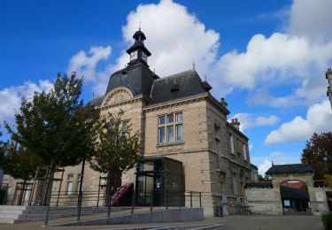
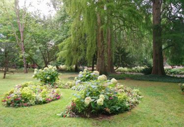
Tour Mountainbike von 63 km verfügbar auf Zentrum-Loiretal, Indre-et-Loire, Saint-Avertin. Diese Tour wird von tracegps vorgeschlagen.
Beschreibung
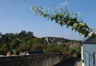
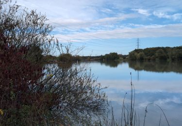
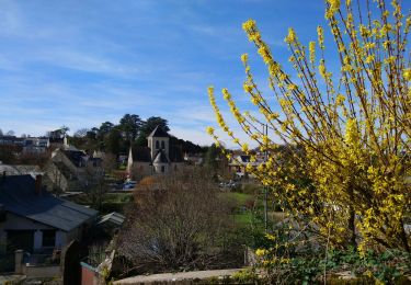
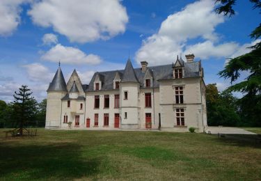
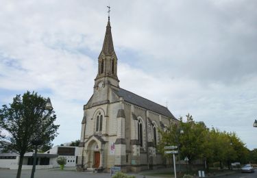
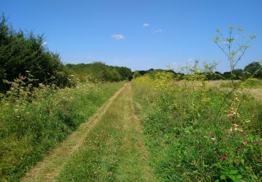
On suit le bord de Cher en bas de Saint Avertin puis Larcay, Veretz (dépt 37 est de Tours) puis Montlouis sur Loire le long du château de la Bourdaisière. On passe dans les vignes et arrivée à Saint Martin le Beau. On traverse une pinède dans la foret d'Amboise, qq singles le long de ruisseau puis retour bord de Cher. Environ 60km 500d
Ort
Kommentare
Touren in der Umgebung
![Tour Wandern Tours - Tours - Marmoutier GR3 GR655 Rochecorbon - 8.2km 105m 1h50 - 2021 10 09 - Photo](https://media.geolcdn.com/t/375/260/8eec29df-bf69-4696-8607-c35bff826c99.jpg&format=jpg&maxdim=2)
![Wandern Wandern](https://static1.geolcdn.com/sitytour/trail-icons/101.png)
Wandern
![](/images/other/stat-length.png)
![](https://static1.geolcdn.com/siteimages/upload/files/16400158638029165_repeat_loop_refresh_sync_direction_icon.png)
![Tour Wandern Chambray-lès-Tours - Chambray-lès-Tours - Sentier au travers des landes avec variantes - GR46 - 26.2km 170m 5h35 (1h) - 2024 10 16 - Photo](https://media.geolcdn.com/t/375/260/76f8d73c-b1be-428b-9345-2e17578c7a0c.jpg&format=jpg&maxdim=2)
![Wandern Wandern](https://static1.geolcdn.com/sitytour/trail-icons/101.png)
Wandern
![](/images/other/stat-length.png)
![](https://static1.geolcdn.com/siteimages/upload/files/16400158638029165_repeat_loop_refresh_sync_direction_icon.png)
![Tour Wandern Rochecorbon - Rochecorbon - Zig zag autour de Rochecorbon - 17km 295m 3h50 - 2024 03 13 - Photo](https://media.geolcdn.com/t/375/260/c0145acf-b15a-4f41-833a-811e7495297d.jpg&format=jpg&maxdim=2)
![Wandern Wandern](https://static1.geolcdn.com/sitytour/trail-icons/101.png)
Wandern
![](/images/other/stat-length.png)
![](https://static1.geolcdn.com/siteimages/upload/files/16400158638029165_repeat_loop_refresh_sync_direction_icon.png)
![Tour Wandern Saint-Pierre-des-Corps - Saint-Pierre-des-Corps - PR Sentier du bord de Loire avec variantes - 13.6km 75m 2h55 (30mn) - 2023 10 22 - Photo](https://media.geolcdn.com/t/375/260/6a165834-3cba-4860-930a-9c6f29b052c7.jpg&format=jpg&maxdim=2)
![Wandern Wandern](https://static1.geolcdn.com/sitytour/trail-icons/101.png)
Wandern
![](/images/other/stat-length.png)
![](https://static1.geolcdn.com/siteimages/upload/files/16400158638029165_repeat_loop_refresh_sync_direction_icon.png)
![Tour Wandern Saint-Avertin - Saint-Avertin - PR Sentier du vieux Cher, Cangé - 9.3km 95m 2h05 (20mn) - 2023 07 12 - Photo](https://media.geolcdn.com/t/375/260/1c5742ed-1795-4a54-ac46-a850f2d399d9.jpg&format=jpg&maxdim=2)
![Wandern Wandern](https://static1.geolcdn.com/sitytour/trail-icons/101.png)
Wandern
![](/images/other/stat-length.png)
![](https://static1.geolcdn.com/siteimages/upload/files/16400158638029165_repeat_loop_refresh_sync_direction_icon.png)
![Tour Wandern Vouvray - Vouvray - PR balisé en bleu - 15.1km 125m 3h30 - 2023 06 28 - Photo](https://media.geolcdn.com/t/375/260/60d19163-b23a-4217-bba8-93e697ea97cd.jpg&format=jpg&maxdim=2)
![Wandern Wandern](https://static1.geolcdn.com/sitytour/trail-icons/101.png)
Wandern
![](/images/other/stat-length.png)
![](https://static1.geolcdn.com/siteimages/upload/files/16400158638029165_repeat_loop_refresh_sync_direction_icon.png)
![Tour Wandern Tours - Tours - Bd Béranger La Riche - 8.8km 45m 2h00 - 2022 09 12 - Photo](https://media.geolcdn.com/t/375/260/42e96b35-6e0b-4b51-82b8-ef6cff621515.jpg&format=jpg&maxdim=2)
![Wandern Wandern](https://static1.geolcdn.com/sitytour/trail-icons/101.png)
Wandern
![](/images/other/stat-length.png)
![](https://static1.geolcdn.com/siteimages/upload/files/16400158638029165_repeat_loop_refresh_sync_direction_icon.png)
![Tour Wandern Chambray-lès-Tours - Chambray-lès-Tours - de la Vrillonnerie Marsin à Tours Prébendes - 8.8km 55m95 1h50 - 2021 09 03 - Photo](https://media.geolcdn.com/t/375/260/bd8e50f7-bd5b-4eee-b3f2-be1ae9d8a065.jpg&format=jpg&maxdim=2)
![Wandern Wandern](https://static1.geolcdn.com/sitytour/trail-icons/101.png)
Wandern
![](/images/other/stat-length.png)
![](https://static1.geolcdn.com/siteimages/upload/files/16400158638029165_repeat_loop_refresh_sync_direction_icon.png)
![Tour Wandern Esvres - Larçay - le Chêne Pendu GR46 GR655 Veigné Montbazon - 23.2km 230m 5h20 (25mn) - 2021 08 11 - Photo](https://media.geolcdn.com/t/375/260/bef14b6a-df34-48bf-b03d-e33ce373ae61.jpg&format=jpg&maxdim=2)
![Wandern Wandern](https://static1.geolcdn.com/sitytour/trail-icons/101.png)
Wandern
![](/images/other/stat-length.png)
![](https://static1.geolcdn.com/siteimages/upload/files/16400158638029165_repeat_loop_refresh_sync_direction_icon.png)
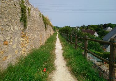
sur cet itinéraire toute la partie située en forêt d'Amboise se déroule sur une propriété privée de 4000 hectares pour laquelle il serait de bon ton d'avoir une autorisation. D'autre part; sur ce territoire se déroulent très souvent des chasses au grand gibier avec des âmes rayées.