![](/images/other/stat-length.png)
![Tour Wandern Hauville - Balade à Hauville - Photo](https://media.geolcdn.com/t/1900/400/ext.pjpeg?maxdim=2&url=https%3A%2F%2Fservices.sitytrail.com%2FGeolivesWS%2FDownloadMedia.ashx%3FTrailID%3D107145%26Media%3D11986_1.jpg)
Balade à Hauville
tracegps
Benutzer
![Länge](/images/other/stat-length.png)
Länge
16,5 km
![Maximale Höhe](https://static1.geolcdn.com/siteimages/upload/files/1508320355ic_sort_altitude_max_24dp.png)
Maximale Höhe
146 m
![Positive Höhendifferenz](https://static1.geolcdn.com/siteimages/upload/files/1508320355ic_sort_den_pos_24dp.png)
Positive Höhendifferenz
315 m
![Km-Effort](/images/other/stat-length.png)
Km-Effort
21 km
![Min. Höhe](https://static1.geolcdn.com/siteimages/upload/files/1508320355ic_sort_altitude_min_24dp.png)
Min. Höhe
0 m
![Negative Höhendifferenz](https://static1.geolcdn.com/siteimages/upload/files/1508320355ic_sort_den_neg_24dp.png)
Negative Höhendifferenz
315 m
![Boucle](https://static1.geolcdn.com/siteimages/upload/files/16400158638029165_repeat_loop_refresh_sync_direction_icon.png)
Boucle
Ja
Erstellungsdatum :
2014-12-10 00:00:00.0
Letzte Änderung :
2014-12-10 00:00:00.0
![Wandern](https://static1.geolcdn.com/sitytour/trail-icons/101.png)
3h19
Schwierigkeit : Medium
![Scannen Sie diesen QR-Code, um die Tour in der SityTrail-Anwendung zu öffnen](https://capi.geolives.com/qq0zvz2zws4bq2lad0pu/sitytour/trails/107145/qr.png?size=200)
Kostenlosegpshiking-Anwendung
Über SityTrail
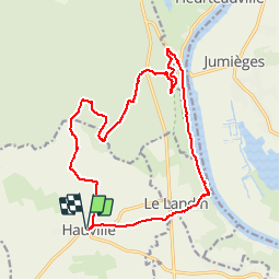
Tour Wandern von 16,5 km verfügbar auf Normandie, Eure, Hauville. Diese Tour wird von tracegps vorgeschlagen.
Beschreibung
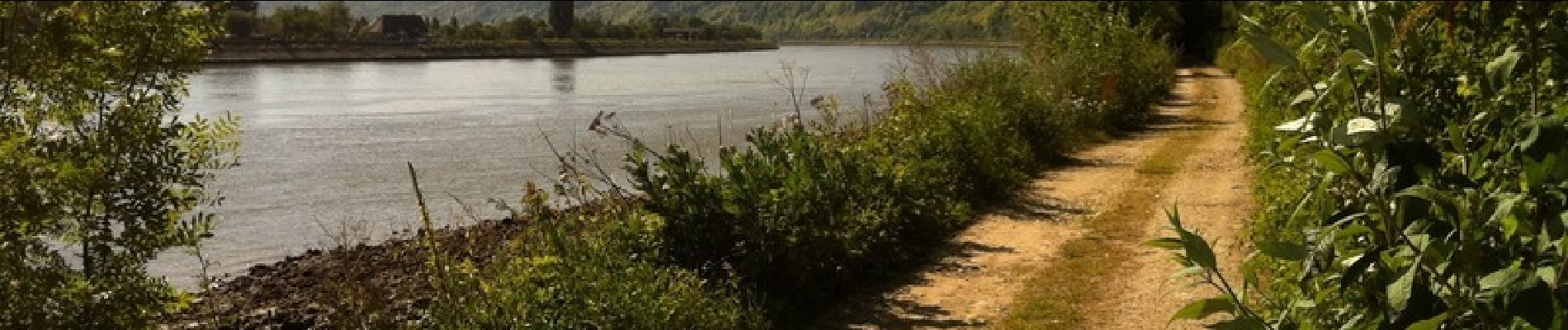
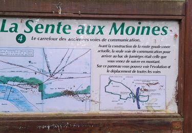
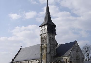
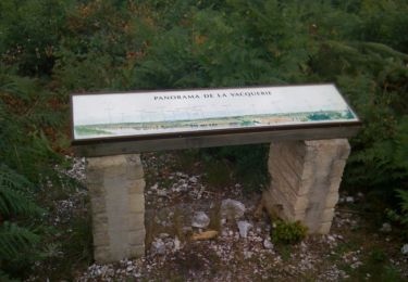
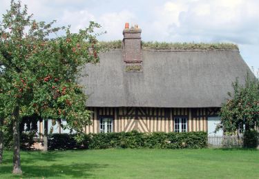
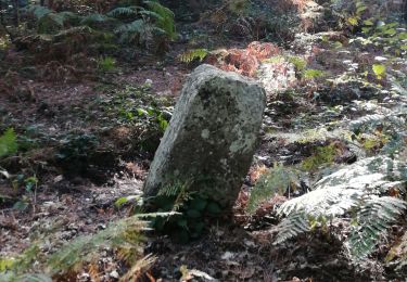
Cette balade utilise en bonne part le GR 23 en forêt domaniale de Brotonne et en chemin de halage au bord de la Seine. La balade nous conduit au pied du Chêne Cuve, reconnu arbre remarquable de France. Toutes les photos sur balades en Normandie.
Ort
Land:
France
Region :
Normandie
Abteilung/Provinz :
Eure
Kommune :
Hauville
Standort:
Unknown
Gehen Sie:(Dec)
Gehen Sie:(UTM)
338268 ; 5474002 (31U) N.
Kommentare
Touren in der Umgebung
![Tour Wandern Jumièges - 076-84-Jumièges 14Km La route des Fruits - Photo](https://media.geolcdn.com/t/375/260/e64b558b-b90d-49d1-a272-2fef28aac5a7.jpg&format=jpg&maxdim=2)
![Wandern Wandern](https://static1.geolcdn.com/sitytour/trail-icons/101.png)
076-84-Jumièges 14Km La route des Fruits
Wandern
Einfach
(1)
Jumièges,
Normandie,
Seine-Maritime,
France
![](/images/other/stat-length.png)
13,7 km | 14,9 km-effort
3h 19min
![](https://static1.geolcdn.com/siteimages/upload/files/16400158638029165_repeat_loop_refresh_sync_direction_icon.png)
Ja
![Tour Wandern La Haye-de-Routot - La Haye de Routot (32) - Photo](https://media.geolcdn.com/t/375/260/ext.jpg?maxdim=2&url=https%3A%2F%2Fstatic1.geolcdn.com%2Fsiteimages%2Fupload%2Ffiles%2F1553511878bg_sport_marche.png)
![Wandern Wandern](https://static1.geolcdn.com/sitytour/trail-icons/101.png)
La Haye de Routot (32)
Wandern
Einfach
(1)
La Haye-de-Routot,
Normandie,
Eure,
France
![](/images/other/stat-length.png)
11 km | 13,7 km-effort
2h 57min
![](https://static1.geolcdn.com/siteimages/upload/files/16400158638029165_repeat_loop_refresh_sync_direction_icon.png)
Ja
![Tour Wandern Heurteauville - HONFLEUR 04 - La Sente aux Moines et Abbaye de Jumiêges (Normandie) - Photo](https://media.geolcdn.com/t/375/260/010082f5-0545-4d4b-952f-4f2094d18163.jpg&format=jpg&maxdim=2)
![Wandern Wandern](https://static1.geolcdn.com/sitytour/trail-icons/101.png)
HONFLEUR 04 - La Sente aux Moines et Abbaye de Jumiêges (Normandie)
Wandern
Medium
Heurteauville,
Normandie,
Seine-Maritime,
France
![](/images/other/stat-length.png)
19,9 km | 25 km-effort
6h 37min
![](https://static1.geolcdn.com/siteimages/upload/files/16400158638029165_repeat_loop_refresh_sync_direction_icon.png)
Nein
![Tour Wandern Routot - Routot , Croix - Sainte-Marie , La Haie de Routot - Photo](https://media.geolcdn.com/t/375/260/674acfee-f83f-475c-97db-50c68854b132.jpg&format=jpg&maxdim=2)
![Wandern Wandern](https://static1.geolcdn.com/sitytour/trail-icons/101.png)
Routot , Croix - Sainte-Marie , La Haie de Routot
Wandern
Schwierig
Routot,
Normandie,
Eure,
France
![](/images/other/stat-length.png)
13,7 km | 15,6 km-effort
4h 5min
![](https://static1.geolcdn.com/siteimages/upload/files/16400158638029165_repeat_loop_refresh_sync_direction_icon.png)
Ja
![Tour Pferd Routot - Circuit de Routot - Photo](https://media.geolcdn.com/t/375/260/ext.jpg?maxdim=2&url=https%3A%2F%2Fservices.sitytrail.com%2FGeolivesWS%2FDownloadMedia.ashx%3FTrailID%3D111672%26Media%3D7911_4.jpg)
![Pferd Pferd](https://static1.geolcdn.com/sitytour/trail-icons/300.png)
![Tour Wandern Routot - Circuit de Routot - Photo](https://media.geolcdn.com/t/375/260/ext.jpg?maxdim=2&url=https%3A%2F%2Fservices.sitytrail.com%2FGeolivesWS%2FDownloadMedia.ashx%3FTrailID%3D111671%26Media%3D7911_4.jpg)
![Wandern Wandern](https://static1.geolcdn.com/sitytour/trail-icons/101.png)
Circuit de Routot
Wandern
Schwierig
Routot,
Normandie,
Eure,
France
![](/images/other/stat-length.png)
12,5 km | 14,4 km-effort
3h 10min
![](https://static1.geolcdn.com/siteimages/upload/files/16400158638029165_repeat_loop_refresh_sync_direction_icon.png)
Ja
![Tour Mountainbike Arelaune-en-Seine - Forêt de Brotonne - Vatteville la Rue - Photo](https://media.geolcdn.com/t/375/260/ext.jpg?maxdim=2&url=https%3A%2F%2Fservices.sitytrail.com%2FGeolivesWS%2FDownloadMedia.ashx%3FTrailID%3D103563%26Media%3D5834_4.jpg)
![Mountainbike Mountainbike](https://static1.geolcdn.com/sitytour/trail-icons/202.png)
Forêt de Brotonne - Vatteville la Rue
Mountainbike
Schwierig
Arelaune-en-Seine,
Normandie,
Seine-Maritime,
France
![](/images/other/stat-length.png)
41 km | 51 km-effort
2h 30min
![](https://static1.geolcdn.com/siteimages/upload/files/16400158638029165_repeat_loop_refresh_sync_direction_icon.png)
Nein
![Tour Wandern La Haye-de-Routot - La Haye-de-Routot - PT - Photo](https://media.geolcdn.com/t/375/260/1e0a3e2a-9c74-413c-91e5-8494647de3b8.jpeg&format=jpg&maxdim=2)
![Wandern Wandern](https://static1.geolcdn.com/sitytour/trail-icons/101.png)
La Haye-de-Routot - PT
Wandern
Medium
(1)
La Haye-de-Routot,
Normandie,
Eure,
France
![](/images/other/stat-length.png)
6,8 km | 8,3 km-effort
1h 53min
![](https://static1.geolcdn.com/siteimages/upload/files/16400158638029165_repeat_loop_refresh_sync_direction_icon.png)
Ja
![Tour Wandern Jumièges - Jumièges - Yainville - Photo](https://media.geolcdn.com/t/375/260/78ded959-9864-412e-adea-aaddc14d1442.jpg&format=jpg&maxdim=2)
![Wandern Wandern](https://static1.geolcdn.com/sitytour/trail-icons/101.png)
Jumièges - Yainville
Wandern
Medium
Jumièges,
Normandie,
Seine-Maritime,
France
![](/images/other/stat-length.png)
8,2 km | 9,8 km-effort
2h 19min
![](https://static1.geolcdn.com/siteimages/upload/files/16400158638029165_repeat_loop_refresh_sync_direction_icon.png)
Ja