


4,1 km | 11,1 km-effort

Benutzer


Kostenlosegpshiking-Anwendung
 SityTrail
IGN / Geografische Institute
SityTrail World
Die Welt öffnet sich für Sie
Tour Laufen von 8,7 km verfügbar auf Auvergne-Rhone-Alpen, Savoyen, Aussois. Diese Tour wird von tracegps vorgeschlagen.
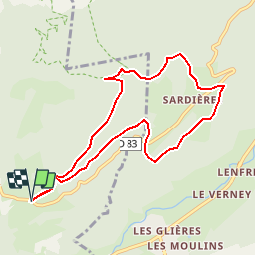
Dans ce fabuleux coin de Haute Maurienne ce petit parcours de 9km800 au départ de Plan Croix est très attractif pour reprendre "contact" et pour se décrasser physiquement, en course à pied par exemple ou bien en balade pour voir ce monolithe spectaculaire et vertigineux .Le tout à 1500m en moyenne. Attention au panneau Bramans prendre le numéro vtt 5 de droite


Wandern

Wandern

Wandern

Skiwanderen

Zu Fuß

Wandern

Wandern

Wandern
Wandern
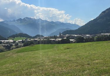
Magnifique