![](/images/other/stat-length.png)
![Tour Mountainbike Armentières - Circuit entre Lys et Voie verte (25 km) - Armentières - Photo](https://media.geolcdn.com/t/1900/400/ext.pjpeg?maxdim=2&url=https%3A%2F%2Fservices.sitytrail.com%2FGeolivesWS%2FDownloadMedia.ashx%3FTrailID%3D107018%26Media%3D11817_6.jpg)
Circuit entre Lys et Voie verte (25 km) - Armentières
tracegps
Benutzer
![Länge](/images/other/stat-length.png)
Länge
25 km
![Maximale Höhe](https://static1.geolcdn.com/siteimages/upload/files/1508320355ic_sort_altitude_max_24dp.png)
Maximale Höhe
21 m
![Positive Höhendifferenz](https://static1.geolcdn.com/siteimages/upload/files/1508320355ic_sort_den_pos_24dp.png)
Positive Höhendifferenz
100 m
![Km-Effort](/images/other/stat-length.png)
Km-Effort
26 km
![Min. Höhe](https://static1.geolcdn.com/siteimages/upload/files/1508320355ic_sort_altitude_min_24dp.png)
Min. Höhe
8 m
![Negative Höhendifferenz](https://static1.geolcdn.com/siteimages/upload/files/1508320355ic_sort_den_neg_24dp.png)
Negative Höhendifferenz
100 m
![Boucle](https://static1.geolcdn.com/siteimages/upload/files/16400158638029165_repeat_loop_refresh_sync_direction_icon.png)
Boucle
Ja
Erstellungsdatum :
2014-12-10 00:00:00.0
Letzte Änderung :
2014-12-10 00:00:00.0
![Mountainbike](https://static1.geolcdn.com/sitytour/trail-icons/202.png)
2h00
Schwierigkeit : Medium
![Scannen Sie diesen QR-Code, um die Tour in der SityTrail-Anwendung zu öffnen](https://capi.geolives.com/qq0zvz2zws4bq2lad0pu/sitytour/trails/107018/qr.png?size=200)
Kostenlosegpshiking-Anwendung
Über SityTrail
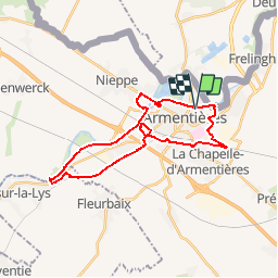
Tour Mountainbike von 25 km verfügbar auf Nordfrankreich, Nord, Armentières. Diese Tour wird von tracegps vorgeschlagen.
Beschreibung
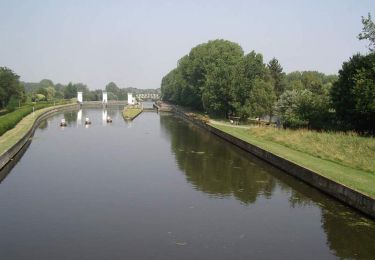
Circuit proposé par l’Office de tourisme d'Armentières. Départ du complexe sportif Léo Lagrange à Armentières. Vous pouvez obtenir le plan et le descriptif du parcours auprès de l’Office de Tourisme
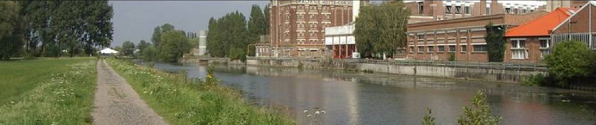
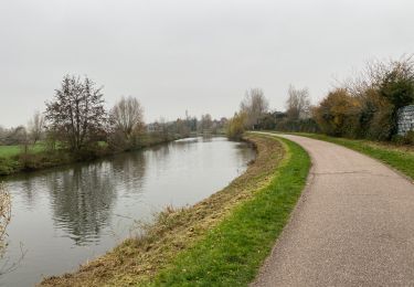
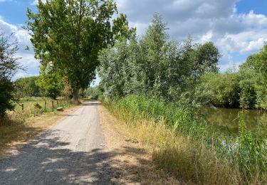
Ort
Land:
France
Region :
Nordfrankreich
Abteilung/Provinz :
Nord
Kommune :
Armentières
Standort:
Unknown
Gehen Sie:(Dec)
Gehen Sie:(UTM)
492256 ; 5615546 (31U) N.
Kommentare
Touren in der Umgebung
![Tour Wandern Comines-Warneton - Ploegsteert2 - Photo](https://media.geolcdn.com/t/375/260/a18aaf3b-b0bc-4f4e-b927-dc13a3158e1c.jpg&format=jpg&maxdim=2)
![Wandern Wandern](https://static1.geolcdn.com/sitytour/trail-icons/101.png)
Ploegsteert2
Wandern
Medium
(1)
Comines-Warneton,
Wallonien,
Hennegau,
Belgium
![](/images/other/stat-length.png)
23 km | 26 km-effort
4h 53min
![](https://static1.geolcdn.com/siteimages/upload/files/16400158638029165_repeat_loop_refresh_sync_direction_icon.png)
Ja
![Tour Wandern Deûlémont - de la base de loisir de Deulemont à Toufflers. - Photo](https://media.geolcdn.com/t/375/260/5ac53abb-339d-4e2a-9cbd-7a169a52403a.jpg&format=jpg&maxdim=2)
![Wandern Wandern](https://static1.geolcdn.com/sitytour/trail-icons/101.png)
de la base de loisir de Deulemont à Toufflers.
Wandern
Schwierig
Deûlémont,
Nordfrankreich,
Nord,
France
![](/images/other/stat-length.png)
38 km | 41 km-effort
9h 32min
![](https://static1.geolcdn.com/siteimages/upload/files/16400158638029165_repeat_loop_refresh_sync_direction_icon.png)
Nein
![Tour Wandern Frelinghien - Frelinghien 10,9 km - Photo](https://media.geolcdn.com/t/375/260/e9892460-75c9-49f2-9a9a-96bdb62e1fb4.jpg&format=jpg&maxdim=2)
![Wandern Wandern](https://static1.geolcdn.com/sitytour/trail-icons/101.png)
Frelinghien 10,9 km
Wandern
Medium
Frelinghien,
Nordfrankreich,
Nord,
France
![](/images/other/stat-length.png)
10,9 km | 11,7 km-effort
2h 56min
![](https://static1.geolcdn.com/siteimages/upload/files/16400158638029165_repeat_loop_refresh_sync_direction_icon.png)
Ja
![Tour Wandern Armentières - Armantiere 11 km - Photo](https://media.geolcdn.com/t/375/260/2b4ca994-85f8-4e5f-b7cf-d67b61642113.jpg&format=jpg&maxdim=2)
![Wandern Wandern](https://static1.geolcdn.com/sitytour/trail-icons/101.png)
Armantiere 11 km
Wandern
Einfach
Armentières,
Nordfrankreich,
Nord,
France
![](/images/other/stat-length.png)
10,9 km | 11,6 km-effort
3h 41min
![](https://static1.geolcdn.com/siteimages/upload/files/16400158638029165_repeat_loop_refresh_sync_direction_icon.png)
Ja
![Tour Wandern Frelinghien - Frelinghien Deule 13 km - Photo](https://media.geolcdn.com/t/375/260/d8d1bfc7-e840-48a0-817e-fbeb606f87c9.jpg&format=jpg&maxdim=2)
![Wandern Wandern](https://static1.geolcdn.com/sitytour/trail-icons/101.png)
Frelinghien Deule 13 km
Wandern
Einfach
Frelinghien,
Nordfrankreich,
Nord,
France
![](/images/other/stat-length.png)
13,2 km | 14 km-effort
4h 3min
![](https://static1.geolcdn.com/siteimages/upload/files/16400158638029165_repeat_loop_refresh_sync_direction_icon.png)
Ja
![Tour Wandern Armentières - Au fil de l''eau - Armentières - Photo](https://media.geolcdn.com/t/375/260/ext.jpg?maxdim=2&url=https%3A%2F%2Fservices.sitytrail.com%2FGeolivesWS%2FDownloadMedia.ashx%3FTrailID%3D215297%26Media%3D15829_6.jpg)
![Wandern Wandern](https://static1.geolcdn.com/sitytour/trail-icons/101.png)
Au fil de l''eau - Armentières
Wandern
Medium
Armentières,
Nordfrankreich,
Nord,
France
![](/images/other/stat-length.png)
8,5 km | 9,1 km-effort
2h 10min
![](https://static1.geolcdn.com/siteimages/upload/files/16400158638029165_repeat_loop_refresh_sync_direction_icon.png)
Ja
![Tour Mountainbike Armentières - Vers la confluence de la Lys et de la Deûle - Armentières - Photo](https://media.geolcdn.com/t/375/260/ext.jpg?maxdim=2&url=https%3A%2F%2Fservices.sitytrail.com%2FGeolivesWS%2FDownloadMedia.ashx%3FTrailID%3D110615%26Media%3D6178_6.jpg)
![Mountainbike Mountainbike](https://static1.geolcdn.com/sitytour/trail-icons/202.png)
Vers la confluence de la Lys et de la Deûle - Armentières
Mountainbike
Medium
Armentières,
Nordfrankreich,
Nord,
France
![](/images/other/stat-length.png)
23 km | 25 km-effort
2h 30min
![](https://static1.geolcdn.com/siteimages/upload/files/16400158638029165_repeat_loop_refresh_sync_direction_icon.png)
Ja
![Tour Wandern Armentières - Vers la confluence de la Lys et de la Deûle - Armentières - Photo](https://media.geolcdn.com/t/375/260/ext.jpg?maxdim=2&url=https%3A%2F%2Fservices.sitytrail.com%2FGeolivesWS%2FDownloadMedia.ashx%3FTrailID%3D110614%26Media%3D6178_6.jpg)
![Wandern Wandern](https://static1.geolcdn.com/sitytour/trail-icons/101.png)
Vers la confluence de la Lys et de la Deûle - Armentières
Wandern
Sehr schwierig
Armentières,
Nordfrankreich,
Nord,
France
![](/images/other/stat-length.png)
23 km | 25 km-effort
6h 0min
![](https://static1.geolcdn.com/siteimages/upload/files/16400158638029165_repeat_loop_refresh_sync_direction_icon.png)
Ja
![Tour Mountainbike Armentières - La Lys du plat pays entre Serpentine et Warnave - Armentières - Photo](https://media.geolcdn.com/t/375/260/ext.jpg?maxdim=2&url=https%3A%2F%2Fservices.sitytrail.com%2FGeolivesWS%2FDownloadMedia.ashx%3FTrailID%3D110349%26Media%3D5801_6.jpg)
![Mountainbike Mountainbike](https://static1.geolcdn.com/sitytour/trail-icons/202.png)
La Lys du plat pays entre Serpentine et Warnave - Armentières
Mountainbike
Medium
Armentières,
Nordfrankreich,
Nord,
France
![](/images/other/stat-length.png)
37 km | 40 km-effort
3h 0min
![](https://static1.geolcdn.com/siteimages/upload/files/16400158638029165_repeat_loop_refresh_sync_direction_icon.png)
Ja