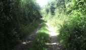

Senoville - Cap Rozel

tracegps
Benutzer

Länge
27 km

Maximale Höhe
94 m

Positive Höhendifferenz
325 m

Km-Effort
31 km

Min. Höhe
1 m

Negative Höhendifferenz
324 m
Boucle
Ja
Erstellungsdatum :
2014-12-10 00:00:00.0
Letzte Änderung :
2014-12-10 00:00:00.0
2h49
Schwierigkeit : Schwierig

Kostenlosegpshiking-Anwendung
Über SityTrail
Tour Mountainbike von 27 km verfügbar auf Normandie, Manche, Sénoville. Diese Tour wird von tracegps vorgeschlagen.
Beschreibung
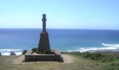
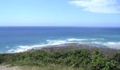
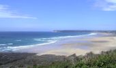
Bonjour à tous, Un circuit mixte, route et chemin, une belle montée pour accéder au cap Rozel et de bonnes descentes.(attention beaucoup de cailloux) les vues sont agréables surtout en haut du cap Rozel. Bonne rando.
Ort
Land:
France
Region :
Normandie
Abteilung/Provinz :
Manche
Kommune :
Sénoville
Standort:
Unknown
Gehen Sie:(Dec)
Gehen Sie:(UTM)
590102 ; 5476380 (30U) N.
Kommentare
Touren in der Umgebung
Tour de Senoville en VTT


Mountainbike
Einfach
Sénoville,
Normandie,
Manche,
France

11,3 km | 13,1 km-effort
1h 0min
Ja
Senoville - Cap Carteret


Mountainbike
Medium
Sénoville,
Normandie,
Manche,
France

23 km | 27 km-effort
2h 0min
Ja

Le Tour de Nathan - Pierreville


Mountainbike
Medium
Pierreville,
Normandie,
Manche,
France

28 km | 34 km-effort
2h 0min
Ja

pierreville


Wandern
Schwierig
Pierreville,
Normandie,
Manche,
France

11 km | 13,2 km-effort
3h 2min
Ja

surtainville grande


Wandern
Schwierig
Surtainville,
Normandie,
Manche,
France

14,4 km | 16,2 km-effort
2h 47min
Nein

Le Vretot


Wandern
Schwierig
Bricquebec-en-Cotentin,
Normandie,
Manche,
France

12,2 km | 15,4 km-effort
2h 54min
Ja

29 décembre 2020


Motorrad
Sehr leicht
Sénoville,
Normandie,
Manche,
France

101 km | 120 km-effort
10h 26min
Ja

3 moulins et allée couverte


Wandern
Les Moitiers-d'Allonne,
Normandie,
Manche,
France

11,2 km | 0 m-effort
2h 45min
Nein

le vretot


Mountainbike
Sehr leicht
Bricquebec-en-Cotentin,
Normandie,
Manche,
France

24 km | 28 km-effort
2h 8min
Ja


 SityTrail


