![](/images/other/stat-length.png)
![Tour Wandern Saint-Hilaire-de-Brethmas - Garrigues et Oppidum N°2 - Saint Hilaire de Brethmas - Photo](https://media.geolcdn.com/t/1900/400/ext.pjpeg?maxdim=2&url=https%3A%2F%2Fservices.sitytrail.com%2FGeolivesWS%2FDownloadMedia.ashx%3FTrailID%3D106868%26Media%3D11616_1.jpg)
Garrigues et Oppidum N°2 - Saint Hilaire de Brethmas
tracegps
Benutzer
![Länge](/images/other/stat-length.png)
![Maximale Höhe](https://static1.geolcdn.com/siteimages/upload/files/1508320355ic_sort_altitude_max_24dp.png)
![Positive Höhendifferenz](https://static1.geolcdn.com/siteimages/upload/files/1508320355ic_sort_den_pos_24dp.png)
![Km-Effort](/images/other/stat-length.png)
![Min. Höhe](https://static1.geolcdn.com/siteimages/upload/files/1508320355ic_sort_altitude_min_24dp.png)
![Negative Höhendifferenz](https://static1.geolcdn.com/siteimages/upload/files/1508320355ic_sort_den_neg_24dp.png)
![Boucle](https://static1.geolcdn.com/siteimages/upload/files/16400158638029165_repeat_loop_refresh_sync_direction_icon.png)
![Wandern](https://static1.geolcdn.com/sitytour/trail-icons/101.png)
6h00
Schwierigkeit : Medium
![Scannen Sie diesen QR-Code, um die Tour in der SityTrail-Anwendung zu öffnen](https://capi.geolives.com/qq0zvz2zws4bq2lad0pu/sitytour/trails/106868/qr.png?size=200)
Kostenlosegpshiking-Anwendung
Über SityTrail
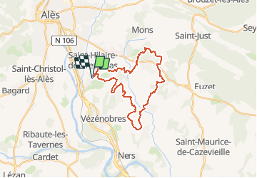
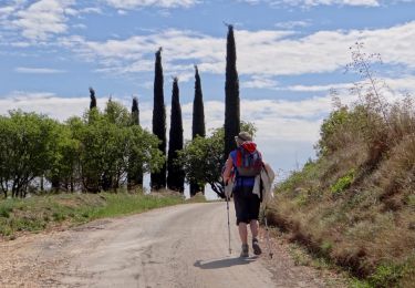
Tour Wandern von 28 km verfügbar auf Okzitanien, Gard, Saint-Hilaire-de-Brethmas. Diese Tour wird von tracegps vorgeschlagen.
Beschreibung
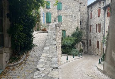
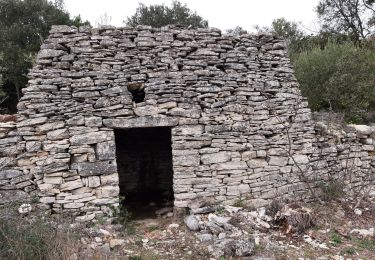
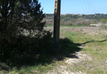
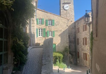
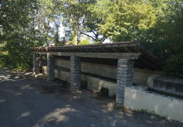
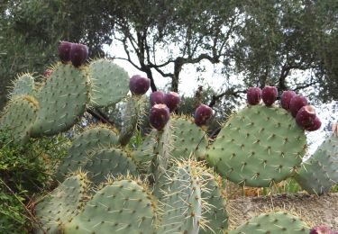
Le départ se fait à partir du Temple de St Hilaire de Brethmas, suivre les flèches "orange VTT". Elles sont parfois peintes sur des cailloux, ou sur des troncs d'arbres, des petits malins les arrachent. Il est possible de quitter le circuit pour visiter les villages qui bordent cette randonnée. Bonne balade.
Ort
Kommentare
Touren in der Umgebung
![Tour Wandern Vézénobres - Vézénobres - Photo](https://media.geolcdn.com/t/375/260/133326a3-8cbb-4088-be57-7b89bc312c23.jpg&format=jpg&maxdim=2)
![Wandern Wandern](https://static1.geolcdn.com/sitytour/trail-icons/101.png)
Wandern
![](/images/other/stat-length.png)
![](https://static1.geolcdn.com/siteimages/upload/files/16400158638029165_repeat_loop_refresh_sync_direction_icon.png)
![Tour Wandern Vézénobres - Venez ivre - Photo](https://media.geolcdn.com/t/375/260/272c1169-d834-477c-80d3-e214642ba92a.jpg&format=jpg&maxdim=2)
![Wandern Wandern](https://static1.geolcdn.com/sitytour/trail-icons/101.png)
Wandern
![](/images/other/stat-length.png)
![](https://static1.geolcdn.com/siteimages/upload/files/16400158638029165_repeat_loop_refresh_sync_direction_icon.png)
![Tour Wandern Vézénobres - Vezenobres - Photo](https://media.geolcdn.com/t/375/260/2787b8e8-8611-46cf-ab9b-ef9c6abd30ae.jpg&format=jpg&maxdim=2)
![Wandern Wandern](https://static1.geolcdn.com/sitytour/trail-icons/101.png)
Wandern
![](/images/other/stat-length.png)
![](https://static1.geolcdn.com/siteimages/upload/files/16400158638029165_repeat_loop_refresh_sync_direction_icon.png)
![Tour Wandern Martignargues - Marsillargues-Vézenorbes 220317 - Photo](https://media.geolcdn.com/t/375/260/0648718d-e661-4ed3-9e67-4c94d80baa28.jpg&format=jpg&maxdim=2)
![Wandern Wandern](https://static1.geolcdn.com/sitytour/trail-icons/101.png)
Wandern
![](/images/other/stat-length.png)
![](https://static1.geolcdn.com/siteimages/upload/files/16400158638029165_repeat_loop_refresh_sync_direction_icon.png)
![Tour Wandern Mons - Mons SCLC 030421 avec photos pour indication - Photo](https://media.geolcdn.com/t/375/260/428e77e1-e6ab-43cc-9016-bc97b720e07d.jpg&format=jpg&maxdim=2)
![Wandern Wandern](https://static1.geolcdn.com/sitytour/trail-icons/101.png)
Wandern
![](/images/other/stat-length.png)
![](https://static1.geolcdn.com/siteimages/upload/files/16400158638029165_repeat_loop_refresh_sync_direction_icon.png)
![Tour Wandern Vézénobres - Vezenobres 2 - Photo](https://media.geolcdn.com/t/375/260/900e2355-3ae0-41ab-9799-d86a37523d13.jpg&format=jpg&maxdim=2)
![Wandern Wandern](https://static1.geolcdn.com/sitytour/trail-icons/101.png)
![Tour Wandern Saint-Christol-lez-Alès - Randonnée Domaine du Rouret 20 mai 2020 - Photo](https://media.geolcdn.com/t/375/260/f43d9c9c-a0b6-44a2-8831-661d46e8665d.jpg&format=jpg&maxdim=2)
![Wandern Wandern](https://static1.geolcdn.com/sitytour/trail-icons/101.png)
Wandern
![](/images/other/stat-length.png)
![](https://static1.geolcdn.com/siteimages/upload/files/16400158638029165_repeat_loop_refresh_sync_direction_icon.png)
![Wandern Wandern](https://static1.geolcdn.com/sitytour/trail-icons/101.png)
Wandern
![](/images/other/stat-length.png)
![](https://static1.geolcdn.com/siteimages/upload/files/16400158638029165_repeat_loop_refresh_sync_direction_icon.png)
![Wandern Wandern](https://static1.geolcdn.com/sitytour/trail-icons/101.png)
Wandern
![](/images/other/stat-length.png)
![](https://static1.geolcdn.com/siteimages/upload/files/16400158638029165_repeat_loop_refresh_sync_direction_icon.png)