![](/images/other/stat-length.png)
![Tour Wandern Bondues - Aux confins de l'Aérodrome (Circuit bleu) - Bondues - Photo](https://media.geolcdn.com/t/1900/400/ext.pjpeg?maxdim=2&url=https%3A%2F%2Fservices.sitytrail.com%2FGeolivesWS%2FDownloadMedia.ashx%3FTrailID%3D106808%26Media%3D11502_6.jpg)
Aux confins de l'Aérodrome (Circuit bleu) - Bondues
tracegps
Benutzer
![Länge](/images/other/stat-length.png)
Länge
15,5 km
![Maximale Höhe](https://static1.geolcdn.com/siteimages/upload/files/1508320355ic_sort_altitude_max_24dp.png)
Maximale Höhe
41 m
![Positive Höhendifferenz](https://static1.geolcdn.com/siteimages/upload/files/1508320355ic_sort_den_pos_24dp.png)
Positive Höhendifferenz
102 m
![Km-Effort](/images/other/stat-length.png)
Km-Effort
16,9 km
![Min. Höhe](https://static1.geolcdn.com/siteimages/upload/files/1508320355ic_sort_altitude_min_24dp.png)
Min. Höhe
15 m
![Negative Höhendifferenz](https://static1.geolcdn.com/siteimages/upload/files/1508320355ic_sort_den_neg_24dp.png)
Negative Höhendifferenz
102 m
![Boucle](https://static1.geolcdn.com/siteimages/upload/files/16400158638029165_repeat_loop_refresh_sync_direction_icon.png)
Boucle
Ja
Erstellungsdatum :
2014-12-10 00:00:00.0
Letzte Änderung :
2014-12-10 00:00:00.0
![Wandern](https://static1.geolcdn.com/sitytour/trail-icons/101.png)
3h55
Schwierigkeit : Schwierig
![Scannen Sie diesen QR-Code, um die Tour in der SityTrail-Anwendung zu öffnen](https://capi.geolives.com/qq0zvz2zws4bq2lad0pu/sitytour/trails/106808/qr.png?size=200)
Kostenlosegpshiking-Anwendung
Über SityTrail
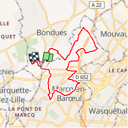
Tour Wandern von 15,5 km verfügbar auf Nordfrankreich, Nord, Bondues. Diese Tour wird von tracegps vorgeschlagen.
Beschreibung
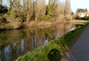
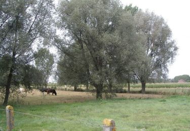
Circuit proposé par le Syndicat Intercommunal pour la Gestion de l'Aérodrome de Loisirs Départ du parking de l'aéroport de Bondues, avenue du général De Gaulle. Retrouvez le circuit sur le site du SIGAL.
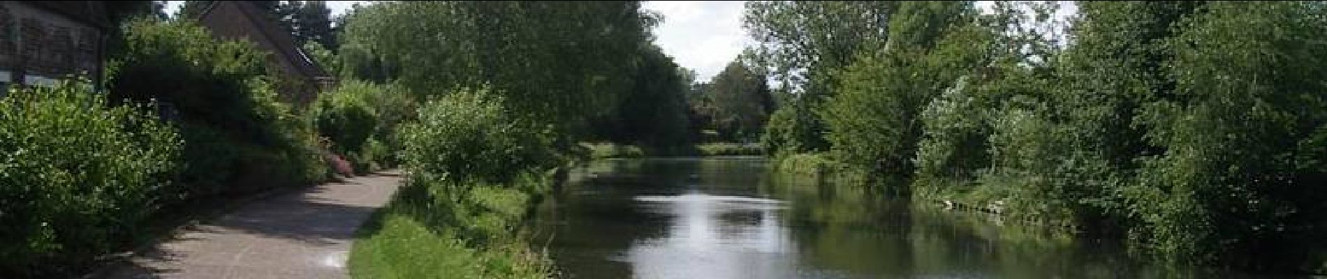
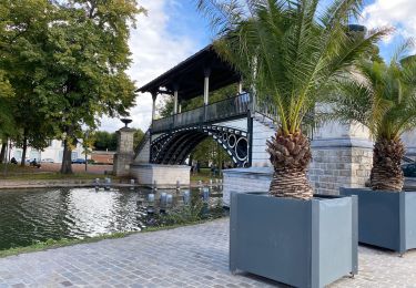
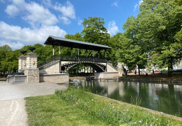
Ort
Land:
France
Region :
Nordfrankreich
Abteilung/Provinz :
Nord
Kommune :
Bondues
Standort:
Unknown
Gehen Sie:(Dec)
Gehen Sie:(UTM)
506025 ; 5615106 (31U) N.
Kommentare
Touren in der Umgebung
![Tour Fahrrad Wambrechies - La Deule canalisée - Wambrechies - Photo](https://media.geolcdn.com/t/375/260/ext.jpg?maxdim=2&url=https%3A%2F%2Fservices.sitytrail.com%2FGeolivesWS%2FDownloadMedia.ashx%3FTrailID%3D111710%26Media%3D8020_6.jpg)
![Fahrrad Fahrrad](https://static1.geolcdn.com/sitytour/trail-icons/200.png)
La Deule canalisée - Wambrechies
Fahrrad
Medium
(2)
Wambrechies,
Nordfrankreich,
Nord,
France
![](/images/other/stat-length.png)
40 km | 43 km-effort
2h 30min
![](https://static1.geolcdn.com/siteimages/upload/files/16400158638029165_repeat_loop_refresh_sync_direction_icon.png)
Ja
![Tour Wandern Wambrechies - Circuit du Genièvre - Wambrechies - Photo](https://media.geolcdn.com/t/375/260/ext.jpg?maxdim=2&url=https%3A%2F%2Fservices.sitytrail.com%2FGeolivesWS%2FDownloadMedia.ashx%3FTrailID%3D109008%26Media%3D2952_6.jpg)
![Wandern Wandern](https://static1.geolcdn.com/sitytour/trail-icons/101.png)
Circuit du Genièvre - Wambrechies
Wandern
Medium
(2)
Wambrechies,
Nordfrankreich,
Nord,
France
![](/images/other/stat-length.png)
13,3 km | 14,2 km-effort
3h 15min
![](https://static1.geolcdn.com/siteimages/upload/files/16400158638029165_repeat_loop_refresh_sync_direction_icon.png)
Ja
![Tour Mountainbike Lambersart - Deûle et ses campagnes - Photo](https://media.geolcdn.com/t/375/260/ext.jpg?maxdim=2&url=https%3A%2F%2Fstatic1.geolcdn.com%2Fsiteimages%2Fupload%2Ffiles%2F1524743154velo.jpg)
![Mountainbike Mountainbike](https://static1.geolcdn.com/sitytour/trail-icons/202.png)
Deûle et ses campagnes
Mountainbike
Einfach
(2)
Lambersart,
Nordfrankreich,
Nord,
France
![](/images/other/stat-length.png)
24 km | 25 km-effort
1h 25min
![](https://static1.geolcdn.com/siteimages/upload/files/16400158638029165_repeat_loop_refresh_sync_direction_icon.png)
Ja
![Tour Wandern Wambrechies - wambrechies quesnois - Photo](https://media.geolcdn.com/t/375/260/ext.jpg?maxdim=2&url=https%3A%2F%2Fstatic1.geolcdn.com%2Fsiteimages%2Fupload%2Ffiles%2F1553511878bg_sport_marche.png)
![Wandern Wandern](https://static1.geolcdn.com/sitytour/trail-icons/101.png)
wambrechies quesnois
Wandern
Einfach
(1)
Wambrechies,
Nordfrankreich,
Nord,
France
![](/images/other/stat-length.png)
10,7 km | 11,4 km-effort
2h 31min
![](https://static1.geolcdn.com/siteimages/upload/files/16400158638029165_repeat_loop_refresh_sync_direction_icon.png)
Ja
![Tour Wandern Lille - Lille Citadelle - Lion bossu 5,4 km - Photo](https://media.geolcdn.com/t/375/260/cac3c5ee-efcd-4c5f-8540-f45174e54dca.jpg&format=jpg&maxdim=2)
![Wandern Wandern](https://static1.geolcdn.com/sitytour/trail-icons/101.png)
Lille Citadelle - Lion bossu 5,4 km
Wandern
Einfach
Lille,
Nordfrankreich,
Nord,
France
![](/images/other/stat-length.png)
5,4 km | 6 km-effort
1h 53min
![](https://static1.geolcdn.com/siteimages/upload/files/16400158638029165_repeat_loop_refresh_sync_direction_icon.png)
Nein
![Tour Wandern Lille - Lille 9,5 km - Photo](https://media.geolcdn.com/t/375/260/4613ef8f-7f8a-43c2-950f-fd137ced6f10.jpg&format=jpg&maxdim=2)
![Wandern Wandern](https://static1.geolcdn.com/sitytour/trail-icons/101.png)
Lille 9,5 km
Wandern
Einfach
Lille,
Nordfrankreich,
Nord,
France
![](/images/other/stat-length.png)
10,3 km | 11,3 km-effort
4h 24min
![](https://static1.geolcdn.com/siteimages/upload/files/16400158638029165_repeat_loop_refresh_sync_direction_icon.png)
Ja
![Tour Wandern Lille - Lille Citadelle parcs remparts centre 12,5 km - Photo](https://media.geolcdn.com/t/375/260/79c56a3c-0714-422d-8318-22ce7061d762.jpg&format=jpg&maxdim=2)
![Wandern Wandern](https://static1.geolcdn.com/sitytour/trail-icons/101.png)
Lille Citadelle parcs remparts centre 12,5 km
Wandern
Einfach
Lille,
Nordfrankreich,
Nord,
France
![](/images/other/stat-length.png)
13,2 km | 14,5 km-effort
4h 53min
![](https://static1.geolcdn.com/siteimages/upload/files/16400158638029165_repeat_loop_refresh_sync_direction_icon.png)
Ja
![Tour Wandern Bondues - Bondue 18/02/17 - Photo](https://media.geolcdn.com/t/375/260/ext.jpg?maxdim=2&url=https%3A%2F%2Fservices.sitytrail.com%2FGeolivesWS%2FDownloadMedia.ashx%3FTrailID%3D700533%26Media%3Dfix__20170218155025.jpg)
![Wandern Wandern](https://static1.geolcdn.com/sitytour/trail-icons/101.png)
Bondue 18/02/17
Wandern
Einfach
Bondues,
Nordfrankreich,
Nord,
France
![](/images/other/stat-length.png)
12,2 km | 13,1 km-effort
2h 53min
![](https://static1.geolcdn.com/siteimages/upload/files/16400158638029165_repeat_loop_refresh_sync_direction_icon.png)
Ja
![Tour Wandern Marcq-en-Barœul - Circuit des trois villes - Marcq-en-Baroeul - Photo](https://media.geolcdn.com/t/375/260/ext.jpg?maxdim=2&url=https%3A%2F%2Fservices.sitytrail.com%2FGeolivesWS%2FDownloadMedia.ashx%3FTrailID%3D110865%26Media%3D6324_6.jpg)
![Wandern Wandern](https://static1.geolcdn.com/sitytour/trail-icons/101.png)
Circuit des trois villes - Marcq-en-Baroeul
Wandern
Medium
Marcq-en-Barœul,
Nordfrankreich,
Nord,
France
![](/images/other/stat-length.png)
13,2 km | 14,4 km-effort
3h 15min
![](https://static1.geolcdn.com/siteimages/upload/files/16400158638029165_repeat_loop_refresh_sync_direction_icon.png)
Ja