Tour Wandern L'Hôme-Chamondot - Traversées Percheronnes L'Home-Chamondot - Tourouvre 12,1Km - Photo

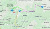
Traversées Percheronnes L'Home-Chamondot - Tourouvre 12,1Km

Un maillage d'une centaine de parcours pour composer à la carte sa randonnée itinérante percheronne.

© OpenStreetMap contributors
Länge
Länge
12 km
Maximale Höhe
Maximale Höhe
296 m
Positive Höhendifferenz
183 m
Km-Effort
Km-Effort  
14,3 km
Min. Höhe
Min. Höhe
217 m
Negative Höhendifferenz
150 m
Boucle
Boucle
Nein
Erstellungsdatum :
2019-04-13 16:33:20.796
Letzte Änderung :
2021-07-22 12:59:47.932

(0 Nachricht)

Wandern
Wandern
3h10
Schwierigkeit : Medium

Scannen Sie diesen QR-Code, um die Tour in der SityTrail-Anwendung zu öffnen

Kostenlosegpshiking-Anwendung

Logo SityTrail SityTrail

IGN / Geografische Institute

SityTrail aus dem App Store herunterladen SityTrail von Google Play herunterladen

Logo SityTrail SityTrail World

Die Welt öffnet sich für Sie

SityTrail aus dem App Store herunterladen SityTrail von Google Play herunterladen SityTrail auf Huawei AppGallery herunterladen

Über SityTrail

Tour Wandern von 12 km verfügbar auf Normandie, Orne, L'Hôme-Chamondot. Diese Tour wird von Traversées Percheronnes vorgeschlagen.

Beschreibung

"Traversées Percheronnes" vous propose près de 105 randonnées linéaires organisées en mailles sur le territoire du grand Perche. ?Pour chaque ville ou village étape, nous vous proposons des destinations pouvant être atteintes à pied ou à VTT.?Vous pouvez ainsi composer votre randonnée itinérante à la carte selon le nombre de jours dont vous disposez.... Et des capacités d'hébergement (possibilité de négocier un "taxi" auprès de certaines chambres d’hôtes).?Les topos guides détaillés sont disponible sur le blog de Traversées Percheronnes, hébergé par IGNRando?Site Web : https://ignrando.fr/fr/customer/communaute/index/?

Höhenprofil

Foto-Galerie

Ort

Land:
France
Region :
Normandie
Abteilung/Provinz :
Orne
Kommune :
L'Hôme-Chamondot
Standort:
Unknown
Gehen Sie:(Dec)
Gehen Sie:(UTM)
331371 ; 5384272 (31U) N.

Touren in der Umgebung

Tour Wandern Longny les Villages - La Fonte - Malétable 7,8 km - Photo
Wandern
ODDAD78

Wandern

Einfach
Longny les Villages, Normandie, Orne, France
7,8 km | 9,2 km-effort
21min
Ja
Tour Wandern L'Hôme-Chamondot - Traversées Percheronnes L'Home-Chamondot - La-Ferté-Vidame 20,4Km - Photo
Wandern

Wandern

Medium
L'Hôme-Chamondot, Normandie, Orne, France
20 km | 23 km-effort
5h 2min
Nein
Tour Wandern L'Hôme-Chamondot - Traversées Percheronnes L'Home-Chamondot - Monceaux-au-Perche 16,8km PROJET - Photo
Wandern

Wandern

Einfach
L'Hôme-Chamondot, Normandie, Orne, France
16,9 km | 20 km-effort
4h 24min
Nein
Tour Wandern Longny les Villages - Moulicent Vallée de la Jambée 3.6 Km - Photo
Wandern
ODDAD78

Wandern

Sehr leicht
(1)
Longny les Villages, Normandie, Orne, France
3,6 km | 4,7 km-effort
1h 1min
Ja
Tour Wandern Tourouvre au Perche - Bellegarde - Autheuil  - Photo
Wandern
tracegps

Wandern

Einfach
(1)
Tourouvre au Perche, Normandie, Orne, France
3,8 km | 4,8 km-effort
1h 19min
Ja
Tour Mountainbike Tourouvre au Perche - [Itinéraire] Les ruines du château de Gannes - Photo
Mountainbike
ODDAD78

Mountainbike

Schwierig
Tourouvre au Perche, Normandie, Orne, France
28 km | 34 km-effort
2h 20min
Ja
Tour Auto L'Hôme-Chamondot - 2024-03-06 VduP Miserai  - Photo
Auto
patrick2m

Auto

L'Hôme-Chamondot, Normandie, Orne, France
39 km | 46 km-effort
5h 26min
Nein
Tour Mountainbike Tourouvre au Perche - 2023-12-2 vduP perche-trappe  - Photo
Mountainbike
patrick2m

Mountainbike

Medium
Tourouvre au Perche, Normandie, Orne, France
22 km | 24 km-effort
3h 46min
Nein
Tour sport Longny les Villages - Bivouac dans le perche - Moulicent  - Photo
sport
sperchant

sport

Sehr leicht
Longny les Villages, Normandie, Orne, France
77 km | 92 km-effort
Unbekannt
Ja


Schließen
Meine Abonnements