![](/images/other/stat-length.png)
![Tour Mountainbike Arches - Espace VTT FFC Chemins du Pays d'Epinal, Coeur des Vosges - circuit n°102 - La Malgrange - Photo](https://media.geolcdn.com/t/1900/400/ext.pjpeg?maxdim=2&url=https%3A%2F%2Fservices.sitytrail.com%2FGeolivesWS%2FDownloadMedia.ashx%3FTrailID%3D105956%26Media%3D10027_1.jpg)
Espace VTT FFC Chemins du Pays d'Epinal, Coeur des Vosges - circuit n°102 - La Malgrange
tracegps
Benutzer
![Länge](/images/other/stat-length.png)
Länge
13,5 km
![Maximale Höhe](https://static1.geolcdn.com/siteimages/upload/files/1508320355ic_sort_altitude_max_24dp.png)
Maximale Höhe
523 m
![Positive Höhendifferenz](https://static1.geolcdn.com/siteimages/upload/files/1508320355ic_sort_den_pos_24dp.png)
Positive Höhendifferenz
383 m
![Km-Effort](/images/other/stat-length.png)
Km-Effort
18,6 km
![Min. Höhe](https://static1.geolcdn.com/siteimages/upload/files/1508320355ic_sort_altitude_min_24dp.png)
Min. Höhe
356 m
![Negative Höhendifferenz](https://static1.geolcdn.com/siteimages/upload/files/1508320355ic_sort_den_neg_24dp.png)
Negative Höhendifferenz
383 m
![Boucle](https://static1.geolcdn.com/siteimages/upload/files/16400158638029165_repeat_loop_refresh_sync_direction_icon.png)
Boucle
Ja
Erstellungsdatum :
2014-12-10 00:00:00.0
Letzte Änderung :
2014-12-10 00:00:00.0
![Mountainbike](https://static1.geolcdn.com/sitytour/trail-icons/202.png)
1h00
Schwierigkeit : Medium
![Scannen Sie diesen QR-Code, um die Tour in der SityTrail-Anwendung zu öffnen](https://capi.geolives.com/qq0zvz2zws4bq2lad0pu/sitytour/trails/105956/qr.png?size=200)
Kostenlosegpshiking-Anwendung
Über SityTrail
Tour Mountainbike von 13,5 km verfügbar auf Großer Osten, Vogesen, Arches. Diese Tour wird von tracegps vorgeschlagen.
Beschreibung
Espace VTT FFC Chemins du Pays d'Epinal, Cœur des Vosges - circuit n°102 - La Malgrange Circuit officiel labellisé par la Fédération Française de Cyclisme. Tour facile par le Haut du Mont et dans les Bois d’Arches.
Ort
Land:
France
Region :
Großer Osten
Abteilung/Provinz :
Vogesen
Kommune :
Arches
Standort:
Unknown
Gehen Sie:(Dec)
Gehen Sie:(UTM)
315776 ; 5332271 (32U) N.
Kommentare
Touren in der Umgebung
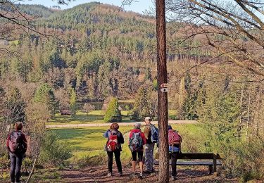
![Tour Zu Fuß Épinal - uzefaing 2 la grenouille - Photo](https://media.geolcdn.com/t/375/260/bbcf75ae-233b-421b-ab5d-c893e05cb26f.jpg&format=jpg&maxdim=2)
![Zu Fuß Zu Fuß](https://static1.geolcdn.com/sitytour/trail-icons/100.png)
uzefaing 2 la grenouille
Zu Fuß
Medium
Épinal,
Großer Osten,
Vogesen,
France
![](/images/other/stat-length.png)
18,1 km | 23 km-effort
5h 17min
![](https://static1.geolcdn.com/siteimages/upload/files/16400158638029165_repeat_loop_refresh_sync_direction_icon.png)
Ja
![Tour Wandern Jarménil - haut jarmenil 2 - Photo](https://media.geolcdn.com/t/375/260/ext.jpg?maxdim=2&url=https%3A%2F%2Fstatic1.geolcdn.com%2Fsiteimages%2Fupload%2Ffiles%2F1553511878bg_sport_marche.png)
![Wandern Wandern](https://static1.geolcdn.com/sitytour/trail-icons/101.png)
haut jarmenil 2
Wandern
Medium
(1)
Jarménil,
Großer Osten,
Vogesen,
France
![](/images/other/stat-length.png)
12,3 km | 16,8 km-effort
2h 39min
![](https://static1.geolcdn.com/siteimages/upload/files/16400158638029165_repeat_loop_refresh_sync_direction_icon.png)
Ja
![Tour Wandern Hadol - hadol - Photo](https://media.geolcdn.com/t/375/260/ext.jpg?maxdim=2&url=https%3A%2F%2Fservices.sitytrail.com%2FGeolivesWS%2FDownloadMedia.ashx%3FTrailID%3D45357%26Media%3Dimage6.jpg)
![Wandern Wandern](https://static1.geolcdn.com/sitytour/trail-icons/101.png)
hadol
Wandern
Sehr leicht
Hadol,
Großer Osten,
Vogesen,
France
![](/images/other/stat-length.png)
11,3 km | 13,6 km-effort
Unbekannt
![](https://static1.geolcdn.com/siteimages/upload/files/16400158638029165_repeat_loop_refresh_sync_direction_icon.png)
Ja
![Tour Wandern Hadol - 2010-09-05 - 12h00m55 - Photo](https://media.geolcdn.com/t/375/260/ext.jpg?maxdim=2&url=https%3A%2F%2Fservices.sitytrail.com%2FGeolivesWS%2FDownloadMedia.ashx%3FTrailID%3D45319%26Media%3D20100905112812.jpg)
![Wandern Wandern](https://static1.geolcdn.com/sitytour/trail-icons/101.png)
2010-09-05 - 12h00m55
Wandern
Sehr leicht
(1)
Hadol,
Großer Osten,
Vogesen,
France
![](/images/other/stat-length.png)
11,3 km | 13,6 km-effort
Unbekannt
![](https://static1.geolcdn.com/siteimages/upload/files/16400158638029165_repeat_loop_refresh_sync_direction_icon.png)
Ja
![Tour Wandern Pouxeux - Pouxeux - Photo](https://media.geolcdn.com/t/375/260/1c75fc37-d80a-4b9f-813d-14fb77a95e56.jpg&format=jpg&maxdim=2)
![Wandern Wandern](https://static1.geolcdn.com/sitytour/trail-icons/101.png)
Pouxeux
Wandern
Schwierig
Pouxeux,
Großer Osten,
Vogesen,
France
![](/images/other/stat-length.png)
11,9 km | 15,7 km-effort
2h 57min
![](https://static1.geolcdn.com/siteimages/upload/files/16400158638029165_repeat_loop_refresh_sync_direction_icon.png)
Ja
![Tour Wandern Pouxeux - St Nabord Malaide - Photo](https://media.geolcdn.com/t/375/260/dad164b5-eb60-4108-82a7-54c3b0f7cec1.jpg&format=jpg&maxdim=2)
![Wandern Wandern](https://static1.geolcdn.com/sitytour/trail-icons/101.png)
St Nabord Malaide
Wandern
Schwierig
Pouxeux,
Großer Osten,
Vogesen,
France
![](/images/other/stat-length.png)
11,2 km | 15 km-effort
3h 32min
![](https://static1.geolcdn.com/siteimages/upload/files/16400158638029165_repeat_loop_refresh_sync_direction_icon.png)
Ja
![Tour Wandern Arches - Arches Lamenil Dinoze Arches - Photo](https://media.geolcdn.com/t/375/260/291ee745-170b-4aa9-bcaa-30a0e7041915.jpg&format=jpg&maxdim=2)
![Wandern Wandern](https://static1.geolcdn.com/sitytour/trail-icons/101.png)
Arches Lamenil Dinoze Arches
Wandern
Medium
Arches,
Großer Osten,
Vogesen,
France
![](/images/other/stat-length.png)
16,8 km | 22 km-effort
4h 0min
![](https://static1.geolcdn.com/siteimages/upload/files/16400158638029165_repeat_loop_refresh_sync_direction_icon.png)
Ja
![Tour Wandern Arches - confi samedi 21 nov - Photo](https://media.geolcdn.com/t/375/260/44e6ae00-c6f5-409d-b697-3f3e20e9dfec.jpg&format=jpg&maxdim=2)
![Wandern Wandern](https://static1.geolcdn.com/sitytour/trail-icons/101.png)
confi samedi 21 nov
Wandern
Medium
Arches,
Großer Osten,
Vogesen,
France
![](/images/other/stat-length.png)
12,2 km | 15,7 km-effort
3h 10min
![](https://static1.geolcdn.com/siteimages/upload/files/16400158638029165_repeat_loop_refresh_sync_direction_icon.png)
Ja
![Tour Wandern Dinozé - 2019 06 04 quéquement - Photo](https://media.geolcdn.com/t/375/260/7951dcd6-459b-4486-8abc-6fc16386c9db.jpg&format=jpg&maxdim=2)
![Wandern Wandern](https://static1.geolcdn.com/sitytour/trail-icons/101.png)
2019 06 04 quéquement
Wandern
Einfach
Dinozé,
Großer Osten,
Vogesen,
France
![](/images/other/stat-length.png)
10,2 km | 13,2 km-effort
3h 25min
![](https://static1.geolcdn.com/siteimages/upload/files/16400158638029165_repeat_loop_refresh_sync_direction_icon.png)
Ja