![](/images/other/stat-length.png)
![Tour Wandern Sains-en-Amiénois - Circuit de Rumigny - Sains-en-Amienois - Photo](https://media.geolcdn.com/t/1900/400/ext.pjpeg?maxdim=2&url=https%3A%2F%2Fservices.sitytrail.com%2FGeolivesWS%2FDownloadMedia.ashx%3FTrailID%3D105809%26Media%3D9731_3.jpg)
Circuit de Rumigny - Sains-en-Amienois
tracegps
Benutzer
![Länge](/images/other/stat-length.png)
Länge
10,9 km
![Maximale Höhe](https://static1.geolcdn.com/siteimages/upload/files/1508320355ic_sort_altitude_max_24dp.png)
Maximale Höhe
118 m
![Positive Höhendifferenz](https://static1.geolcdn.com/siteimages/upload/files/1508320355ic_sort_den_pos_24dp.png)
Positive Höhendifferenz
129 m
![Km-Effort](/images/other/stat-length.png)
Km-Effort
12,7 km
![Min. Höhe](https://static1.geolcdn.com/siteimages/upload/files/1508320355ic_sort_altitude_min_24dp.png)
Min. Höhe
56 m
![Negative Höhendifferenz](https://static1.geolcdn.com/siteimages/upload/files/1508320355ic_sort_den_neg_24dp.png)
Negative Höhendifferenz
129 m
![Boucle](https://static1.geolcdn.com/siteimages/upload/files/16400158638029165_repeat_loop_refresh_sync_direction_icon.png)
Boucle
Ja
Erstellungsdatum :
2014-12-10 00:00:00.0
Letzte Änderung :
2014-12-10 00:00:00.0
![Wandern](https://static1.geolcdn.com/sitytour/trail-icons/101.png)
2h15
Schwierigkeit : Medium
![Scannen Sie diesen QR-Code, um die Tour in der SityTrail-Anwendung zu öffnen](https://capi.geolives.com/qq0zvz2zws4bq2lad0pu/sitytour/trails/105809/qr.png?size=200)
Kostenlosegpshiking-Anwendung
Über SityTrail
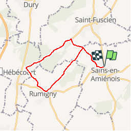
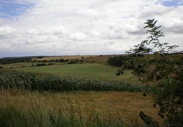
Tour Wandern von 10,9 km verfügbar auf Nordfrankreich, Somme, Sains-en-Amiénois. Diese Tour wird von tracegps vorgeschlagen.
Beschreibung
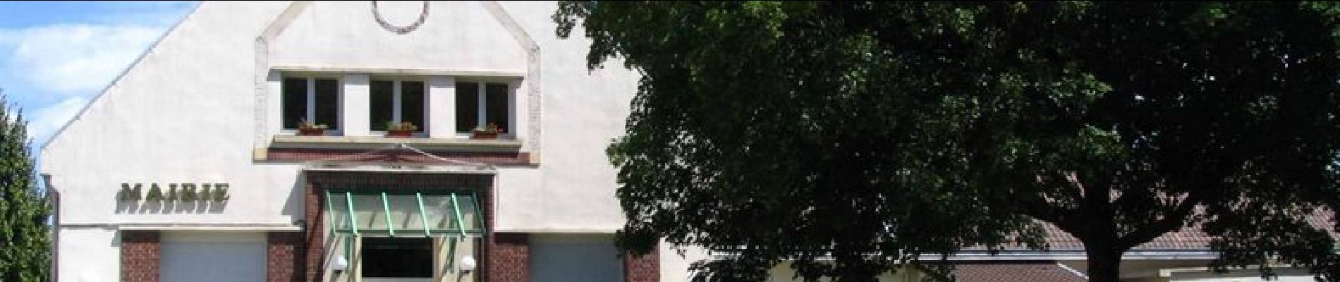
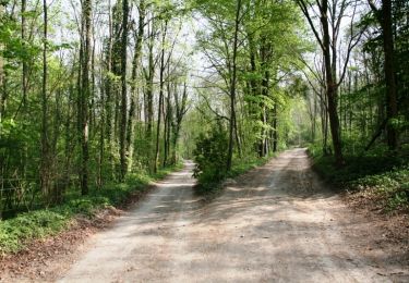
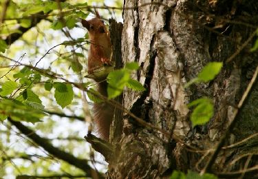
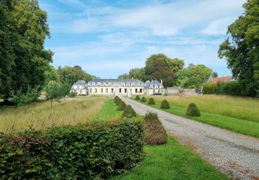
Circuit proposé par la Mairie de Camon. Départ de l’église de Sains-en-Amienois. A découvrir : - Sains en Amiénois : église du XVe s. tombeau des saints-martyrs - château de Rumigny Retrouvez cette randonnée sur le site de la mairie, rubrique «Tourisme et loisirs».
Ort
Land:
France
Region :
Nordfrankreich
Abteilung/Provinz :
Somme
Kommune :
Sains-en-Amiénois
Standort:
Unknown
Gehen Sie:(Dec)
Gehen Sie:(UTM)
451021 ; 5518739 (31U) N.
Kommentare
Touren in der Umgebung
![Tour Wandern Remiencourt - Le bois du Roi - Photo](https://media.geolcdn.com/t/375/260/ext.jpg?maxdim=2&url=https%3A%2F%2Fservices.sitytrail.com%2FGeolivesWS%2FDownloadMedia.ashx%3FTrailID%3D108859%26Media%3D2403_2.jpg)
![Wandern Wandern](https://static1.geolcdn.com/sitytour/trail-icons/101.png)
Le bois du Roi
Wandern
Schwierig
(1)
Remiencourt,
Nordfrankreich,
Somme,
France
![](/images/other/stat-length.png)
12,4 km | 15,2 km-effort
4h 0min
![](https://static1.geolcdn.com/siteimages/upload/files/16400158638029165_repeat_loop_refresh_sync_direction_icon.png)
Ja
![Tour Wandern Dury - La belle épine - Photo](https://media.geolcdn.com/t/375/260/ext.jpg?maxdim=2&url=https%3A%2F%2Fservices.sitytrail.com%2FGeolivesWS%2FDownloadMedia.ashx%3FTrailID%3D108857%26Media%3D2401_1.jpg)
![Wandern Wandern](https://static1.geolcdn.com/sitytour/trail-icons/101.png)
La belle épine
Wandern
Medium
(1)
Dury,
Nordfrankreich,
Somme,
France
![](/images/other/stat-length.png)
12,2 km | 13,8 km-effort
4h 0min
![](https://static1.geolcdn.com/siteimages/upload/files/16400158638029165_repeat_loop_refresh_sync_direction_icon.png)
Ja
![Tour Wandern Boves - 20190606-Boves - Photo](https://media.geolcdn.com/t/375/260/ext.jpg?maxdim=2&url=https%3A%2F%2Fstatic1.geolcdn.com%2Fsiteimages%2Fupload%2Ffiles%2F1553511878bg_sport_marche.png)
![Wandern Wandern](https://static1.geolcdn.com/sitytour/trail-icons/101.png)
20190606-Boves
Wandern
Medium
(1)
Boves,
Nordfrankreich,
Somme,
France
![](/images/other/stat-length.png)
24 km | 28 km-effort
6h 31min
![](https://static1.geolcdn.com/siteimages/upload/files/16400158638029165_repeat_loop_refresh_sync_direction_icon.png)
Ja
![Tour Wandern Remiencourt - le bois du roi Remiencourt 80 - Photo](https://media.geolcdn.com/t/375/260/bc50bb6a-30a4-4e52-8497-2c709f5b6312.jpg&format=jpg&maxdim=2)
![Wandern Wandern](https://static1.geolcdn.com/sitytour/trail-icons/101.png)
le bois du roi Remiencourt 80
Wandern
Medium
Remiencourt,
Nordfrankreich,
Somme,
France
![](/images/other/stat-length.png)
12,7 km | 15,4 km-effort
3h 10min
![](https://static1.geolcdn.com/siteimages/upload/files/16400158638029165_repeat_loop_refresh_sync_direction_icon.png)
Ja
![Tour Zu Fuß Boves - Sainte-Ulphe - Photo](https://media.geolcdn.com/t/375/260/f794ff92-058a-48a4-aa54-dbc0fc355bd0.jpeg&format=jpg&maxdim=2)
![Zu Fuß Zu Fuß](https://static1.geolcdn.com/sitytour/trail-icons/100.png)
Sainte-Ulphe
Zu Fuß
Einfach
Boves,
Nordfrankreich,
Somme,
France
![](/images/other/stat-length.png)
12,3 km | 14,2 km-effort
3h 13min
![](https://static1.geolcdn.com/siteimages/upload/files/16400158638029165_repeat_loop_refresh_sync_direction_icon.png)
Ja
![Tour Zu Fuß Saint-Fuscien - La Belle Epine - Photo](https://media.geolcdn.com/t/375/260/494d7640-4b66-4a01-bc5b-2cd06784324e.jpeg&format=jpg&maxdim=2)
![Zu Fuß Zu Fuß](https://static1.geolcdn.com/sitytour/trail-icons/100.png)
La Belle Epine
Zu Fuß
Einfach
Saint-Fuscien,
Nordfrankreich,
Somme,
France
![](/images/other/stat-length.png)
4,3 km | 5,2 km-effort
1h 11min
![](https://static1.geolcdn.com/siteimages/upload/files/16400158638029165_repeat_loop_refresh_sync_direction_icon.png)
Nein
![Tour Wandern Dury - balade de la belle épine - Photo](https://media.geolcdn.com/t/375/260/aa3dbddc-fff5-408e-9607-8e8138c3275e.jpg&format=jpg&maxdim=2)
![Wandern Wandern](https://static1.geolcdn.com/sitytour/trail-icons/101.png)
balade de la belle épine
Wandern
Sehr leicht
Dury,
Nordfrankreich,
Somme,
France
![](/images/other/stat-length.png)
12,3 km | 13,9 km-effort
3h 11min
![](https://static1.geolcdn.com/siteimages/upload/files/16400158638029165_repeat_loop_refresh_sync_direction_icon.png)
Ja
![Tour Motor Boves - longueau circuit 1 eric - Photo](https://media.geolcdn.com/t/375/260/ext.jpg?maxdim=2&url=https%3A%2F%2Fservices.sitytrail.com%2FGeolivesWS%2FDownloadMedia.ashx%3FTrailID%3D636243%26Media%3D48646eca-3e2c-4615-a6d1-72c3b6f6b849.jpg)
![Motor Motor](https://static1.geolcdn.com/sitytour/trail-icons/400.png)
longueau circuit 1 eric
Motor
Medium
(1)
Boves,
Nordfrankreich,
Somme,
France
![](/images/other/stat-length.png)
51 km | 61 km-effort
3h 0min
![](https://static1.geolcdn.com/siteimages/upload/files/16400158638029165_repeat_loop_refresh_sync_direction_icon.png)
Ja
![Tour Wandern Grattepanche - Grattepanche-Absous-Larris - Photo](https://media.geolcdn.com/t/375/260/ext.jpg?maxdim=2&url=https%3A%2F%2Fstatic1.geolcdn.com%2Fsiteimages%2Fupload%2Ffiles%2F1553511878bg_sport_marche.png)
![Wandern Wandern](https://static1.geolcdn.com/sitytour/trail-icons/101.png)
Grattepanche-Absous-Larris
Wandern
Schwierig
(1)
Grattepanche,
Nordfrankreich,
Somme,
France
![](/images/other/stat-length.png)
11 km | 13 km-effort
2h 51min
![](https://static1.geolcdn.com/siteimages/upload/files/16400158638029165_repeat_loop_refresh_sync_direction_icon.png)
Ja