


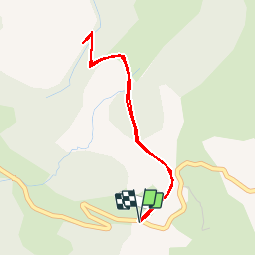


8,9 km | 14,6 km-effort


Benutzer


Kostenlosegpshiking-Anwendung
 SityTrail
IGN / Geografische Institute
SityTrail World
Die Welt öffnet sich für Sie
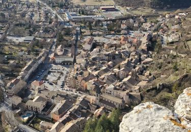
Tour Wandern von 3,8 km verfügbar auf Provence-Alpes-Côte d'Azur, Alpes-de-Haute-Provence, Castellane. Diese Tour wird von Dervalmarc vorgeschlagen.
Sentier original.
Thématique sur les roches et les fossiles mis en place par la réserve géologique.
Très beaux aménagements.
Vaut le détour.


Wandern

Mountainbike

Wandern

Wandern
Wandern

Wandern

Wandern

Wandern
Wandern
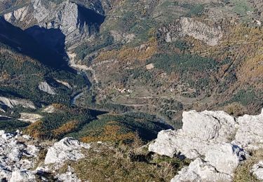
Chouette rando ! Ça monte, ça descend ! Ça fait chauffer les mollets et c'est bon pour le souffle !