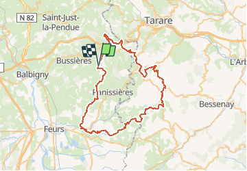
![](/images/other/stat-length.png)
![Tour Mountainbike Montchal - VTT - 22ème édition de La Tour Matagrin - Photo](https://media.geolcdn.com/t/1900/400/ext.pjpeg?maxdim=2&url=https%3A%2F%2Fservices.sitytrail.com%2FGeolivesWS%2FDownloadMedia.ashx%3FTrailID%3D105559%26Media%3D9321_6.jpg)
VTT - 22ème édition de La Tour Matagrin
tracegps
Benutzer
![Länge](/images/other/stat-length.png)
![Maximale Höhe](https://static1.geolcdn.com/siteimages/upload/files/1508320355ic_sort_altitude_max_24dp.png)
![Positive Höhendifferenz](https://static1.geolcdn.com/siteimages/upload/files/1508320355ic_sort_den_pos_24dp.png)
![Km-Effort](/images/other/stat-length.png)
![Min. Höhe](https://static1.geolcdn.com/siteimages/upload/files/1508320355ic_sort_altitude_min_24dp.png)
![Negative Höhendifferenz](https://static1.geolcdn.com/siteimages/upload/files/1508320355ic_sort_den_neg_24dp.png)
![Boucle](https://static1.geolcdn.com/siteimages/upload/files/16400158638029165_repeat_loop_refresh_sync_direction_icon.png)
![Mountainbike](https://static1.geolcdn.com/sitytour/trail-icons/202.png)
5h00
Schwierigkeit : Sehr schwierig
![Scannen Sie diesen QR-Code, um die Tour in der SityTrail-Anwendung zu öffnen](https://capi.geolives.com/qq0zvz2zws4bq2lad0pu/sitytour/trails/105559/qr.png?size=200)
Kostenlosegpshiking-Anwendung
Über SityTrail
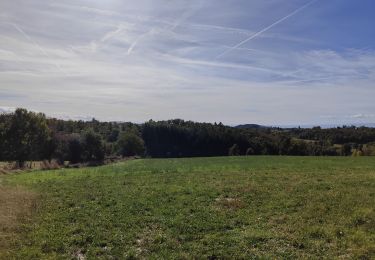
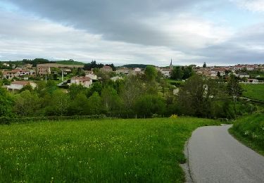
Tour Mountainbike von 68 km verfügbar auf Auvergne-Rhone-Alpen, Loire, Montchal. Diese Tour wird von tracegps vorgeschlagen.
Beschreibung
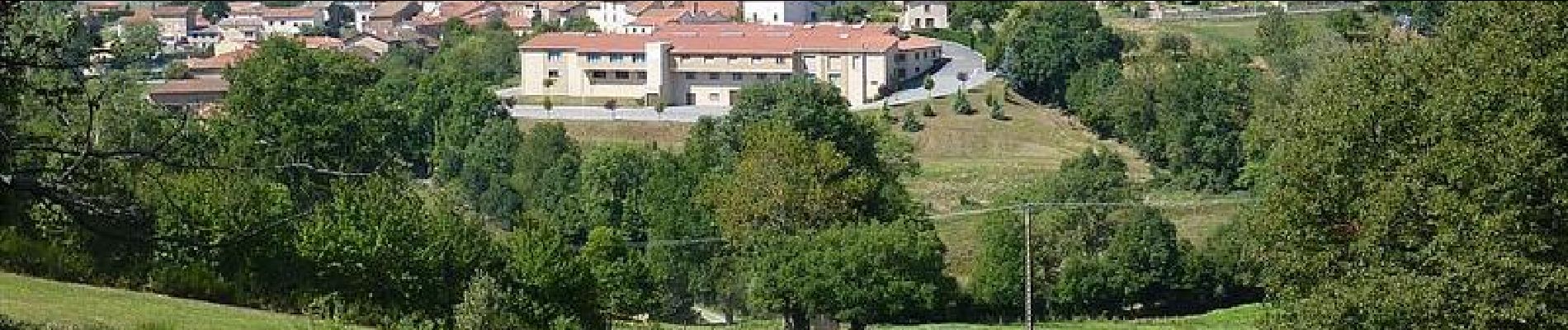
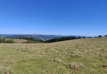
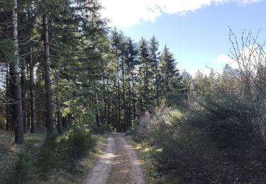
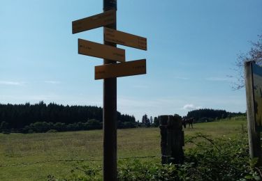
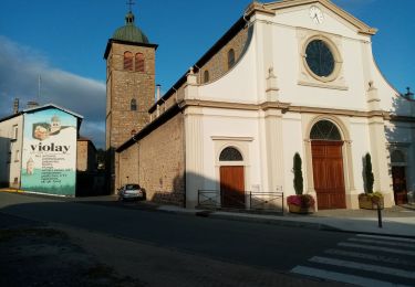
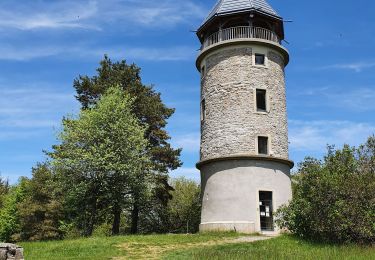
Montchal se situe dans les Montagnes du Matin (Monts du Lyonnais)... La randonnée VTT de "LA TOUR MATAGRIN" est organisée chaque année, le premier dimanche de septembre, par le club "SQUADRA FEURS" (la 22ème édition s'est déroulée le dimanche 5 septembre 2010). Parking gratuit proche du stade. Départ : entre le stade et la salle polyvalente "LES ROCHES". Ce marathon VTT est de toute beauté... du pur VTT ! Ce parcours physique de 70 km avec 1800 m de dénivelé positif est exclusivement réservé aux VTTistes confirmés et endurants. Topoguides : Montagnes du Matin : Itinéraires VTT (27 parcours) Montagnes du Matin : Randonnée pédestre (54 circuits) Disponibles dans les OT/SI des Montagnes du Matin (Violay)...
Ort
Kommentare
Touren in der Umgebung
![Tour Wandern Violay - Randonnée de Violay - Photo](https://media.geolcdn.com/t/375/260/b78157fd-81fd-4bc7-9694-a9bddd2f8a7a.jpg&format=jpg&maxdim=2)
![Wandern Wandern](https://static1.geolcdn.com/sitytour/trail-icons/101.png)
Wandern
![](/images/other/stat-length.png)
![](https://static1.geolcdn.com/siteimages/upload/files/16400158638029165_repeat_loop_refresh_sync_direction_icon.png)
![Tour Wandern Violay - Randonnée au dessus de Violay - Photo](https://media.geolcdn.com/t/375/260/914fdf13-9068-40b2-8a60-d21e2612afe3.jpg&format=jpg&maxdim=2)
![Wandern Wandern](https://static1.geolcdn.com/sitytour/trail-icons/101.png)
Wandern
![](/images/other/stat-length.png)
![](https://static1.geolcdn.com/siteimages/upload/files/16400158638029165_repeat_loop_refresh_sync_direction_icon.png)
![Tour Wandern Montchal - randonnée de Montchal - Photo](https://media.geolcdn.com/t/375/260/ca094be3-a112-4258-b8ae-8d5bd31d7ca6.jpg&format=jpg&maxdim=2)
![Wandern Wandern](https://static1.geolcdn.com/sitytour/trail-icons/101.png)
Wandern
![](/images/other/stat-length.png)
![](https://static1.geolcdn.com/siteimages/upload/files/16400158638029165_repeat_loop_refresh_sync_direction_icon.png)
![Tour Wandern Sainte-Agathe-en-Donzy - Sentier botanique de la Belette - Photo](https://media.geolcdn.com/t/375/260/ext.jpg?maxdim=2&url=https%3A%2F%2Fstatic1.geolcdn.com%2Fsiteimages%2Fupload%2Ffiles%2F1553511878bg_sport_marche.png)
![Wandern Wandern](https://static1.geolcdn.com/sitytour/trail-icons/101.png)
Wandern
![](/images/other/stat-length.png)
![](https://static1.geolcdn.com/siteimages/upload/files/16400158638029165_repeat_loop_refresh_sync_direction_icon.png)
![Tour Wandern Violay - La Tour de Matagrin avec un départ à Violay - Photo](https://media.geolcdn.com/t/375/260/fa198858-1080-46a0-8e5e-b317e5494583.jpg&format=jpg&maxdim=2)
![Wandern Wandern](https://static1.geolcdn.com/sitytour/trail-icons/101.png)
Wandern
![](/images/other/stat-length.png)
![](https://static1.geolcdn.com/siteimages/upload/files/16400158638029165_repeat_loop_refresh_sync_direction_icon.png)
![Tour Wandern Violay - Départ de Violay - Photo](https://media.geolcdn.com/t/375/260/133748ea-395d-4ae8-8676-41a51b16fd2c.jpg&format=jpg&maxdim=2)
![Wandern Wandern](https://static1.geolcdn.com/sitytour/trail-icons/101.png)
Wandern
![](/images/other/stat-length.png)
![](https://static1.geolcdn.com/siteimages/upload/files/16400158638029165_repeat_loop_refresh_sync_direction_icon.png)
![Tour Wandern Violay - Violay - La Tour Matagrin - Photo](https://media.geolcdn.com/t/375/260/9fd45418-c881-4167-b97b-25160dce28f5.jpg&format=jpg&maxdim=2)
![Wandern Wandern](https://static1.geolcdn.com/sitytour/trail-icons/101.png)
Wandern
![](/images/other/stat-length.png)
![](https://static1.geolcdn.com/siteimages/upload/files/16400158638029165_repeat_loop_refresh_sync_direction_icon.png)
![Tour Wandern Panissières - Panissieres ESsertines en donzy Terre de Tisseurs - Photo](https://media.geolcdn.com/t/375/260/631bba6f-d5b1-402a-9b45-b3a8c73a9e44.jpg&format=jpg&maxdim=2)
![Wandern Wandern](https://static1.geolcdn.com/sitytour/trail-icons/101.png)
Wandern
![](/images/other/stat-length.png)
![](https://static1.geolcdn.com/siteimages/upload/files/16400158638029165_repeat_loop_refresh_sync_direction_icon.png)
![Tour Mountainbike Bussières - La Bussièroise (2013-VTT-30km) - Bussières - Photo](https://media.geolcdn.com/t/375/260/ext.jpg?maxdim=2&url=https%3A%2F%2Fservices.sitytrail.com%2FGeolivesWS%2FDownloadMedia.ashx%3FTrailID%3D214827%26Media%3D15340_6.jpg)
![Mountainbike Mountainbike](https://static1.geolcdn.com/sitytour/trail-icons/202.png)
Mountainbike
![](/images/other/stat-length.png)
![](https://static1.geolcdn.com/siteimages/upload/files/16400158638029165_repeat_loop_refresh_sync_direction_icon.png)