![](/images/other/stat-length.png)
![Tour Hybrid-Bike Douzy - La chartreuse du Mont-Dieu - Photo](https://media.geolcdn.com/t/1900/400/ext.pjpeg?maxdim=2&url=https%3A%2F%2Fstatic1.geolcdn.com%2Fsiteimages%2Fupload%2Ffiles%2F1524743154velo.jpg)
La chartreuse du Mont-Dieu
papadoc
Benutzer
![Länge](/images/other/stat-length.png)
Länge
58 km
![Maximale Höhe](https://static1.geolcdn.com/siteimages/upload/files/1508320355ic_sort_altitude_max_24dp.png)
Maximale Höhe
336 m
![Positive Höhendifferenz](https://static1.geolcdn.com/siteimages/upload/files/1508320355ic_sort_den_pos_24dp.png)
Positive Höhendifferenz
766 m
![Km-Effort](/images/other/stat-length.png)
Km-Effort
68 km
![Min. Höhe](https://static1.geolcdn.com/siteimages/upload/files/1508320355ic_sort_altitude_min_24dp.png)
Min. Höhe
150 m
![Negative Höhendifferenz](https://static1.geolcdn.com/siteimages/upload/files/1508320355ic_sort_den_neg_24dp.png)
Negative Höhendifferenz
766 m
![Boucle](https://static1.geolcdn.com/siteimages/upload/files/16400158638029165_repeat_loop_refresh_sync_direction_icon.png)
Boucle
Ja
Erstellungsdatum :
2019-01-15 17:28:20.117
Letzte Änderung :
2020-05-31 19:43:25.823
![Hybrid-Bike](https://static1.geolcdn.com/sitytour/trail-icons/203.png)
--
Schwierigkeit : Einfach
![Elektrofahrrad](https://static1.geolcdn.com/sitytour/trail-icons/205.png)
--
Schwierigkeit : Einfach
![Scannen Sie diesen QR-Code, um die Tour in der SityTrail-Anwendung zu öffnen](https://capi.geolives.com/qq0zvz2zws4bq2lad0pu/sitytour/trails/1053676/qr.png?size=200)
Kostenlosegpshiking-Anwendung
Über SityTrail
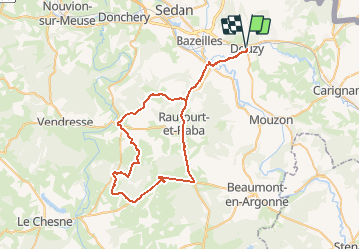
Tour Hybrid-Bike von 58 km verfügbar auf Großer Osten, Ardennes, Douzy. Diese Tour wird von papadoc vorgeschlagen.
Beschreibung
Circuit au départ de Douzy en direction de la Chartreuse du Mont Dieu, en passant par Stonne, la Corrérie, Chémery et Bulson.
Ort
Land:
France
Region :
Großer Osten
Abteilung/Provinz :
Ardennes
Kommune :
Douzy
Standort:
Douzy
Gehen Sie:(Dec)
Gehen Sie:(UTM)
647432 ; 5503864 (31U) N.
Kommentare
Touren in der Umgebung
![Tour Rennrad Remilly-Aillicourt - Bazeilles - Charleville - Mézières via Voie verte - Trans Ardennes - Photo](https://media.geolcdn.com/t/375/260/ext.jpg?maxdim=2&url=https%3A%2F%2Fstatic1.geolcdn.com%2Fsiteimages%2Fupload%2Ffiles%2F1524743154velo.jpg)
![Rennrad Rennrad](https://static1.geolcdn.com/sitytour/trail-icons/201.png)
Bazeilles - Charleville - Mézières via Voie verte - Trans Ardennes
Rennrad
Schwierig
(1)
Remilly-Aillicourt,
Großer Osten,
Ardennes,
France
![](/images/other/stat-length.png)
37 km | 40 km-effort
2h 27min
![](https://static1.geolcdn.com/siteimages/upload/files/16400158638029165_repeat_loop_refresh_sync_direction_icon.png)
Nein
![Tour Elektrofahrrad Douzy - Chateau-Ferme de Maison à Bar et Vendresse au départ de Douzy. Variante par Le Lavoir. - Photo](https://media.geolcdn.com/t/375/260/ext.jpg?maxdim=2&url=https%3A%2F%2Fstatic1.geolcdn.com%2Fsiteimages%2Fupload%2Ffiles%2F1524743154velo.jpg)
![Elektrofahrrad Elektrofahrrad](https://static1.geolcdn.com/sitytour/trail-icons/205.png)
Chateau-Ferme de Maison à Bar et Vendresse au départ de Douzy. Variante par L...
Elektrofahrrad
Medium
Douzy,
Großer Osten,
Ardennes,
France
![](/images/other/stat-length.png)
61 km | 70 km-effort
Unbekannt
![](https://static1.geolcdn.com/siteimages/upload/files/16400158638029165_repeat_loop_refresh_sync_direction_icon.png)
Ja
![Tour Elektrofahrrad Douzy - Chateau-Ferme de Maison à Bar et Vendresse au départ de Douzy. - Photo](https://media.geolcdn.com/t/375/260/ext.jpg?maxdim=2&url=https%3A%2F%2Fstatic1.geolcdn.com%2Fsiteimages%2Fupload%2Ffiles%2F1524743154velo.jpg)
![Elektrofahrrad Elektrofahrrad](https://static1.geolcdn.com/sitytour/trail-icons/205.png)
Chateau-Ferme de Maison à Bar et Vendresse au départ de Douzy.
Elektrofahrrad
Medium
Douzy,
Großer Osten,
Ardennes,
France
![](/images/other/stat-length.png)
63 km | 72 km-effort
Unbekannt
![](https://static1.geolcdn.com/siteimages/upload/files/16400158638029165_repeat_loop_refresh_sync_direction_icon.png)
Ja
![Tour Rennrad Douzy - Douzy - Pont-à-Bar - Photo](https://media.geolcdn.com/t/375/260/ext.jpg?maxdim=2&url=https%3A%2F%2Fstatic1.geolcdn.com%2Fsiteimages%2Fupload%2Ffiles%2F1524743154velo.jpg)
![Rennrad Rennrad](https://static1.geolcdn.com/sitytour/trail-icons/201.png)
Douzy - Pont-à-Bar
Rennrad
Medium
(1)
Douzy,
Großer Osten,
Ardennes,
France
![](/images/other/stat-length.png)
51 km | 58 km-effort
3h 24min
![](https://static1.geolcdn.com/siteimages/upload/files/16400158638029165_repeat_loop_refresh_sync_direction_icon.png)
Ja
![Tour Elektrofahrrad Douzy - Alle sur Semois au départ de Douzy - Photo](https://media.geolcdn.com/t/375/260/ext.jpg?maxdim=2&url=https%3A%2F%2Fstatic1.geolcdn.com%2Fsiteimages%2Fupload%2Ffiles%2F1524743154velo.jpg)
![Elektrofahrrad Elektrofahrrad](https://static1.geolcdn.com/sitytour/trail-icons/205.png)
Alle sur Semois au départ de Douzy
Elektrofahrrad
Medium
Douzy,
Großer Osten,
Ardennes,
France
![](/images/other/stat-length.png)
56 km | 70 km-effort
Unbekannt
![](https://static1.geolcdn.com/siteimages/upload/files/16400158638029165_repeat_loop_refresh_sync_direction_icon.png)
Ja
![Tour Hybrid-Bike Douzy - Le Sati - Dohan - Photo](https://media.geolcdn.com/t/375/260/ext.jpg?maxdim=2&url=https%3A%2F%2Fstatic1.geolcdn.com%2Fsiteimages%2Fupload%2Ffiles%2F1524743154velo.jpg)
![Hybrid-Bike Hybrid-Bike](https://static1.geolcdn.com/sitytour/trail-icons/203.png)
Le Sati - Dohan
Hybrid-Bike
Schwierig
Douzy,
Großer Osten,
Ardennes,
France
![](/images/other/stat-length.png)
51 km | 65 km-effort
Unbekannt
![](https://static1.geolcdn.com/siteimages/upload/files/16400158638029165_repeat_loop_refresh_sync_direction_icon.png)
Ja
![Tour Fahrrad Remilly-Aillicourt - Remilly - Raucourt - Remilly - Photo](https://media.geolcdn.com/t/375/260/ext.jpg?maxdim=2&url=https%3A%2F%2Fstatic1.geolcdn.com%2Fsiteimages%2Fupload%2Ffiles%2F1524743154velo.jpg)
![Fahrrad Fahrrad](https://static1.geolcdn.com/sitytour/trail-icons/200.png)
Remilly - Raucourt - Remilly
Fahrrad
Medium
Remilly-Aillicourt,
Großer Osten,
Ardennes,
France
![](/images/other/stat-length.png)
12,3 km | 13,9 km-effort
48min
![](https://static1.geolcdn.com/siteimages/upload/files/16400158638029165_repeat_loop_refresh_sync_direction_icon.png)
Ja
![Tour Mountainbike Douzy - Boucle 2 Douzy - Photo](https://media.geolcdn.com/t/375/260/ext.jpg?maxdim=2&url=https%3A%2F%2Fstatic1.geolcdn.com%2Fsiteimages%2Fupload%2Ffiles%2F1524743154velo.jpg)
![Mountainbike Mountainbike](https://static1.geolcdn.com/sitytour/trail-icons/202.png)
Boucle 2 Douzy
Mountainbike
Medium
Douzy,
Großer Osten,
Ardennes,
France
![](/images/other/stat-length.png)
14,7 km | 17,5 km-effort
1h 9min
![](https://static1.geolcdn.com/siteimages/upload/files/16400158638029165_repeat_loop_refresh_sync_direction_icon.png)
Ja
![Tour Wandern Pouru-aux-Bois - pourru 2 bis - Photo](https://media.geolcdn.com/t/375/260/ext.jpg?maxdim=2&url=https%3A%2F%2Fstatic1.geolcdn.com%2Fsiteimages%2Fupload%2Ffiles%2F1553511878bg_sport_marche.png)
![Wandern Wandern](https://static1.geolcdn.com/sitytour/trail-icons/101.png)
pourru 2 bis
Wandern
Schwierig
Pouru-aux-Bois,
Großer Osten,
Ardennes,
France
![](/images/other/stat-length.png)
12,5 km | 16,6 km-effort
3h 28min
![](https://static1.geolcdn.com/siteimages/upload/files/16400158638029165_repeat_loop_refresh_sync_direction_icon.png)
Ja