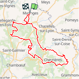
![](/images/other/stat-length.png)
![Tour Mountainbike Maringes - VTT Maringes - 14ème randonnée des blés - Photo](https://media.geolcdn.com/t/1900/400/ext.pjpeg?maxdim=2&url=https%3A%2F%2Fservices.sitytrail.com%2FGeolivesWS%2FDownloadMedia.ashx%3FTrailID%3D105347%26Media%3D9049_5.jpg)
VTT Maringes - 14ème randonnée des blés
tracegps
Benutzer
![Länge](/images/other/stat-length.png)
![Maximale Höhe](https://static1.geolcdn.com/siteimages/upload/files/1508320355ic_sort_altitude_max_24dp.png)
![Positive Höhendifferenz](https://static1.geolcdn.com/siteimages/upload/files/1508320355ic_sort_den_pos_24dp.png)
![Km-Effort](/images/other/stat-length.png)
![Min. Höhe](https://static1.geolcdn.com/siteimages/upload/files/1508320355ic_sort_altitude_min_24dp.png)
![Negative Höhendifferenz](https://static1.geolcdn.com/siteimages/upload/files/1508320355ic_sort_den_neg_24dp.png)
![Boucle](https://static1.geolcdn.com/siteimages/upload/files/16400158638029165_repeat_loop_refresh_sync_direction_icon.png)
![Mountainbike](https://static1.geolcdn.com/sitytour/trail-icons/202.png)
4h00
Schwierigkeit : Sehr schwierig
![Scannen Sie diesen QR-Code, um die Tour in der SityTrail-Anwendung zu öffnen](https://capi.geolives.com/qq0zvz2zws4bq2lad0pu/sitytour/trails/105347/qr.png?size=200)
Kostenlosegpshiking-Anwendung
Über SityTrail
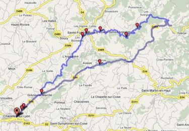
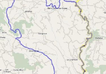
Tour Mountainbike von 43 km verfügbar auf Auvergne-Rhone-Alpen, Loire, Maringes. Diese Tour wird von tracegps vorgeschlagen.
Beschreibung
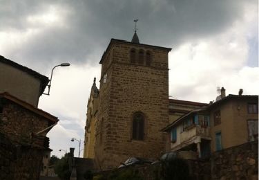
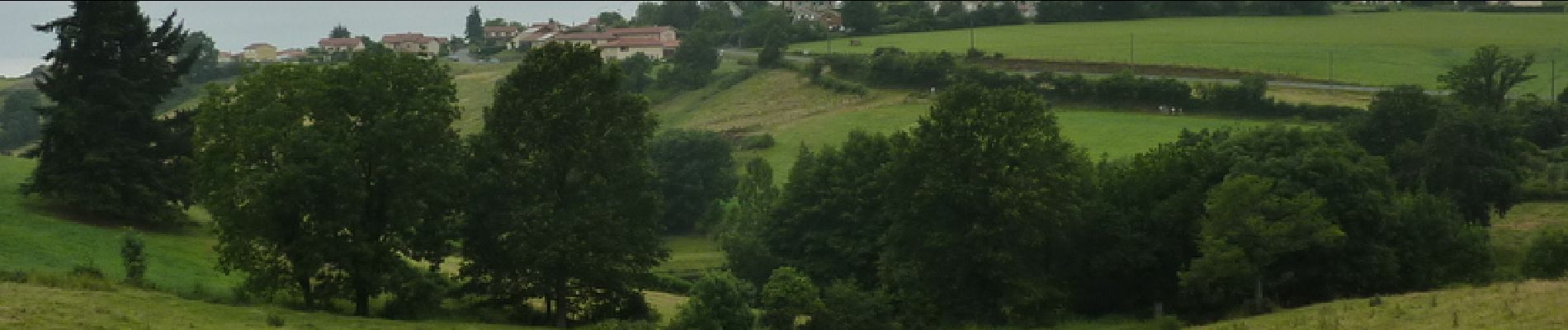
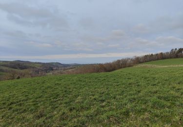
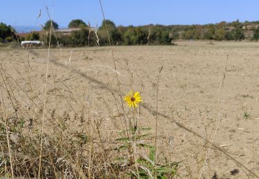
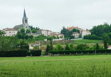
La "14ème randonnée des blés", randonnée pédestre et VTT, s'est déroulée le dimanche 4 juillet 2010 à Maringes. Le parcours étant technique et exigeant, par conséquent il s'adresse aux VTTistes confirmés. Du pur VTT, tout en montagnes russes avec de beaux singles tracks et de beaux paysages. Parking gratuit place de l'église, et départ devant la mairie.
Ort
Kommentare
Touren in der Umgebung
![Tour Wandern Virigneux - Randonnée de Vérigneux - Photo](https://media.geolcdn.com/t/375/260/a8d04ff0-e710-4b8d-9834-ff832b8aef32.jpg&format=jpg&maxdim=2)
![Wandern Wandern](https://static1.geolcdn.com/sitytour/trail-icons/101.png)
Wandern
![](/images/other/stat-length.png)
![](https://static1.geolcdn.com/siteimages/upload/files/16400158638029165_repeat_loop_refresh_sync_direction_icon.png)
![Tour Wandern Saint-Cyr-les-Vignes - St Cyr Les Vignes - Photo](https://media.geolcdn.com/t/375/260/91c5acbc-b0aa-480d-9515-9edb8a0006e5.jpg&format=jpg&maxdim=2)
![Wandern Wandern](https://static1.geolcdn.com/sitytour/trail-icons/101.png)
Wandern
![](/images/other/stat-length.png)
![](https://static1.geolcdn.com/siteimages/upload/files/16400158638029165_repeat_loop_refresh_sync_direction_icon.png)
![Tour Mountainbike Saint-Cyr-les-Vignes - D6 - VTT Montagnes du Matin - Saint Cyr les Vignes - Photo](https://media.geolcdn.com/t/375/260/ext.jpg?maxdim=2&url=https%3A%2F%2Fservices.sitytrail.com%2FGeolivesWS%2FDownloadMedia.ashx%3FTrailID%3D172338%26Media%3D13661_6.jpg)
![Mountainbike Mountainbike](https://static1.geolcdn.com/sitytour/trail-icons/202.png)
Mountainbike
![](/images/other/stat-length.png)
![](https://static1.geolcdn.com/siteimages/upload/files/16400158638029165_repeat_loop_refresh_sync_direction_icon.png)
![Tour Mountainbike Saint-Cyr-les-Vignes - 3ème Randonnée de la Cyriade (2011-VTT-65 km) - Saint-Cyr-les-Vignes - Photo](https://media.geolcdn.com/t/375/260/ext.jpg?maxdim=2&url=https%3A%2F%2Fservices.sitytrail.com%2FGeolivesWS%2FDownloadMedia.ashx%3FTrailID%3D107379%26Media%3D12281_1.jpg)
![Mountainbike Mountainbike](https://static1.geolcdn.com/sitytour/trail-icons/202.png)
Mountainbike
![](/images/other/stat-length.png)
![](https://static1.geolcdn.com/siteimages/upload/files/16400158638029165_repeat_loop_refresh_sync_direction_icon.png)
![Tour Fahrrad Chazelles-sur-Lyon - Chazelles sur Lyon Col des Brosse Col de la Croix de Pars - Photo](https://media.geolcdn.com/t/375/260/ext.jpg?maxdim=2&url=https%3A%2F%2Fservices.sitytrail.com%2FGeolivesWS%2FDownloadMedia.ashx%3FTrailID%3D103139%26Media%3D4935_2.jpg)
![Fahrrad Fahrrad](https://static1.geolcdn.com/sitytour/trail-icons/200.png)
Fahrrad
![](/images/other/stat-length.png)
![](https://static1.geolcdn.com/siteimages/upload/files/16400158638029165_repeat_loop_refresh_sync_direction_icon.png)
![Tour Fahrrad Chazelles-sur-Lyon - Montée Grammond départ Chazelles sur Lyon - Photo](https://media.geolcdn.com/t/375/260/ext.jpg?maxdim=2&url=https%3A%2F%2Fservices.sitytrail.com%2FGeolivesWS%2FDownloadMedia.ashx%3FTrailID%3D103138%26Media%3D4934_2.jpg)
![Fahrrad Fahrrad](https://static1.geolcdn.com/sitytour/trail-icons/200.png)
Fahrrad
![](/images/other/stat-length.png)
![](https://static1.geolcdn.com/siteimages/upload/files/16400158638029165_repeat_loop_refresh_sync_direction_icon.png)
![Tour Pfad Virigneux - fff - Photo](https://media.geolcdn.com/t/375/260/ext.jpg?maxdim=2&url=https%3A%2F%2Fstatic1.geolcdn.com%2Fsiteimages%2Fupload%2Ffiles%2F1524743154running.jpg)
![Pfad Pfad](https://static1.geolcdn.com/sitytour/trail-icons/104.png)
Pfad
![](/images/other/stat-length.png)
![](https://static1.geolcdn.com/siteimages/upload/files/16400158638029165_repeat_loop_refresh_sync_direction_icon.png)
![Tour Pferd Saint-Cyr-les-Vignes - Veauche St Cyr les vignes - Photo](https://media.geolcdn.com/t/375/260/ext.jpg?maxdim=2&url=https%3A%2F%2Fstatic1.geolcdn.com%2Fsiteimages%2Fupload%2Ffiles%2F1524743154cheval.jpg)
![Pferd Pferd](https://static1.geolcdn.com/sitytour/trail-icons/300.png)
Pferd
![](/images/other/stat-length.png)
![](https://static1.geolcdn.com/siteimages/upload/files/16400158638029165_repeat_loop_refresh_sync_direction_icon.png)