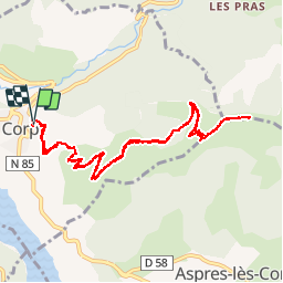
![](/images/other/stat-length.png)
![Tour Wandern Corps - Sommet du Grand Journal - Corps - Photo](https://media.geolcdn.com/t/1900/400/ext.pjpeg?maxdim=2&url=https%3A%2F%2Fservices.sitytrail.com%2FGeolivesWS%2FDownloadMedia.ashx%3FTrailID%3D105335%26Media%3D9034_2.jpg)
Sommet du Grand Journal - Corps
tracegps
Benutzer
![Länge](/images/other/stat-length.png)
![Maximale Höhe](https://static1.geolcdn.com/siteimages/upload/files/1508320355ic_sort_altitude_max_24dp.png)
![Positive Höhendifferenz](https://static1.geolcdn.com/siteimages/upload/files/1508320355ic_sort_den_pos_24dp.png)
![Km-Effort](/images/other/stat-length.png)
![Min. Höhe](https://static1.geolcdn.com/siteimages/upload/files/1508320355ic_sort_altitude_min_24dp.png)
![Negative Höhendifferenz](https://static1.geolcdn.com/siteimages/upload/files/1508320355ic_sort_den_neg_24dp.png)
![Boucle](https://static1.geolcdn.com/siteimages/upload/files/16400158638029165_repeat_loop_refresh_sync_direction_icon.png)
![Wandern](https://static1.geolcdn.com/sitytour/trail-icons/101.png)
4h30
Schwierigkeit : Schwierig
![Scannen Sie diesen QR-Code, um die Tour in der SityTrail-Anwendung zu öffnen](https://capi.geolives.com/qq0zvz2zws4bq2lad0pu/sitytour/trails/105335/qr.png?size=200)
Kostenlosegpshiking-Anwendung
Über SityTrail
Tour Wandern von 12,2 km verfügbar auf Auvergne-Rhone-Alpen, Isère, Corps. Diese Tour wird von tracegps vorgeschlagen.
Beschreibung
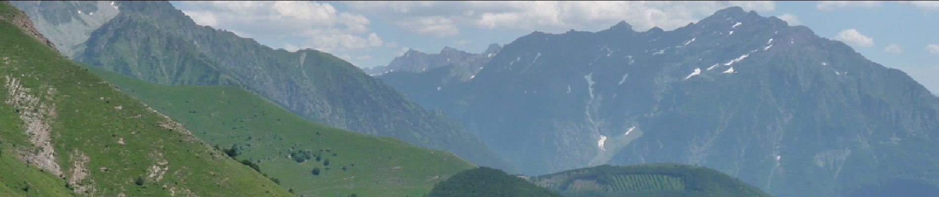
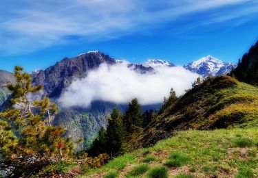
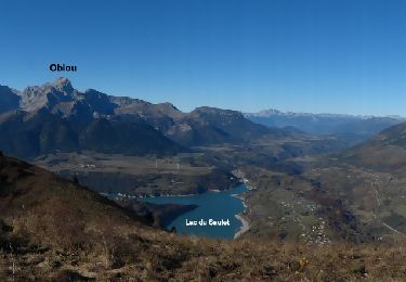
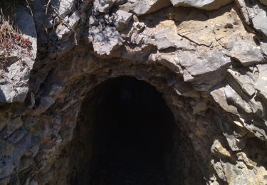
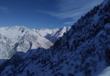
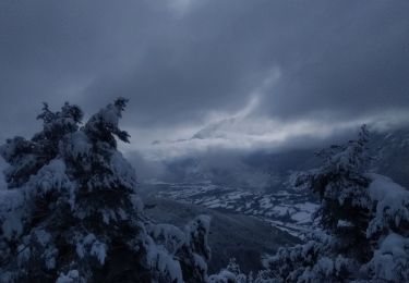
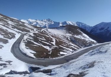
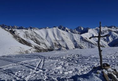
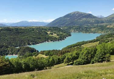
Et c'est parti pour une montée continue depuis le village de Corps jusqu'au sommet du Grand Journal d'où l'on a une superbe vue panoramique sur le lac du Sautet et sur une partie des montagne du Parc National des Écrins. Suivre le balisage jaune, le sentier s'élève en sous bois puis dans les estives pour finir sur les crêtes.
Ort
Kommentare
Touren in der Umgebung
![Tour Wandern La Salette-Fallavaux - Croix de Rougny via ND de la Salette - Photo](https://media.geolcdn.com/t/375/260/2c02e1cb-779c-4473-995c-4136efa43ee7.jpg&format=jpg&maxdim=2)
![Wandern Wandern](https://static1.geolcdn.com/sitytour/trail-icons/101.png)
Wandern
![](/images/other/stat-length.png)
![](https://static1.geolcdn.com/siteimages/upload/files/16400158638029165_repeat_loop_refresh_sync_direction_icon.png)
![Tour Wandern Aspres-lès-Corps - Aspres les corps - Roche Courbe - Photo](https://media.geolcdn.com/t/375/260/ext.jpg?maxdim=2&url=https%3A%2F%2Fservices.sitytrail.com%2FGeolivesWS%2FDownloadMedia.ashx%3FTrailID%3D655638%26Media%3Dd468d5e8-71c8-44e5-98f2-217554c35ba5.JPG)
![Wandern Wandern](https://static1.geolcdn.com/sitytour/trail-icons/101.png)
Wandern
![](/images/other/stat-length.png)
![](https://static1.geolcdn.com/siteimages/upload/files/16400158638029165_repeat_loop_refresh_sync_direction_icon.png)
![Tour Wandern Pellafol - 38 source gaillarde internet ch fée - Photo](https://media.geolcdn.com/t/375/260/34314d4b-0476-4e34-bbdb-55d6e7cd37b0.jpg&format=jpg&maxdim=2)
![Wandern Wandern](https://static1.geolcdn.com/sitytour/trail-icons/101.png)
Wandern
![](/images/other/stat-length.png)
![](https://static1.geolcdn.com/siteimages/upload/files/16400158638029165_repeat_loop_refresh_sync_direction_icon.png)
![Tour Skiwanderen La Salette-Fallavaux - Pale ronde et col de près clos - Photo](https://media.geolcdn.com/t/375/260/a90c1b03-7ad1-47e8-aa30-8d2ad928ae52.jpg&format=jpg&maxdim=2)
![Skiwanderen Skiwanderen](https://static1.geolcdn.com/sitytour/trail-icons/503.png)
Skiwanderen
![](/images/other/stat-length.png)
![](https://static1.geolcdn.com/siteimages/upload/files/16400158638029165_repeat_loop_refresh_sync_direction_icon.png)
![Tour Skiwanderen Aspres-lès-Corps - tentative du Laton, pic gazonné - Photo](https://media.geolcdn.com/t/375/260/bb214dca-e6e7-4564-b147-bec3a550b510.jpg&format=jpg&maxdim=2)
![Skiwanderen Skiwanderen](https://static1.geolcdn.com/sitytour/trail-icons/503.png)
Skiwanderen
![](/images/other/stat-length.png)
![](https://static1.geolcdn.com/siteimages/upload/files/16400158638029165_repeat_loop_refresh_sync_direction_icon.png)
![Tour Skiwanderen La Salette-Fallavaux - côté belle et Gargas - Photo](https://media.geolcdn.com/t/375/260/dc2d20ac-386f-4432-b67f-65443d05e523.jpg&format=jpg&maxdim=2)
![Skiwanderen Skiwanderen](https://static1.geolcdn.com/sitytour/trail-icons/503.png)
Skiwanderen
![](/images/other/stat-length.png)
![](https://static1.geolcdn.com/siteimages/upload/files/16400158638029165_repeat_loop_refresh_sync_direction_icon.png)
![Tour Wandern Sainte-Luce - Côte Rouge - Photo](https://media.geolcdn.com/t/375/260/de862aa8-3a89-4016-889b-2ec83352f8c0.jpg&format=jpg&maxdim=2)
![Wandern Wandern](https://static1.geolcdn.com/sitytour/trail-icons/101.png)
Wandern
![](/images/other/stat-length.png)
![](https://static1.geolcdn.com/siteimages/upload/files/16400158638029165_repeat_loop_refresh_sync_direction_icon.png)
![Tour Wandern Monestier-d'Ambel - croix de la plaigni - Photo](https://media.geolcdn.com/t/375/260/7aa3c75b-f8c7-4007-a1bc-ecea376ae690.jpg&format=jpg&maxdim=2)
![Wandern Wandern](https://static1.geolcdn.com/sitytour/trail-icons/101.png)
Wandern
![](/images/other/stat-length.png)
![](https://static1.geolcdn.com/siteimages/upload/files/16400158638029165_repeat_loop_refresh_sync_direction_icon.png)
![Tour Wandern La Salette-Fallavaux - La salette - Photo](https://media.geolcdn.com/t/375/260/880a8558-be54-494d-9c7e-4c9a3dd74f15.jpg&format=jpg&maxdim=2)
![Wandern Wandern](https://static1.geolcdn.com/sitytour/trail-icons/101.png)
Wandern
![](/images/other/stat-length.png)
![](https://static1.geolcdn.com/siteimages/upload/files/16400158638029165_repeat_loop_refresh_sync_direction_icon.png)