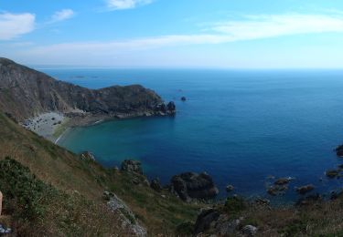
Tour Mountainbike La Hague - L'Ode au Raz des Haguards - Jobourg - Photo

L'Ode au Raz des Haguards - Jobourg

 tracegps
tracegps

Benutzer

© OpenStreetMap contributors
Länge
Länge
24 km
Maximale Höhe
Maximale Höhe
175 m
Positive Höhendifferenz
462 m
Km-Effort
Km-Effort  
30 km
Min. Höhe
Min. Höhe
11 m
Negative Höhendifferenz
462 m
Boucle
Boucle
Ja
Erstellungsdatum :
2014-12-10 00:00:00.0
Letzte Änderung :
2014-12-10 00:00:00.0

(0 Nachricht)

Mountainbike
Mountainbike
2h30
Schwierigkeit : Schwierig

Scannen Sie diesen QR-Code, um die Tour in der SityTrail-Anwendung zu öffnen

Kostenlosegpshiking-Anwendung

Logo SityTrail SityTrail

IGN / Geografische Institute

SityTrail aus dem App Store herunterladen SityTrail von Google Play herunterladen

Logo SityTrail SityTrail World

Die Welt öffnet sich für Sie

SityTrail aus dem App Store herunterladen SityTrail von Google Play herunterladen SityTrail auf Huawei AppGallery herunterladen

Über SityTrail

Tour Mountainbike von 24 km verfügbar auf Normandie, Manche, La Hague. Diese Tour wird von tracegps vorgeschlagen.

Beschreibung

Circuit proposé par Isabelle du club Les Haguards de Gréville-Hague. Club qui vous donne rendez-vous tous les dimanches autours de Cherbourg si, comme nous, vous appréciez les randos dans une ambiance conviviale. Les Haguards ne sont pas sectaires et apprécient aussi d'autres activités sportives tel que les raids multisports, trails, triathlons etc..... et n'hésitent pas à se déplacer tous ensembles sur des évènements incontournables comme la GAMELLE TROPHY, LA JEAN RACINE, LES SENTIERS DE LA HAGUE etc.... Pour plus d'info :Les Haguards facebook : vtt les haguards

Höhenprofil

POIs

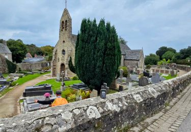
POI Brix - 001 - Photo
tracegps
BRIX 
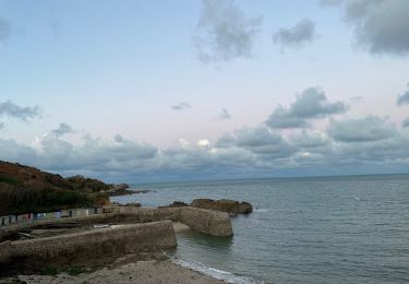
POI La Hague - 002 - Photo
tracegps
LA HAGUE 
POI La Hague - 003 - Photo
tracegps
LA HAGUE 
POI La Hague - 004 - Photo
tracegps
LA HAGUE 

Ort

Land:
France
Region :
Normandie
Abteilung/Provinz :
Manche
Kommune :
La Hague
Standort:
Jobourg
Gehen Sie:(Dec)
Gehen Sie:(UTM)
578997 ; 5504035 (30U) N.

Touren in der Umgebung

Tour Wandern La Hague - NEZ JOBOURG - Photo
Wandern
TOULAUDIN

Wandern

Schwierig
(2)
La Hague, Normandie, Manche, France
21 km | 27 km-effort
5h 48min
Ja
Tour Mountainbike La Hague - Le Tour des Echoués - Jobourg - Photo
Mountainbike
tracegps

Mountainbike

Medium
(1)
La Hague, Normandie, Manche, France
26 km | 32 km-effort
2h 0min
Ja
Tour Wandern La Hague - Ecalgrain et sa baie. - Photo
Wandern
tracegps

Wandern

Schwierig
(4)
La Hague, Normandie, Manche, France
13,4 km | 18,3 km-effort
3h 15min
Ja
Tour Zu Fuß La Hague - SityTrail - 4202124 - cotentin-j3 - Photo
Zu Fuß
GUIDE
chessyca

Zu Fuß

Schwierig
La Hague, Normandie, Manche, France
23 km | 33 km-effort
7h 30min
Nein
Tour Wandern La Hague - Séjour Cotentin Etape 3 Le nez de Jobourg et Biville a corriger - Photo
Wandern
GUIDE
chessyca

Wandern

Sehr schwierig
La Hague, Normandie, Manche, France
23 km | 33 km-effort
7h 31min
Nein
Tour Zu Fuß La Hague - Séjour Cotentin Etape 2 Boucle Jobourg La Hague - Port Racine - Omonville la petite - Photo
Zu Fuß
GUIDE
chessyca

Zu Fuß

Schwierig
La Hague, Normandie, Manche, France
28 km | 34 km-effort
7h 44min
Ja
Tour Wandern La Hague - goury / vauville - Photo
Wandern
mimisouge72

Wandern

Schwierig
(1)
La Hague, Normandie, Manche, France
16,5 km | 24 km-effort
5h 17min
Nein
Tour Wandern La Hague - Magiquement votre  - Photo
Wandern
zefreefly

Wandern

Medium
La Hague, Normandie, Manche, France
25 km | 33 km-effort
6h 12min
Ja
Tour Wandern La Hague - Boucle St-Germain-des-Vaux - Auderville - La Roche - Goury - Photo
Wandern
LightStalker

Wandern

Einfach
La Hague, Normandie, Manche, France
12,4 km | 14,7 km-effort
5h 22min
Ja


Schließen
Meine Abonnements