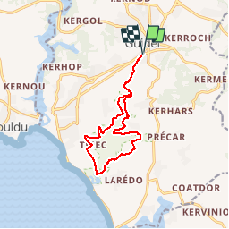
![](/images/other/stat-length.png)
![Tour Wandern Guidel - Circuit du Loch - Guidel - Photo](https://media.geolcdn.com/t/1900/400/ext.pjpeg?maxdim=2&url=https%3A%2F%2Fservices.sitytrail.com%2FGeolivesWS%2FDownloadMedia.ashx%3FTrailID%3D105127%26Media%3D8737_1.jpg)
Circuit du Loch - Guidel
tracegps
Benutzer
![Länge](/images/other/stat-length.png)
![Maximale Höhe](https://static1.geolcdn.com/siteimages/upload/files/1508320355ic_sort_altitude_max_24dp.png)
![Positive Höhendifferenz](https://static1.geolcdn.com/siteimages/upload/files/1508320355ic_sort_den_pos_24dp.png)
![Km-Effort](/images/other/stat-length.png)
![Min. Höhe](https://static1.geolcdn.com/siteimages/upload/files/1508320355ic_sort_altitude_min_24dp.png)
![Negative Höhendifferenz](https://static1.geolcdn.com/siteimages/upload/files/1508320355ic_sort_den_neg_24dp.png)
![Boucle](https://static1.geolcdn.com/siteimages/upload/files/16400158638029165_repeat_loop_refresh_sync_direction_icon.png)
![Wandern](https://static1.geolcdn.com/sitytour/trail-icons/101.png)
2h45
Schwierigkeit : Medium
![Scannen Sie diesen QR-Code, um die Tour in der SityTrail-Anwendung zu öffnen](https://capi.geolives.com/qq0zvz2zws4bq2lad0pu/sitytour/trails/105127/qr.png?size=200)
Kostenlosegpshiking-Anwendung
Über SityTrail
Tour Wandern von 12 km verfügbar auf Bretagne, Morbihan, Guidel. Diese Tour wird von tracegps vorgeschlagen.
Beschreibung
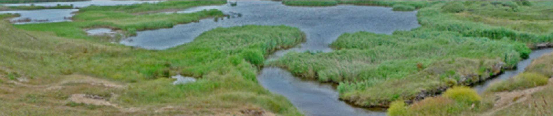
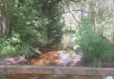
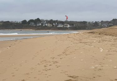
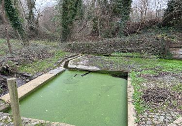
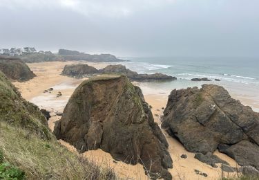
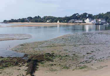
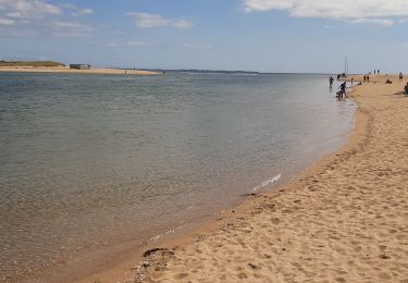
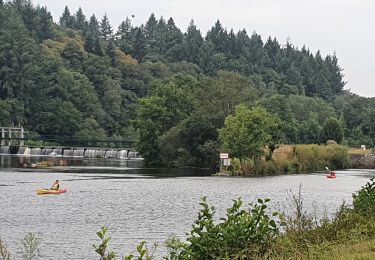
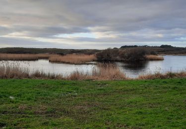
Circuit de 12 kilomètres se fait facilement en 2h45. Vous partez de la grande surface super U et prenez en face entre la cité des HLM et traversez le parc, en bas du parc prenez à gauche et longez entre le ruisseau et la station d'épuration. Le long de votre circuit vous trouverez des observatoires d'oiseaux et traverserez des zones humides (praticables) de roseaux.
Ort
Kommentare
Touren in der Umgebung
![Tour Wandern Guidel - PR_56_Guidel_DA_04_Circuit3a_De-Guidel-Centre-Vers-La-Laita_20240510 - Photo](https://media.geolcdn.com/t/375/260/fd655af4-6a2a-49f0-825f-e8fdebea6460.jpg&format=jpg&maxdim=2)
![Wandern Wandern](https://static1.geolcdn.com/sitytour/trail-icons/101.png)
Wandern
![](/images/other/stat-length.png)
![](https://static1.geolcdn.com/siteimages/upload/files/16400158638029165_repeat_loop_refresh_sync_direction_icon.png)
![Tour Wandern Clohars-Carnoët - Le Pouldu - Photo](https://media.geolcdn.com/t/375/260/1a38db66-97d5-4b5b-9eac-2a7eff6538ed.jpg&format=jpg&maxdim=2)
![Wandern Wandern](https://static1.geolcdn.com/sitytour/trail-icons/101.png)
![Tour Wandern Guidel - Guidel plage 7,6 km - Photo](https://media.geolcdn.com/t/375/260/ea313e26-3f1c-4186-89bc-ac39bff3fa8a.jpg&format=jpg&maxdim=2)
![Wandern Wandern](https://static1.geolcdn.com/sitytour/trail-icons/101.png)
Wandern
![](/images/other/stat-length.png)
![](https://static1.geolcdn.com/siteimages/upload/files/16400158638029165_repeat_loop_refresh_sync_direction_icon.png)
![Tour Wandern Clohars-Carnoët - Pouldu port peintres 6,3 km - Photo](https://media.geolcdn.com/t/375/260/d878685e-3577-4835-a424-00b6066e1383.jpg&format=jpg&maxdim=2)
![Wandern Wandern](https://static1.geolcdn.com/sitytour/trail-icons/101.png)
Wandern
![](/images/other/stat-length.png)
![](https://static1.geolcdn.com/siteimages/upload/files/16400158638029165_repeat_loop_refresh_sync_direction_icon.png)
![Tour Wandern Clohars-Carnoët - Pouldu Roche Percée et retour 9,5 km - Photo](https://media.geolcdn.com/t/375/260/9c185896-328f-4e1d-8063-56e555ea4d34.jpg&format=jpg&maxdim=2)
![Wandern Wandern](https://static1.geolcdn.com/sitytour/trail-icons/101.png)
Wandern
![](/images/other/stat-length.png)
![](https://static1.geolcdn.com/siteimages/upload/files/16400158638029165_repeat_loop_refresh_sync_direction_icon.png)
![Tour Wandern Guidel - PR_56_Guidel_BA_02_Circuit3b_Entre-Loch-Et-Laita_20231004 - Photo](https://media.geolcdn.com/t/375/260/c4260127-a5b9-4007-9324-09ddf3ba24ca.jpg&format=jpg&maxdim=2)
![Wandern Wandern](https://static1.geolcdn.com/sitytour/trail-icons/101.png)
Wandern
![](/images/other/stat-length.png)
![](https://static1.geolcdn.com/siteimages/upload/files/16400158638029165_repeat_loop_refresh_sync_direction_icon.png)
![Tour Wandern Guidel - laita - Photo](https://media.geolcdn.com/t/375/260/d2fc7529-c784-40ff-828a-4079bf6b08e9.jpg&format=jpg&maxdim=2)
![Wandern Wandern](https://static1.geolcdn.com/sitytour/trail-icons/101.png)
![Tour Elektrofahrrad Clohars-Carnoët - Moelans Pontivy par les berges du Blavet - Photo](https://media.geolcdn.com/t/375/260/02b1cea7-157d-417f-bb92-c1bdb0f96c6e.jpg&format=jpg&maxdim=2)
![Elektrofahrrad Elektrofahrrad](https://static1.geolcdn.com/sitytour/trail-icons/205.png)
Elektrofahrrad
![](/images/other/stat-length.png)
![](https://static1.geolcdn.com/siteimages/upload/files/16400158638029165_repeat_loop_refresh_sync_direction_icon.png)
![Tour Wandern Guidel - PR_56_Guidel_AA_01_Circuit3b_Autour-Du-Loc'h_20220120 - Photo](https://media.geolcdn.com/t/375/260/d0aa8b77-81ab-4782-b792-dad3ac7c6e42.jpg&format=jpg&maxdim=2)
![Wandern Wandern](https://static1.geolcdn.com/sitytour/trail-icons/101.png)
Wandern
![](/images/other/stat-length.png)
![](https://static1.geolcdn.com/siteimages/upload/files/16400158638029165_repeat_loop_refresh_sync_direction_icon.png)