![](/images/other/stat-length.png)
![Tour Mountainbike Hauterives - Boucle Hauterives Lens Lestang - Photo](https://media.geolcdn.com/t/1900/400/ext.pjpeg?maxdim=2&url=https%3A%2F%2Fstatic1.geolcdn.com%2Fsiteimages%2Fupload%2Ffiles%2F1524743154velo.jpg)
Boucle Hauterives Lens Lestang
tracegps
Benutzer
![Länge](/images/other/stat-length.png)
![Maximale Höhe](https://static1.geolcdn.com/siteimages/upload/files/1508320355ic_sort_altitude_max_24dp.png)
![Positive Höhendifferenz](https://static1.geolcdn.com/siteimages/upload/files/1508320355ic_sort_den_pos_24dp.png)
![Km-Effort](/images/other/stat-length.png)
![Min. Höhe](https://static1.geolcdn.com/siteimages/upload/files/1508320355ic_sort_altitude_min_24dp.png)
![Negative Höhendifferenz](https://static1.geolcdn.com/siteimages/upload/files/1508320355ic_sort_den_neg_24dp.png)
![Boucle](https://static1.geolcdn.com/siteimages/upload/files/16400158638029165_repeat_loop_refresh_sync_direction_icon.png)
![Mountainbike](https://static1.geolcdn.com/sitytour/trail-icons/202.png)
2h30
Schwierigkeit : Medium
![Scannen Sie diesen QR-Code, um die Tour in der SityTrail-Anwendung zu öffnen](https://capi.geolives.com/qq0zvz2zws4bq2lad0pu/sitytour/trails/105090/qr.png?size=200)
Kostenlosegpshiking-Anwendung
Über SityTrail
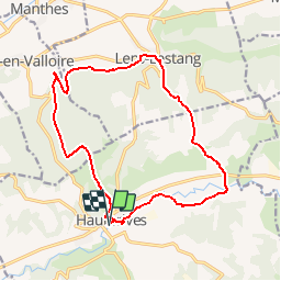
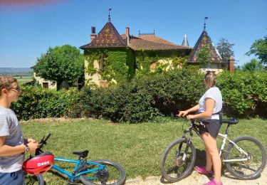
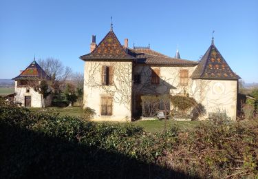
Tour Mountainbike von 16,3 km verfügbar auf Auvergne-Rhone-Alpen, Drôme, Hauterives. Diese Tour wird von tracegps vorgeschlagen.
Beschreibung
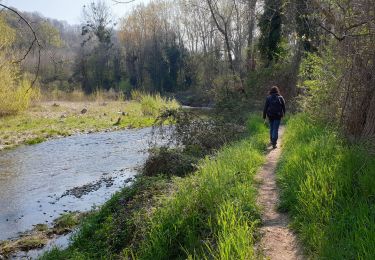
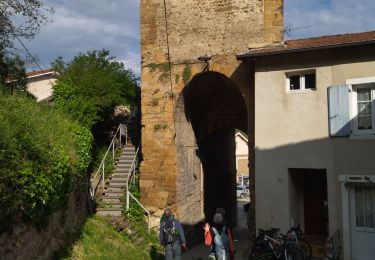
Au départ d'Hauterives, célèbre pour son Palais du Facteur Cheval, ce circuit est plutôt destiné au VTT, mais peut être parcouru à pied. Démarrage par une passerelle enjambant la Galaure, puis suivre la rivière et se fier aux guidage GPS, ou aux triangles jaunes agrafés aux arbres. Risques de boue et de grandes flaques dans la partie haute du circuit après de fortes pluies.
Ort
Kommentare
Touren in der Umgebung
![Tour Wandern Hauterives - boucle idéale - Photo](https://media.geolcdn.com/t/375/260/b847dbd1-b22b-4333-8c83-1297ebdeae39.jpg&format=jpg&maxdim=2)
![Wandern Wandern](https://static1.geolcdn.com/sitytour/trail-icons/101.png)
Wandern
![](/images/other/stat-length.png)
![](https://static1.geolcdn.com/siteimages/upload/files/16400158638029165_repeat_loop_refresh_sync_direction_icon.png)
![Tour sport Moras-en-Valloire - Moras en valloire l’ecolline - Photo](https://media.geolcdn.com/t/375/260/e19f84ca-f352-4c87-8922-7a4e48f9f8b6.jpg&format=jpg&maxdim=2)
sport
![](/images/other/stat-length.png)
![](https://static1.geolcdn.com/siteimages/upload/files/16400158638029165_repeat_loop_refresh_sync_direction_icon.png)
![Tour Wandern Hauterives - Hauterives amicale - Photo](https://media.geolcdn.com/t/375/260/c40e550d-f5cd-4e6d-937a-11509e095014.jpg&format=jpg&maxdim=2)
![Wandern Wandern](https://static1.geolcdn.com/sitytour/trail-icons/101.png)
Wandern
![](/images/other/stat-length.png)
![](https://static1.geolcdn.com/siteimages/upload/files/16400158638029165_repeat_loop_refresh_sync_direction_icon.png)
![Tour Rennrad Lens-Lestang - Lens-lestang à Veyrac - Photo](https://media.geolcdn.com/t/375/260/ext.jpg?maxdim=2&url=https%3A%2F%2Fstatic1.geolcdn.com%2Fsiteimages%2Fupload%2Ffiles%2F1524743154velo.jpg)
![Rennrad Rennrad](https://static1.geolcdn.com/sitytour/trail-icons/201.png)
Rennrad
![](/images/other/stat-length.png)
![](https://static1.geolcdn.com/siteimages/upload/files/16400158638029165_repeat_loop_refresh_sync_direction_icon.png)
![Tour Wandern Hauterives - 26 hauterives 01.05.23 - Photo](https://media.geolcdn.com/t/375/260/695824ed-e11f-4942-a8d5-167f50e85b62.jpg&format=jpg&maxdim=2)
![Wandern Wandern](https://static1.geolcdn.com/sitytour/trail-icons/101.png)
Wandern
![](/images/other/stat-length.png)
![](https://static1.geolcdn.com/siteimages/upload/files/16400158638029165_repeat_loop_refresh_sync_direction_icon.png)
![Tour Fahrrad Lens-Lestang - Lens Lestang ballade historique en vélo - Photo](https://media.geolcdn.com/t/375/260/75910d13-8c4a-4cf1-8a55-7a307b59f910.jpg&format=jpg&maxdim=2)
![Fahrrad Fahrrad](https://static1.geolcdn.com/sitytour/trail-icons/200.png)
Fahrrad
![](/images/other/stat-length.png)
![](https://static1.geolcdn.com/siteimages/upload/files/16400158638029165_repeat_loop_refresh_sync_direction_icon.png)
![Tour Wandern Lens-Lestang - Lens Lestang- route des Châteaux - Photo](https://media.geolcdn.com/t/375/260/ad478f74-f6f1-4d23-b23c-0533237814a2.jpg&format=jpg&maxdim=2)
![Wandern Wandern](https://static1.geolcdn.com/sitytour/trail-icons/101.png)
Wandern
![](/images/other/stat-length.png)
![](https://static1.geolcdn.com/siteimages/upload/files/16400158638029165_repeat_loop_refresh_sync_direction_icon.png)
![Tour Wandern Hauterives - Hauterives - Photo](https://media.geolcdn.com/t/375/260/8f51211a-d544-41d0-9822-209ca83a3066.jpg&format=jpg&maxdim=2)
![Wandern Wandern](https://static1.geolcdn.com/sitytour/trail-icons/101.png)
Wandern
![](/images/other/stat-length.png)
![](https://static1.geolcdn.com/siteimages/upload/files/16400158638029165_repeat_loop_refresh_sync_direction_icon.png)
![Tour Wandern Hauterives - marche du facteur Cheval 2024 - Photo](https://media.geolcdn.com/t/375/260/c0bb333c-d9c7-4640-b583-7395dd087ab3.jpg&format=jpg&maxdim=2)
![Wandern Wandern](https://static1.geolcdn.com/sitytour/trail-icons/101.png)
Wandern
![](/images/other/stat-length.png)
![](https://static1.geolcdn.com/siteimages/upload/files/16400158638029165_repeat_loop_refresh_sync_direction_icon.png)