![](/images/other/stat-length.png)
![Tour Wandern Eygalières - Le Gros Calan - Photo](https://media.geolcdn.com/t/1900/400/ext.pjpeg?maxdim=2&url=https%3A%2F%2Fstatic1.geolcdn.com%2Fsiteimages%2Fupload%2Ffiles%2F1553511878bg_sport_marche.png)
Le Gros Calan
Bredu
Benutzer
![Länge](/images/other/stat-length.png)
Länge
8,7 km
![Maximale Höhe](https://static1.geolcdn.com/siteimages/upload/files/1508320355ic_sort_altitude_max_24dp.png)
Maximale Höhe
303 m
![Positive Höhendifferenz](https://static1.geolcdn.com/siteimages/upload/files/1508320355ic_sort_den_pos_24dp.png)
Positive Höhendifferenz
185 m
![Km-Effort](/images/other/stat-length.png)
Km-Effort
11,2 km
![Min. Höhe](https://static1.geolcdn.com/siteimages/upload/files/1508320355ic_sort_altitude_min_24dp.png)
Min. Höhe
149 m
![Negative Höhendifferenz](https://static1.geolcdn.com/siteimages/upload/files/1508320355ic_sort_den_neg_24dp.png)
Negative Höhendifferenz
188 m
![Boucle](https://static1.geolcdn.com/siteimages/upload/files/16400158638029165_repeat_loop_refresh_sync_direction_icon.png)
Boucle
Ja
Erstellungsdatum :
2019-01-15 17:08:27.754
Letzte Änderung :
2019-01-15 17:08:27.754
![Wandern](https://static1.geolcdn.com/sitytour/trail-icons/101.png)
2h35
Schwierigkeit : Einfach
![Scannen Sie diesen QR-Code, um die Tour in der SityTrail-Anwendung zu öffnen](https://capi.geolives.com/qq0zvz2zws4bq2lad0pu/sitytour/trails/1050126/qr.png?size=200)
Kostenlosegpshiking-Anwendung
Über SityTrail
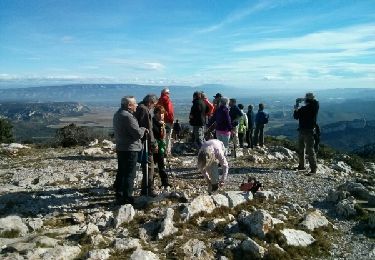
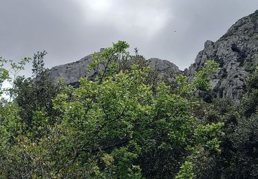
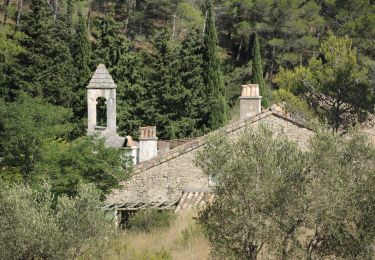
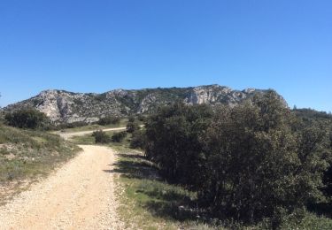
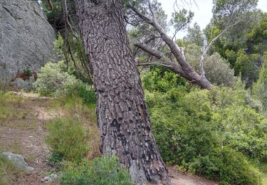
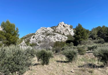
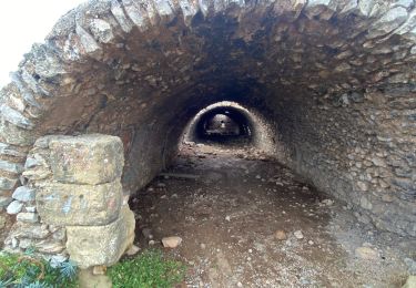
Tour Wandern von 8,7 km verfügbar auf Provence-Alpes-Côte d'Azur, Bouches-du-Rhône, Eygalières. Diese Tour wird von Bredu vorgeschlagen.
Beschreibung
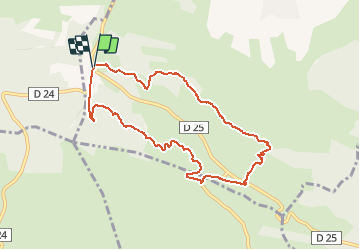
Départ : carrefour D24/D25 - suivre le Chemin forestier du Gros Calan - revenir par la Chemin du Mas de Pascal.
Ort
Land:
France
Region :
Provence-Alpes-Côte d'Azur
Abteilung/Provinz :
Bouches-du-Rhône
Kommune :
Eygalières
Standort:
Unknown
Gehen Sie:(Dec)
Gehen Sie:(UTM)
654685 ; 4845558 (31T) N.
Kommentare
Touren in der Umgebung
![Tour Wandern Aureille - Alpilles, Les Opies par Aureille - Photo](https://media.geolcdn.com/t/375/260/ext.jpg?maxdim=2&url=https%3A%2F%2Fservices.sitytrail.com%2FGeolivesWS%2FDownloadMedia.ashx%3FTrailID%3D529483%26Media%3Dfix__20160223105211.jpg)
![Wandern Wandern](https://static1.geolcdn.com/sitytour/trail-icons/101.png)
Alpilles, Les Opies par Aureille
Wandern
Medium
(1)
Aureille,
Provence-Alpes-Côte d'Azur,
Bouches-du-Rhône,
France
![](/images/other/stat-length.png)
14,5 km | 20 km-effort
4h 48min
![](https://static1.geolcdn.com/siteimages/upload/files/16400158638029165_repeat_loop_refresh_sync_direction_icon.png)
Ja
![Tour Wandern Aureille - boucle du Saint Sépulcre 30/12/33 - Photo](https://media.geolcdn.com/t/375/260/ext.jpg?maxdim=2&url=https%3A%2F%2Fstatic1.geolcdn.com%2Fsiteimages%2Fupload%2Ffiles%2F1553511878bg_sport_marche.png)
![Wandern Wandern](https://static1.geolcdn.com/sitytour/trail-icons/101.png)
boucle du Saint Sépulcre 30/12/33
Wandern
Medium
(2)
Aureille,
Provence-Alpes-Côte d'Azur,
Bouches-du-Rhône,
France
![](/images/other/stat-length.png)
7,4 km | 10,2 km-effort
2h 19min
![](https://static1.geolcdn.com/siteimages/upload/files/16400158638029165_repeat_loop_refresh_sync_direction_icon.png)
Ja
![Tour Wandern Aureille - Tour des Opies retour les Barres rouges - Photo](https://media.geolcdn.com/t/375/260/71cfaa4f-663b-4a27-83f2-11a361f17915.jpg&format=jpg&maxdim=2)
![Wandern Wandern](https://static1.geolcdn.com/sitytour/trail-icons/101.png)
Tour des Opies retour les Barres rouges
Wandern
Schwierig
Aureille,
Provence-Alpes-Côte d'Azur,
Bouches-du-Rhône,
France
![](/images/other/stat-length.png)
14,7 km | 23 km-effort
5h 2min
![](https://static1.geolcdn.com/siteimages/upload/files/16400158638029165_repeat_loop_refresh_sync_direction_icon.png)
Ja
![Wandern Wandern](https://static1.geolcdn.com/sitytour/trail-icons/101.png)
PF-Mouriès - Chapelle de Pierredon
Wandern
Einfach
Mouriès,
Provence-Alpes-Côte d'Azur,
Bouches-du-Rhône,
France
![](/images/other/stat-length.png)
8,3 km | 10,6 km-effort
2h 18min
![](https://static1.geolcdn.com/siteimages/upload/files/16400158638029165_repeat_loop_refresh_sync_direction_icon.png)
Ja
![Tour Wandern Eygalières - PF-Eygalières - Chemin du Mas de Pascal - Photo](https://media.geolcdn.com/t/375/260/ext.jpg?maxdim=2&url=https%3A%2F%2Fservices.sitytrail.com%2FGeolivesWS%2FDownloadMedia.ashx%3FTrailID%3D404634%26Media%3D20150406143520.jpg)
![Wandern Wandern](https://static1.geolcdn.com/sitytour/trail-icons/101.png)
PF-Eygalières - Chemin du Mas de Pascal
Wandern
Einfach
Eygalières,
Provence-Alpes-Côte d'Azur,
Bouches-du-Rhône,
France
![](/images/other/stat-length.png)
8,9 km | 11,5 km-effort
2h 37min
![](https://static1.geolcdn.com/siteimages/upload/files/16400158638029165_repeat_loop_refresh_sync_direction_icon.png)
Ja
![Tour Wandern Eygalières - Eygalières, Petit Calan - Photo](https://media.geolcdn.com/t/375/260/ext.jpg?maxdim=2&url=https%3A%2F%2Fstatic1.geolcdn.com%2Fsiteimages%2Fupload%2Ffiles%2F1553511878bg_sport_marche.png)
![Wandern Wandern](https://static1.geolcdn.com/sitytour/trail-icons/101.png)
Eygalières, Petit Calan
Wandern
Einfach
(1)
Eygalières,
Provence-Alpes-Côte d'Azur,
Bouches-du-Rhône,
France
![](/images/other/stat-length.png)
8,2 km | 10,4 km-effort
2h 15min
![](https://static1.geolcdn.com/siteimages/upload/files/16400158638029165_repeat_loop_refresh_sync_direction_icon.png)
Ja
![Tour Wandern Aureille - Aureille les caisses de Jean Jean - Photo](https://media.geolcdn.com/t/375/260/70a00eab-1728-423c-99fb-6c1202d0990d.jpg&format=jpg&maxdim=2)
![Wandern Wandern](https://static1.geolcdn.com/sitytour/trail-icons/101.png)
Aureille les caisses de Jean Jean
Wandern
Schwierig
Aureille,
Provence-Alpes-Côte d'Azur,
Bouches-du-Rhône,
France
![](/images/other/stat-length.png)
18,4 km | 22 km-effort
7h 24min
![](https://static1.geolcdn.com/siteimages/upload/files/16400158638029165_repeat_loop_refresh_sync_direction_icon.png)
Ja
![Tour Wandern Aureille - PF-Aureille - La Vallongue d'Aureille - MDu - Photo](https://media.geolcdn.com/t/375/260/7ba7fa25-e68d-4ab7-8be1-47e45790a43d.jpg&format=jpg&maxdim=2)
![Wandern Wandern](https://static1.geolcdn.com/sitytour/trail-icons/101.png)
PF-Aureille - La Vallongue d'Aureille - MDu
Wandern
Medium
Aureille,
Provence-Alpes-Côte d'Azur,
Bouches-du-Rhône,
France
![](/images/other/stat-length.png)
7,3 km | 10 km-effort
2h 16min
![](https://static1.geolcdn.com/siteimages/upload/files/16400158638029165_repeat_loop_refresh_sync_direction_icon.png)
Ja
![Tour Wandern Aureille - Auréole - Photo](https://media.geolcdn.com/t/375/260/21f957e9-9863-4bba-978d-18bd8c9b1a5f.jpg&format=jpg&maxdim=2)
![Wandern Wandern](https://static1.geolcdn.com/sitytour/trail-icons/101.png)
Auréole
Wandern
Sehr schwierig
Aureille,
Provence-Alpes-Côte d'Azur,
Bouches-du-Rhône,
France
![](/images/other/stat-length.png)
14,2 km | 22 km-effort
4h 59min
![](https://static1.geolcdn.com/siteimages/upload/files/16400158638029165_repeat_loop_refresh_sync_direction_icon.png)
Ja