![](/images/other/stat-length.png)
![Tour Mountainbike Les Monts d'Aunay - Coupe des Martiens VTT 2010 - 25km - Aunay S/Odon - Photo](https://media.geolcdn.com/t/1900/400/ext.pjpeg?maxdim=2&url=https%3A%2F%2Fstatic1.geolcdn.com%2Fsiteimages%2Fupload%2Ffiles%2F1524743154velo.jpg)
Coupe des Martiens VTT 2010 - 25km - Aunay S/Odon
tracegps
Benutzer
![Länge](/images/other/stat-length.png)
Länge
26 km
![Maximale Höhe](https://static1.geolcdn.com/siteimages/upload/files/1508320355ic_sort_altitude_max_24dp.png)
Maximale Höhe
278 m
![Positive Höhendifferenz](https://static1.geolcdn.com/siteimages/upload/files/1508320355ic_sort_den_pos_24dp.png)
Positive Höhendifferenz
462 m
![Km-Effort](/images/other/stat-length.png)
Km-Effort
32 km
![Min. Höhe](https://static1.geolcdn.com/siteimages/upload/files/1508320355ic_sort_altitude_min_24dp.png)
Min. Höhe
124 m
![Negative Höhendifferenz](https://static1.geolcdn.com/siteimages/upload/files/1508320355ic_sort_den_neg_24dp.png)
Negative Höhendifferenz
462 m
![Boucle](https://static1.geolcdn.com/siteimages/upload/files/16400158638029165_repeat_loop_refresh_sync_direction_icon.png)
Boucle
Ja
Erstellungsdatum :
2014-12-10 00:00:00.0
Letzte Änderung :
2014-12-10 00:00:00.0
![Mountainbike](https://static1.geolcdn.com/sitytour/trail-icons/202.png)
2h19
Schwierigkeit : Medium
![Scannen Sie diesen QR-Code, um die Tour in der SityTrail-Anwendung zu öffnen](https://capi.geolives.com/qq0zvz2zws4bq2lad0pu/sitytour/trails/104942/qr.png?size=200)
Kostenlosegpshiking-Anwendung
Über SityTrail
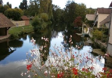
Tour Mountainbike von 26 km verfügbar auf Normandie, Calvados, Les Monts d'Aunay. Diese Tour wird von tracegps vorgeschlagen.
Beschreibung
Rando de 25 km Coupe des Martiens de Aunay sur Odon. Très sympa, et pas trop dure puisqu'on évite le Mont Pinçon. Bon dénivelé quand même.
Ort
Land:
France
Region :
Normandie
Abteilung/Provinz :
Calvados
Kommune :
Les Monts d'Aunay
Standort:
Unknown
Gehen Sie:(Dec)
Gehen Sie:(UTM)
673247 ; 5432020 (30U) N.
Kommentare
Touren in der Umgebung
![Tour Mountainbike Les Monts d'Aunay - Boucle d'Aunay via Hamars - Photo](https://media.geolcdn.com/t/375/260/ext.jpg?maxdim=2&url=https%3A%2F%2Fservices.sitytrail.com%2FGeolivesWS%2FDownloadMedia.ashx%3FTrailID%3D191363%26Media%3D14929_6.jpg)
![Mountainbike Mountainbike](https://static1.geolcdn.com/sitytour/trail-icons/202.png)
Boucle d'Aunay via Hamars
Mountainbike
Schwierig
Les Monts d'Aunay,
Normandie,
Calvados,
France
![](/images/other/stat-length.png)
26 km | 33 km-effort
2h 0min
![](https://static1.geolcdn.com/siteimages/upload/files/16400158638029165_repeat_loop_refresh_sync_direction_icon.png)
Ja
![Tour Mountainbike Les Monts d'Aunay - L'Arbre de la Liberté - Chartres - Photo](https://media.geolcdn.com/t/375/260/ext.jpg?maxdim=2&url=https%3A%2F%2Fservices.sitytrail.com%2FGeolivesWS%2FDownloadMedia.ashx%3FTrailID%3D172787%26Media%3D14216_5.jpg)
![Mountainbike Mountainbike](https://static1.geolcdn.com/sitytour/trail-icons/202.png)
L'Arbre de la Liberté - Chartres
Mountainbike
Medium
Les Monts d'Aunay,
Normandie,
Calvados,
France
![](/images/other/stat-length.png)
2756 km | 3635 km-effort
3h 19min
![](https://static1.geolcdn.com/siteimages/upload/files/16400158638029165_repeat_loop_refresh_sync_direction_icon.png)
Nein
![Tour Mountainbike Les Monts d'Aunay - NormVass 2/6 7juin2022 - Photo](https://media.geolcdn.com/t/375/260/d0bc5af3-e059-40cb-bedf-b1f6bca4eeba.jpg&format=jpg&maxdim=2)
![Mountainbike Mountainbike](https://static1.geolcdn.com/sitytour/trail-icons/202.png)
NormVass 2/6 7juin2022
Mountainbike
Sehr schwierig
Les Monts d'Aunay,
Normandie,
Calvados,
France
![](/images/other/stat-length.png)
47 km | 59 km-effort
8h 36min
![](https://static1.geolcdn.com/siteimages/upload/files/16400158638029165_repeat_loop_refresh_sync_direction_icon.png)
Nein
![Tour Zu Fuß Les Monts d'Aunay - Sous les monts d'Aunay - Photo](https://media.geolcdn.com/t/375/260/b08a1bcf-1ecf-49f8-87f9-ebee83161d95.jpeg&format=jpg&maxdim=2)
![Zu Fuß Zu Fuß](https://static1.geolcdn.com/sitytour/trail-icons/100.png)
Sous les monts d'Aunay
Zu Fuß
Einfach
Les Monts d'Aunay,
Normandie,
Calvados,
France
![](/images/other/stat-length.png)
8 km | 9,4 km-effort
2h 7min
![](https://static1.geolcdn.com/siteimages/upload/files/16400158638029165_repeat_loop_refresh_sync_direction_icon.png)
Ja
![Tour Zu Fuß Malherbe-sur-Ajon - La Vallée de l'Ajon - Photo](https://media.geolcdn.com/t/375/260/526b3219-597e-49aa-b241-0b2c006314c6.jpeg&format=jpg&maxdim=2)
![Zu Fuß Zu Fuß](https://static1.geolcdn.com/sitytour/trail-icons/100.png)
La Vallée de l'Ajon
Zu Fuß
Einfach
Malherbe-sur-Ajon,
Normandie,
Calvados,
France
![](/images/other/stat-length.png)
14,4 km | 17,3 km-effort
3h 55min
![](https://static1.geolcdn.com/siteimages/upload/files/16400158638029165_repeat_loop_refresh_sync_direction_icon.png)
Ja
![Tour Wandern Les Monts d'Aunay - ROUCAMPS 2 - Photo](https://media.geolcdn.com/t/375/260/ext.jpg?maxdim=2&url=https%3A%2F%2Fstatic1.geolcdn.com%2Fsiteimages%2Fupload%2Ffiles%2F1553511878bg_sport_marche.png)
![Wandern Wandern](https://static1.geolcdn.com/sitytour/trail-icons/101.png)
ROUCAMPS 2
Wandern
Schwierig
Les Monts d'Aunay,
Normandie,
Calvados,
France
![](/images/other/stat-length.png)
8,7 km | 11,2 km-effort
2h 52min
![](https://static1.geolcdn.com/siteimages/upload/files/16400158638029165_repeat_loop_refresh_sync_direction_icon.png)
Ja
![Tour Zu Fuß Le Mesnil-au-Grain - Petit Tour à Bauquay - Photo](https://media.geolcdn.com/t/375/260/ext.jpg?maxdim=2&url=https%3A%2F%2Fstatic1.geolcdn.com%2Fsiteimages%2Fupload%2Ffiles%2F1545311037marcheuse_200dpi.jpg)
![Zu Fuß Zu Fuß](https://static1.geolcdn.com/sitytour/trail-icons/100.png)
Petit Tour à Bauquay
Zu Fuß
Einfach
Le Mesnil-au-Grain,
Normandie,
Calvados,
France
![](/images/other/stat-length.png)
4,3 km | 5,3 km-effort
1h 11min
![](https://static1.geolcdn.com/siteimages/upload/files/16400158638029165_repeat_loop_refresh_sync_direction_icon.png)
Ja
![Tour Zu Fuß Malherbe-sur-Ajon - Circuit de l'Orgueil - Photo](https://media.geolcdn.com/t/375/260/ext.jpg?maxdim=2&url=https%3A%2F%2Fstatic1.geolcdn.com%2Fsiteimages%2Fupload%2Ffiles%2F1545311037marcheuse_200dpi.jpg)
![Zu Fuß Zu Fuß](https://static1.geolcdn.com/sitytour/trail-icons/100.png)
Circuit de l'Orgueil
Zu Fuß
Einfach
Malherbe-sur-Ajon,
Normandie,
Calvados,
France
![](/images/other/stat-length.png)
5,6 km | 6,6 km-effort
1h 30min
![](https://static1.geolcdn.com/siteimages/upload/files/16400158638029165_repeat_loop_refresh_sync_direction_icon.png)
Ja
![Tour Zu Fuß Les Monts d'Aunay - Sous le Mont d'Ancre - Photo](https://media.geolcdn.com/t/375/260/ext.jpg?maxdim=2&url=https%3A%2F%2Fstatic1.geolcdn.com%2Fsiteimages%2Fupload%2Ffiles%2F1545311037marcheuse_200dpi.jpg)
![Zu Fuß Zu Fuß](https://static1.geolcdn.com/sitytour/trail-icons/100.png)
Sous le Mont d'Ancre
Zu Fuß
Einfach
Les Monts d'Aunay,
Normandie,
Calvados,
France
![](/images/other/stat-length.png)
13,2 km | 17,3 km-effort
3h 55min
![](https://static1.geolcdn.com/siteimages/upload/files/16400158638029165_repeat_loop_refresh_sync_direction_icon.png)
Ja