![](/images/other/stat-length.png)
![Tour Mountainbike Mauperthuis - Espace VTT FFC - Les Coteaux du Morin et de l'Aubetin - Circuit n° 11 - Mauperthuis - Photo](https://media.geolcdn.com/t/1900/400/ext.pjpeg?maxdim=2&url=https%3A%2F%2Fservices.sitytrail.com%2FGeolivesWS%2FDownloadMedia.ashx%3FTrailID%3D104871%26Media%3D8380_1.jpg)
Espace VTT FFC - Les Coteaux du Morin et de l'Aubetin - Circuit n° 11 - Mauperthuis
tracegps
Benutzer
![Länge](/images/other/stat-length.png)
![Maximale Höhe](https://static1.geolcdn.com/siteimages/upload/files/1508320355ic_sort_altitude_max_24dp.png)
![Positive Höhendifferenz](https://static1.geolcdn.com/siteimages/upload/files/1508320355ic_sort_den_pos_24dp.png)
![Km-Effort](/images/other/stat-length.png)
![Min. Höhe](https://static1.geolcdn.com/siteimages/upload/files/1508320355ic_sort_altitude_min_24dp.png)
![Negative Höhendifferenz](https://static1.geolcdn.com/siteimages/upload/files/1508320355ic_sort_den_neg_24dp.png)
![Boucle](https://static1.geolcdn.com/siteimages/upload/files/16400158638029165_repeat_loop_refresh_sync_direction_icon.png)
![Mountainbike](https://static1.geolcdn.com/sitytour/trail-icons/202.png)
1h00
Schwierigkeit : Medium
![Scannen Sie diesen QR-Code, um die Tour in der SityTrail-Anwendung zu öffnen](https://capi.geolives.com/qq0zvz2zws4bq2lad0pu/sitytour/trails/104871/qr.png?size=200)
Kostenlosegpshiking-Anwendung
Über SityTrail
Tour Mountainbike von 11,6 km verfügbar auf Île-de-France, Seine-et-Marne, Mauperthuis. Diese Tour wird von tracegps vorgeschlagen.
Beschreibung
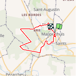
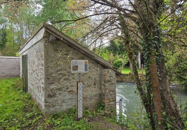
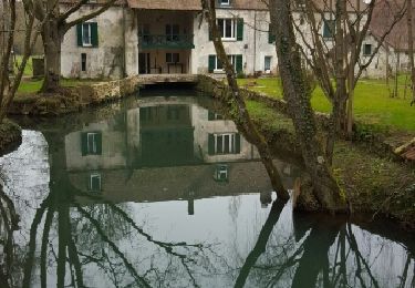
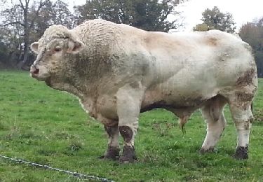
Espace VTT FFC - Les Coteaux du Morin et de l'Aubetin - Circuit n° 11 – Mauperthuis Départ : église De part et d’autres des coteaux, à la découverte de l’Aubetin et de la forêt de Malvoisine. Assurément l’un des plus jolis parcours du site, à relier avec les circuits voisins. Points d’accueils • Office du tourisme : 7 rue du Général de Gaulle - 77120 COULOMMIERS Tél. : 01 64 03 88 09 - mail : off.tourisme@coulommiers.fr • Vélo Nature : 8 avenue de Strasbourg - 77120 COULOMMIERS Tél. : 01 64 20 84 42 - mail : velonature@tele2.fr • Association cycliste partenaire Association Cycliste Pommeuse Boissy (ACPB) Site internet : http://acpommeuseboissy.free.fr
Ort
Kommentare
Touren in der Umgebung
![Tour Andere Aktivitäten Coulommiers - coulommiers - Photo](https://media.geolcdn.com/t/375/260/ext.jpg?maxdim=2&url=https%3A%2F%2Fservices.sitytrail.com%2FGeolivesWS%2FDownloadMedia.ashx%3FTrailID%3D661376%26Media%3D20161117135808.jpg)
![Andere Aktivitäten Andere Aktivitäten](https://static1.geolcdn.com/sitytour/trail-icons/900.png)
Andere Aktivitäten
![](/images/other/stat-length.png)
![](https://static1.geolcdn.com/siteimages/upload/files/16400158638029165_repeat_loop_refresh_sync_direction_icon.png)
![Tour Mountainbike Saint-Augustin - Espace VTT FFC - Les Coteaux du Morin et de l'Aubetin - Circuit n° 15 - Saint Augustin - Photo](https://media.geolcdn.com/t/375/260/ext.jpg?maxdim=2&url=https%3A%2F%2Fservices.sitytrail.com%2FGeolivesWS%2FDownloadMedia.ashx%3FTrailID%3D104879%26Media%3D8402_1.jpg)
![Mountainbike Mountainbike](https://static1.geolcdn.com/sitytour/trail-icons/202.png)
Mountainbike
![](/images/other/stat-length.png)
![](https://static1.geolcdn.com/siteimages/upload/files/16400158638029165_repeat_loop_refresh_sync_direction_icon.png)
![Tour Zu Fuß Pommeuse - Les lavoirs de Pommeuse - Photo](https://media.geolcdn.com/t/375/260/a3e1e608-548a-4bdf-b5b0-e6261cd9b13e.jpg&format=jpg&maxdim=2)
![Zu Fuß Zu Fuß](https://static1.geolcdn.com/sitytour/trail-icons/100.png)
Zu Fuß
![](/images/other/stat-length.png)
![](https://static1.geolcdn.com/siteimages/upload/files/16400158638029165_repeat_loop_refresh_sync_direction_icon.png)
![Tour Wandern Coulommiers - COULOMMIERS > FAREMOUTIERS 18 KM - Photo](https://media.geolcdn.com/t/375/260/ext.jpg?maxdim=2&url=https%3A%2F%2Fstatic1.geolcdn.com%2Fsiteimages%2Fupload%2Ffiles%2F1553511878bg_sport_marche.png)
![Wandern Wandern](https://static1.geolcdn.com/sitytour/trail-icons/101.png)
Wandern
![](/images/other/stat-length.png)
![](https://static1.geolcdn.com/siteimages/upload/files/16400158638029165_repeat_loop_refresh_sync_direction_icon.png)
![Tour Wandern Coulommiers - Commanderie de COULOMMIERS - Photo](https://media.geolcdn.com/t/375/260/ext.jpg?maxdim=2&url=https%3A%2F%2Fstatic1.geolcdn.com%2Fsiteimages%2Fupload%2Ffiles%2F1553511878bg_sport_marche.png)
![Wandern Wandern](https://static1.geolcdn.com/sitytour/trail-icons/101.png)
Wandern
![](/images/other/stat-length.png)
![](https://static1.geolcdn.com/siteimages/upload/files/16400158638029165_repeat_loop_refresh_sync_direction_icon.png)
![Tour Wandern Coulommiers - Coulommiers/Aunoy - Photo](https://media.geolcdn.com/t/375/260/e74aaa5c-c78a-41c1-a9c9-b28f10b2a0b6.jpg&format=jpg&maxdim=2)
![Wandern Wandern](https://static1.geolcdn.com/sitytour/trail-icons/101.png)
Wandern
![](/images/other/stat-length.png)
![](https://static1.geolcdn.com/siteimages/upload/files/16400158638029165_repeat_loop_refresh_sync_direction_icon.png)
![Tour Wandern Faremoutiers - Faremoutiers - Photo](https://media.geolcdn.com/t/375/260/ext.jpg?maxdim=2&url=https%3A%2F%2Fservices.sitytrail.com%2FGeolivesWS%2FDownloadMedia.ashx%3FTrailID%3D541010%26Media%3Dfix__20160320114029.jpg)
![Wandern Wandern](https://static1.geolcdn.com/sitytour/trail-icons/101.png)
Wandern
![](/images/other/stat-length.png)
![](https://static1.geolcdn.com/siteimages/upload/files/16400158638029165_repeat_loop_refresh_sync_direction_icon.png)
![Tour Wandern Pommeuse - pommeuse - Photo](https://media.geolcdn.com/t/375/260/ext.jpg?maxdim=2&url=https%3A%2F%2Fservices.sitytrail.com%2FGeolivesWS%2FDownloadMedia.ashx%3FTrailID%3D234179%26Media%3Dfix__20131124134631.jpg)
![Wandern Wandern](https://static1.geolcdn.com/sitytour/trail-icons/101.png)
Wandern
![](/images/other/stat-length.png)
![](https://static1.geolcdn.com/siteimages/upload/files/16400158638029165_repeat_loop_refresh_sync_direction_icon.png)
![Tour Wandern Beautheil-Saints - Saints - Photo](https://media.geolcdn.com/t/375/260/ext.jpg?maxdim=2&url=https%3A%2F%2Fservices.sitytrail.com%2FGeolivesWS%2FDownloadMedia.ashx%3FTrailID%3D178374%26Media%3D20130306145442.jpeg)
![Wandern Wandern](https://static1.geolcdn.com/sitytour/trail-icons/101.png)
Wandern
![](/images/other/stat-length.png)
![](https://static1.geolcdn.com/siteimages/upload/files/16400158638029165_repeat_loop_refresh_sync_direction_icon.png)