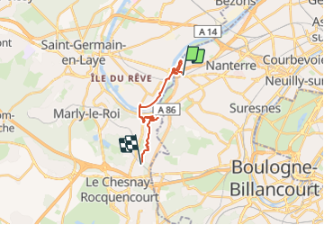
![](/images/other/stat-length.png)
![Tour Wandern Rueil-Malmaison - RSP Rueil Malmaison-LaCelle Saint Cloud - Photo](https://media.geolcdn.com/t/1900/400/ext.pjpeg?maxdim=2&url=https%3A%2F%2Fstatic1.geolcdn.com%2Fsiteimages%2Fupload%2Ffiles%2F1553511878bg_sport_marche.png)
RSP Rueil Malmaison-LaCelle Saint Cloud
Quarta
Benutzer
![Länge](/images/other/stat-length.png)
![Maximale Höhe](https://static1.geolcdn.com/siteimages/upload/files/1508320355ic_sort_altitude_max_24dp.png)
![Positive Höhendifferenz](https://static1.geolcdn.com/siteimages/upload/files/1508320355ic_sort_den_pos_24dp.png)
![Km-Effort](/images/other/stat-length.png)
![Min. Höhe](https://static1.geolcdn.com/siteimages/upload/files/1508320355ic_sort_altitude_min_24dp.png)
![Negative Höhendifferenz](https://static1.geolcdn.com/siteimages/upload/files/1508320355ic_sort_den_neg_24dp.png)
![Boucle](https://static1.geolcdn.com/siteimages/upload/files/16400158638029165_repeat_loop_refresh_sync_direction_icon.png)
![Wandern](https://static1.geolcdn.com/sitytour/trail-icons/101.png)
3h54
Schwierigkeit : Schwierig
![Scannen Sie diesen QR-Code, um die Tour in der SityTrail-Anwendung zu öffnen](https://capi.geolives.com/qq0zvz2zws4bq2lad0pu/sitytour/trails/1048691/qr.png?size=200)
Kostenlosegpshiking-Anwendung
Über SityTrail
Tour Wandern von 13,6 km verfügbar auf Île-de-France, Hauts-de-Seine, Rueil-Malmaison. Diese Tour wird von Quarta vorgeschlagen.
Beschreibung
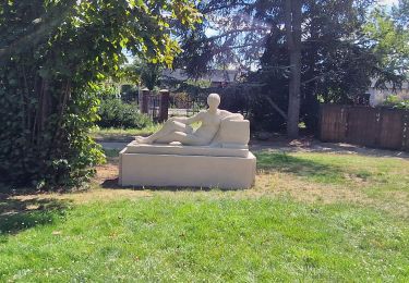
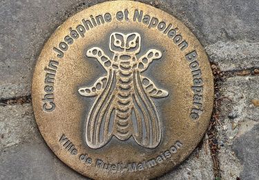
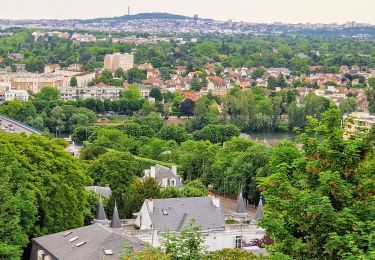
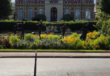
RERA sortie 1, rue des 2 gares à D, 1er G, escaliers, Passer dans centre com., Place de l'Europe, Cours F De Lesseps, D louis Blériot, 3ie G Queneau, 2ième allée, entrer Jardin des impressionnistes, sortie bords de Seine aval, jusqu'au Pont de Chatou, Maison Fournaise, Gare d'eau, Pt RER vers Croisy, Quai de Seine, crochet rue de l'Abreuvoir vers M.de Grenouillère, chapelle et chateau, Berges jusqu'au Pont de Bougival, passer Seine,monter jusqu'à la maison de Berthe Morisot, prendre à G, puis 1ere D jusqu'à l'église, épingle à cheveu G,dans le P entrer Parc de la Jonchère,ligne droite 2 lacets en montée puis 2 lacets en descente (pique nique), Rebrousser chemin puis S,vers chateau d'eau, école,contourner le chateau de La Celle St Cloud,Bois de La Celle, rejoindre la Gare de La Cellesaint Cloud
Ort
Kommentare
Touren in der Umgebung
![Tour Wandern Rueil-Malmaison - St Germain en Laye - Rueil Malmaison 28 km Inversee - Photo](https://media.geolcdn.com/t/375/260/b687f904-9338-4fa0-aef2-9bacff37d877.jpg&format=jpg&maxdim=2)
![Wandern Wandern](https://static1.geolcdn.com/sitytour/trail-icons/101.png)
Wandern
![](/images/other/stat-length.png)
![](https://static1.geolcdn.com/siteimages/upload/files/16400158638029165_repeat_loop_refresh_sync_direction_icon.png)
![Tour Wandern Bougival - Bougival-Saint-cucufa reel - Photo](https://media.geolcdn.com/t/375/260/f8214235-f5e3-4ba5-8084-044ba7cbf132.jpeg&format=jpg&maxdim=2)
![Wandern Wandern](https://static1.geolcdn.com/sitytour/trail-icons/101.png)
Wandern
![](/images/other/stat-length.png)
![](https://static1.geolcdn.com/siteimages/upload/files/16400158638029165_repeat_loop_refresh_sync_direction_icon.png)
![Tour Zu Fuß Rueil-Malmaison - SityTrail - 3850997 - rando-chatou (1) - Photo](https://media.geolcdn.com/t/375/260/c514a42a-e126-47ef-85f0-d75f60d63c7a.jpg&format=jpg&maxdim=2)
![Zu Fuß Zu Fuß](https://static1.geolcdn.com/sitytour/trail-icons/100.png)
Zu Fuß
![](/images/other/stat-length.png)
![](https://static1.geolcdn.com/siteimages/upload/files/16400158638029165_repeat_loop_refresh_sync_direction_icon.png)
![Tour Wandern Saint-Germain-en-Laye - SityTrail - 202230519 RS 5km - Photo](https://media.geolcdn.com/t/375/260/ext.jpg?maxdim=2&url=https%3A%2F%2Fstatic1.geolcdn.com%2Fsiteimages%2Fupload%2Ffiles%2F1553511878bg_sport_marche.png)
![Wandern Wandern](https://static1.geolcdn.com/sitytour/trail-icons/101.png)
Wandern
![](/images/other/stat-length.png)
![](https://static1.geolcdn.com/siteimages/upload/files/16400158638029165_repeat_loop_refresh_sync_direction_icon.png)
![Tour Wandern Rueil-Malmaison - De Rueil Malmaison aux Serres d'Auteuil via Suresnes - Photo](https://media.geolcdn.com/t/375/260/69c5aa69-7a4f-4e7d-be07-682d5ba1172b.jpg&format=jpg&maxdim=2)
![Wandern Wandern](https://static1.geolcdn.com/sitytour/trail-icons/101.png)
Wandern
![](/images/other/stat-length.png)
![](https://static1.geolcdn.com/siteimages/upload/files/16400158638029165_repeat_loop_refresh_sync_direction_icon.png)
![Tour Wandern Rueil-Malmaison - Domaine Malmaison - Cité jardin Suresnes - Boulogne - Serres d'Auteuil - Photo](https://media.geolcdn.com/t/375/260/f35951a9-b213-4c85-9bfa-cc06ec3dd722.jpg&format=jpg&maxdim=2)
![Wandern Wandern](https://static1.geolcdn.com/sitytour/trail-icons/101.png)
Wandern
![](/images/other/stat-length.png)
![](https://static1.geolcdn.com/siteimages/upload/files/16400158638029165_repeat_loop_refresh_sync_direction_icon.png)
![Tour Wandern Rueil-Malmaison - De rueil Malmaison à St Germain en Laye - Photo](https://media.geolcdn.com/t/375/260/2cfb8298-4a88-4640-a039-54786d423968.jpg&format=jpg&maxdim=2)
![Wandern Wandern](https://static1.geolcdn.com/sitytour/trail-icons/101.png)
Wandern
![](/images/other/stat-length.png)
![](https://static1.geolcdn.com/siteimages/upload/files/16400158638029165_repeat_loop_refresh_sync_direction_icon.png)
![Tour Wandern Marly-le-Roi - 2025 02 05 Louveciennes 11 km - Photo](https://media.geolcdn.com/t/375/260/ext.jpg?maxdim=2&url=https%3A%2F%2Fstatic1.geolcdn.com%2Fsiteimages%2Fupload%2Ffiles%2F1553511878bg_sport_marche.png)
![Wandern Wandern](https://static1.geolcdn.com/sitytour/trail-icons/101.png)
Wandern
![](/images/other/stat-length.png)
![](https://static1.geolcdn.com/siteimages/upload/files/16400158638029165_repeat_loop_refresh_sync_direction_icon.png)
![Tour Wandern Rueil-Malmaison - Rueil Ville, château, Cucufa-Seine - Photo](https://media.geolcdn.com/t/375/260/c2b90b8f-08d6-4c14-833f-306078b35459.jpg&format=jpg&maxdim=2)
![Wandern Wandern](https://static1.geolcdn.com/sitytour/trail-icons/101.png)
Wandern
![](/images/other/stat-length.png)
![](https://static1.geolcdn.com/siteimages/upload/files/16400158638029165_repeat_loop_refresh_sync_direction_icon.png)