


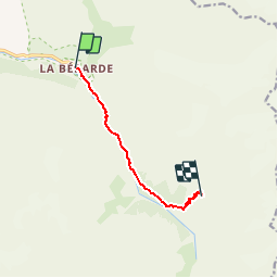

6,3 km | 11,2 km-effort

Benutzer


Kostenlosegpshiking-Anwendung
 SityTrail
IGN / Geografische Institute
SityTrail World
Die Welt öffnet sich für Sie
Tour Wandern von 6,5 km verfügbar auf Auvergne-Rhone-Alpen, Isère, Saint-Christophe-en-Oisans. Diese Tour wird von tracegps vorgeschlagen.
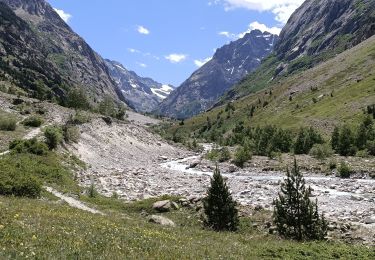
Départ de la Bérarde jusqu'au refuge du Carrelet (moyen de ce désaltérer), ensuite monter vers le Refuge du Temple des Ecrins. Tél refuge du Temple des Ecrins : 04/76790828 A la Bérarde, très beau gîte accueillant, "Le Champ de Pin", tél.:04/76795409


Wandern

Wandern

Wandern

Wandern

Wandern
Wandern
Wandern

Wandern

Wandern