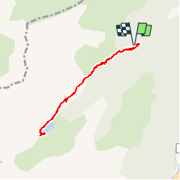
![](/images/other/stat-length.png)
![Tour Wandern Mérens-les-Vals - Etang de Comte - Merens les Vals - Photo](https://media.geolcdn.com/t/1900/400/ext.pjpeg?maxdim=2&url=https%3A%2F%2Fservices.sitytrail.com%2FGeolivesWS%2FDownloadMedia.ashx%3FTrailID%3D104799%26Media%3D8276_1.jpg)
Etang de Comte - Merens les Vals
tracegps
Benutzer
![Länge](/images/other/stat-length.png)
![Maximale Höhe](https://static1.geolcdn.com/siteimages/upload/files/1508320355ic_sort_altitude_max_24dp.png)
![Positive Höhendifferenz](https://static1.geolcdn.com/siteimages/upload/files/1508320355ic_sort_den_pos_24dp.png)
![Km-Effort](/images/other/stat-length.png)
![Min. Höhe](https://static1.geolcdn.com/siteimages/upload/files/1508320355ic_sort_altitude_min_24dp.png)
![Negative Höhendifferenz](https://static1.geolcdn.com/siteimages/upload/files/1508320355ic_sort_den_neg_24dp.png)
![Boucle](https://static1.geolcdn.com/siteimages/upload/files/16400158638029165_repeat_loop_refresh_sync_direction_icon.png)
![Wandern](https://static1.geolcdn.com/sitytour/trail-icons/101.png)
2h15
Schwierigkeit : Medium
![Scannen Sie diesen QR-Code, um die Tour in der SityTrail-Anwendung zu öffnen](https://capi.geolives.com/qq0zvz2zws4bq2lad0pu/sitytour/trails/104799/qr.png?size=200)
Kostenlosegpshiking-Anwendung
Über SityTrail
Tour Wandern von 6,8 km verfügbar auf Okzitanien, Ariège, Mérens-les-Vals. Diese Tour wird von tracegps vorgeschlagen.
Beschreibung
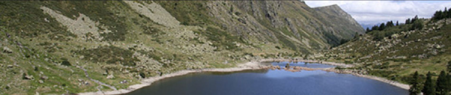
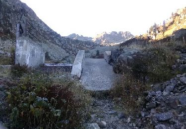
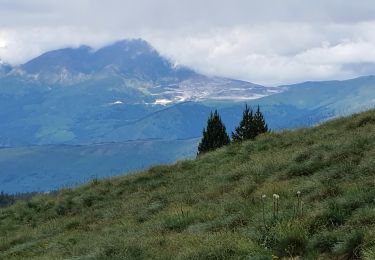
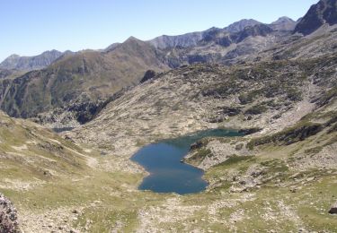
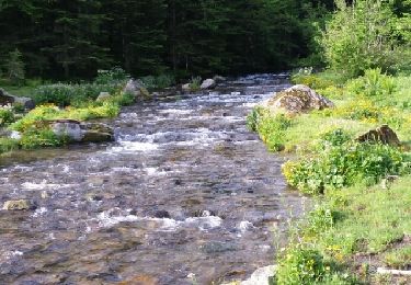
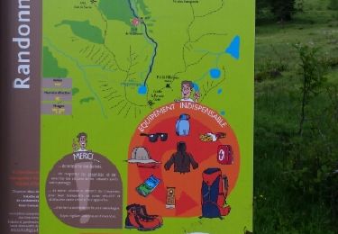
Voici la course d’initiation idéale pour la découverte de la montagne en famille. Après un départ dans la forêt où un vieux chemin dallé un peu raide mène jusqu’au ruisseau de Mourguilhou, les pâturages subalpins jonchés de grandes gentianes et de rhododendrons remontent jusqu’à l’étang de Comte où le pique-nique sera le bienvenu. Les montagnards chevronnés, à plus fortes raison s’ils sont pêcheurs pourront continuer jusqu’à l’étang de Couart (2h40), le merveilleux étang e l’Albe (4h) ou jusqu’au col de l’Albe (4h45) qui marque la frontière avec l’Andorre. (source Comité Départemental du Tourisme de l'Ariège)
Ort
Kommentare
Touren in der Umgebung
![Tour Wandern Orgeix - aiguelongue - Photo](https://media.geolcdn.com/t/375/260/ext.jpg?maxdim=2&url=https%3A%2F%2Fservices.sitytrail.com%2FGeolivesWS%2FDownloadMedia.ashx%3FTrailID%3D643989%26Media%3Dfix__20161010104856.jpg)
![Wandern Wandern](https://static1.geolcdn.com/sitytour/trail-icons/101.png)
Wandern
![](/images/other/stat-length.png)
![](https://static1.geolcdn.com/siteimages/upload/files/16400158638029165_repeat_loop_refresh_sync_direction_icon.png)
![Tour Wandern Mérens-les-Vals - 2022 TRANSPYRÉNÉENNE : refuge des Bésines - barrage des Bouillouesses - Superbolquère - Photo](https://media.geolcdn.com/t/375/260/3e945d26-7746-4a0a-a0a5-7c997bd521c0.jpg&format=jpg&maxdim=2)
![Wandern Wandern](https://static1.geolcdn.com/sitytour/trail-icons/101.png)
Wandern
![](/images/other/stat-length.png)
![](https://static1.geolcdn.com/siteimages/upload/files/16400158638029165_repeat_loop_refresh_sync_direction_icon.png)
![Tour Wandern Mérens-les-Vals - Pic de canals en boucle - Photo](https://media.geolcdn.com/t/375/260/57bc1271-5a5a-4949-81ec-e2fba4899a43.jpg&format=jpg&maxdim=2)
![Wandern Wandern](https://static1.geolcdn.com/sitytour/trail-icons/101.png)
Wandern
![](/images/other/stat-length.png)
![](https://static1.geolcdn.com/siteimages/upload/files/16400158638029165_repeat_loop_refresh_sync_direction_icon.png)
![Tour Wandern Mérens-les-Vals - Pic de Canals - Photo](https://media.geolcdn.com/t/375/260/c8c92fc2-dcb2-4400-9d3c-800f4744a213.jpg&format=jpg&maxdim=2)
![Wandern Wandern](https://static1.geolcdn.com/sitytour/trail-icons/101.png)
Wandern
![](/images/other/stat-length.png)
![](https://static1.geolcdn.com/siteimages/upload/files/16400158638029165_repeat_loop_refresh_sync_direction_icon.png)
![Tour Wandern Orgeix - Pic de l'homme par les crêtes - Photo](https://media.geolcdn.com/t/375/260/ext.jpg?maxdim=2&url=https%3A%2F%2Fservices.sitytrail.com%2FGeolivesWS%2FDownloadMedia.ashx%3FTrailID%3D815731%26Media%3D50b6cd61-3adc-46d0-8ebf-fb8b362ce67b.JPG)
![Wandern Wandern](https://static1.geolcdn.com/sitytour/trail-icons/101.png)
Wandern
![](/images/other/stat-length.png)
![](https://static1.geolcdn.com/siteimages/upload/files/16400158638029165_repeat_loop_refresh_sync_direction_icon.png)
![Tour Wandern Mérens-les-Vals - le lac Couart - Photo](https://media.geolcdn.com/t/375/260/ext.jpg?maxdim=2&url=https%3A%2F%2Fservices.sitytrail.com%2FGeolivesWS%2FDownloadMedia.ashx%3FTrailID%3D315324%26Media%3Dfix__20140622084804.jpg)
![Wandern Wandern](https://static1.geolcdn.com/sitytour/trail-icons/101.png)
Wandern
![](/images/other/stat-length.png)
![](https://static1.geolcdn.com/siteimages/upload/files/16400158638029165_repeat_loop_refresh_sync_direction_icon.png)
![Tour Wandern Orgeix - Lac d ' Aiguelongue - Photo](https://media.geolcdn.com/t/375/260/ext.jpg?maxdim=2&url=https%3A%2F%2Fservices.sitytrail.com%2FGeolivesWS%2FDownloadMedia.ashx%3FTrailID%3D314853%26Media%3Dfix__20140621082519.jpg)
![Wandern Wandern](https://static1.geolcdn.com/sitytour/trail-icons/101.png)
Wandern
![](/images/other/stat-length.png)
![](https://static1.geolcdn.com/siteimages/upload/files/16400158638029165_repeat_loop_refresh_sync_direction_icon.png)
![Tour Wandern Mérens-les-Vals - Col de Joux depuis Merens les Vals - Variante retour route forestiere - Photo](https://media.geolcdn.com/t/375/260/9b2dcdb9-e06a-4bf5-bac1-56efbf13e437.jpg&format=jpg&maxdim=2)
![Wandern Wandern](https://static1.geolcdn.com/sitytour/trail-icons/101.png)
Wandern
![](/images/other/stat-length.png)
![](https://static1.geolcdn.com/siteimages/upload/files/16400158638029165_repeat_loop_refresh_sync_direction_icon.png)
![Tour Wandern Mérens-les-Vals - cécé Gégé lac de comte - Photo](https://media.geolcdn.com/t/375/260/8e57eb6c-eeb0-4ed3-9d16-21fcfeb537b4.jpg&format=jpg&maxdim=2)
![Wandern Wandern](https://static1.geolcdn.com/sitytour/trail-icons/101.png)
Wandern
![](/images/other/stat-length.png)
![](https://static1.geolcdn.com/siteimages/upload/files/16400158638029165_repeat_loop_refresh_sync_direction_icon.png)