


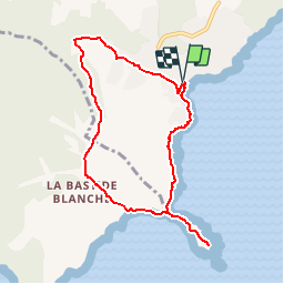

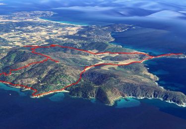
15,2 km | 20 km-effort


Benutzer GUIDE


Kostenlosegpshiking-Anwendung
 SityTrail
IGN / Geografische Institute
SityTrail World
Die Welt öffnet sich für Sie
Tour Wandern von 8,5 km verfügbar auf Provence-Alpes-Côte d'Azur, Var, Ramatuelle. Diese Tour wird von lhomme.ph vorgeschlagen.
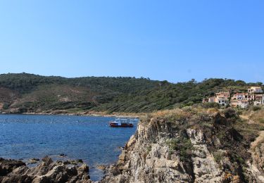
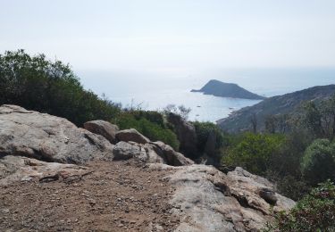
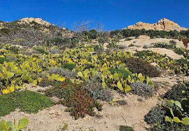
Cette promenade sur le sentier des douaniers donne l'occasion de constater l'incroyable résilience de la nature méditerranéenne, qui se remet de l'incendie de 2017
Zu Fuß
Elektrofahrrad
Elektrofahrrad
Wandern

Mountainbike

Wandern
Wandern
Wandern
Wandern