![](/images/other/stat-length.png)
![Tour Wandern Saint-Alban-les-Eaux - Des Gorges du désert aux sources de la Montouse - Photo](https://media.geolcdn.com/t/1900/400/ext.pjpeg?maxdim=2&url=https%3A%2F%2Fservices.sitytrail.com%2FGeolivesWS%2FDownloadMedia.ashx%3FTrailID%3D104643%26Media%3D8030_6.jpg)
Des Gorges du désert aux sources de la Montouse
tracegps
Benutzer
![Länge](/images/other/stat-length.png)
![Maximale Höhe](https://static1.geolcdn.com/siteimages/upload/files/1508320355ic_sort_altitude_max_24dp.png)
![Positive Höhendifferenz](https://static1.geolcdn.com/siteimages/upload/files/1508320355ic_sort_den_pos_24dp.png)
![Km-Effort](/images/other/stat-length.png)
![Min. Höhe](https://static1.geolcdn.com/siteimages/upload/files/1508320355ic_sort_altitude_min_24dp.png)
![Negative Höhendifferenz](https://static1.geolcdn.com/siteimages/upload/files/1508320355ic_sort_den_neg_24dp.png)
![Boucle](https://static1.geolcdn.com/siteimages/upload/files/16400158638029165_repeat_loop_refresh_sync_direction_icon.png)
![Wandern](https://static1.geolcdn.com/sitytour/trail-icons/101.png)
3h00
Schwierigkeit : Schwierig
![Scannen Sie diesen QR-Code, um die Tour in der SityTrail-Anwendung zu öffnen](https://capi.geolives.com/qq0zvz2zws4bq2lad0pu/sitytour/trails/104643/qr.png?size=200)
Kostenlosegpshiking-Anwendung
Über SityTrail
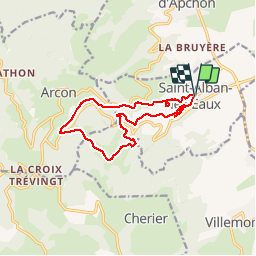
Tour Wandern von 12,4 km verfügbar auf Auvergne-Rhone-Alpen, Loire, Saint-Alban-les-Eaux. Diese Tour wird von tracegps vorgeschlagen.
Beschreibung
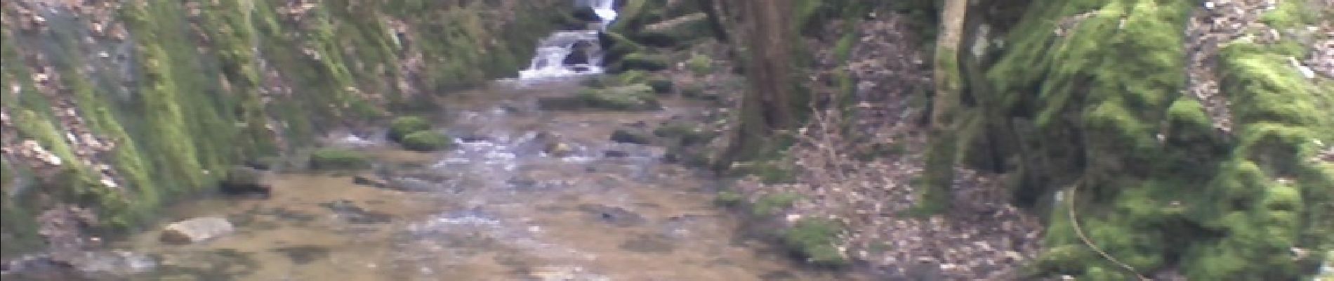
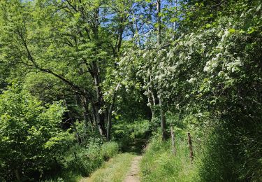
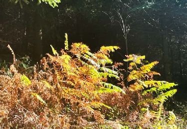
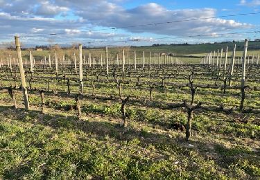
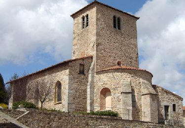
Parking gratuit face à l'église. A voir sur le parcours : le lavoir, la vierge, le barrage de la Montouse, les gorges du désert, la chute d'eau au niveau de la barre rocheuse, de beaux panoramas sur la plaine roannaise et les monts du Beaujolais,le Châtelus. A visiter dans le village : descendre sous le parking vers le parc et découvrir la fontaine au lion et le sentier des sculptures, l'église, l'usine d'eau minérale. Prévoir des chaussures techniques (imperméables) pour franchir les nombreux passages à gué. Restaurant gastronomique face au parking.
Ort
Kommentare
Touren in der Umgebung
![Tour Wandern - Randonnée sur les plateaux au dessus du village de Moulins -Chérier - Photo](https://media.geolcdn.com/t/375/260/328a50ea-b5e1-4410-88c7-07bd0b3b435c.jpg&format=jpg&maxdim=2)
![Wandern Wandern](https://static1.geolcdn.com/sitytour/trail-icons/101.png)
Wandern
![](/images/other/stat-length.png)
![](https://static1.geolcdn.com/siteimages/upload/files/16400158638029165_repeat_loop_refresh_sync_direction_icon.png)
![Tour Wandern Cherier - rocher de rochefort depuis la croix Trévingt - Photo](https://media.geolcdn.com/t/375/260/dcc1659c-efdc-4c94-9e85-a848a823e0bd.jpg&format=jpg&maxdim=2)
![Wandern Wandern](https://static1.geolcdn.com/sitytour/trail-icons/101.png)
Wandern
![](/images/other/stat-length.png)
![](https://static1.geolcdn.com/siteimages/upload/files/16400158638029165_repeat_loop_refresh_sync_direction_icon.png)
![Tour Wandern Renaison - Renaison : d’un barrage à l’autre - Photo](https://media.geolcdn.com/t/375/260/0c55d59a-831c-4f21-8687-c1695b3393b5.jpg&format=jpg&maxdim=2)
![Wandern Wandern](https://static1.geolcdn.com/sitytour/trail-icons/101.png)
Wandern
![](/images/other/stat-length.png)
![](https://static1.geolcdn.com/siteimages/upload/files/16400158638029165_repeat_loop_refresh_sync_direction_icon.png)
![Tour Wandern Arcon - Arcon: Roche Corbière-Quatre Murs - Photo](https://media.geolcdn.com/t/375/260/f084a593-c8ab-4485-bad9-4355d9e9f1a8.jpg&format=jpg&maxdim=2)
![Wandern Wandern](https://static1.geolcdn.com/sitytour/trail-icons/101.png)
Wandern
![](/images/other/stat-length.png)
![](https://static1.geolcdn.com/siteimages/upload/files/16400158638029165_repeat_loop_refresh_sync_direction_icon.png)
![Tour Wandern Cherier - rando à Moulin Charier - Photo](https://media.geolcdn.com/t/375/260/3886ddf7-94b0-4692-af5c-3d0753f12223.jpg&format=jpg&maxdim=2)
![Wandern Wandern](https://static1.geolcdn.com/sitytour/trail-icons/101.png)
Wandern
![](/images/other/stat-length.png)
![](https://static1.geolcdn.com/siteimages/upload/files/16400158638029165_repeat_loop_refresh_sync_direction_icon.png)
![Tour Wandern Villemontais - Villemontais : Chérier et Haut Ste-Agathe - Photo](https://media.geolcdn.com/t/375/260/43288f42-5353-465e-b07f-32492fc85c11.jpg&format=jpg&maxdim=2)
![Wandern Wandern](https://static1.geolcdn.com/sitytour/trail-icons/101.png)
Wandern
![](/images/other/stat-length.png)
![](https://static1.geolcdn.com/siteimages/upload/files/16400158638029165_repeat_loop_refresh_sync_direction_icon.png)
![Tour Wandern Ouches - Ouches : de la plaine à la côte roannaise - Photo](https://media.geolcdn.com/t/375/260/6b9e8121-0a01-4791-9e45-beccd7d62b78.jpg&format=jpg&maxdim=2)
![Wandern Wandern](https://static1.geolcdn.com/sitytour/trail-icons/101.png)
Wandern
![](/images/other/stat-length.png)
![](https://static1.geolcdn.com/siteimages/upload/files/16400158638029165_repeat_loop_refresh_sync_direction_icon.png)
![Tour Zu Fuß Cherier - Les Moulins Chérier - boucles autour du vieux bourg - Photo](https://media.geolcdn.com/t/375/260/02a5a11d-56eb-4a94-af63-ae9a9466184f.jpg&format=jpg&maxdim=2)
![Zu Fuß Zu Fuß](https://static1.geolcdn.com/sitytour/trail-icons/100.png)
Zu Fuß
![](/images/other/stat-length.png)
![](https://static1.geolcdn.com/siteimages/upload/files/16400158638029165_repeat_loop_refresh_sync_direction_icon.png)
![Tour Wandern Saint-André-d'Apchon - St-André-d'Apchon-Rocher de Bellevue - Photo](https://media.geolcdn.com/t/375/260/8e975bfa-15cb-4d0f-9f11-d5beb6ba5a25.jpg&format=jpg&maxdim=2)
![Wandern Wandern](https://static1.geolcdn.com/sitytour/trail-icons/101.png)
Wandern
![](/images/other/stat-length.png)
![](https://static1.geolcdn.com/siteimages/upload/files/16400158638029165_repeat_loop_refresh_sync_direction_icon.png)