


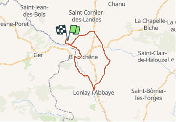

11,2 km | 14,6 km-effort


Benutzer


Kostenlosegpshiking-Anwendung
 SityTrail
IGN / Geografische Institute
SityTrail World
Die Welt öffnet sich für Sie
Tour Mountainbike von 21 km verfügbar auf Normandie, Orne, Tinchebray-Bocage. Diese Tour wird von tracegps vorgeschlagen.
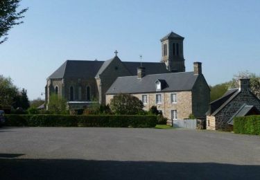
Une boucle avec majoritairement de la route et un peu de chemin. Passage à Lonlay l'Abbaye et son...abbaye (bien sûr) assez austère. La biscuiterie de Lonlay vous apportera peut être quelques bonnes odeurs à l'approche du bourg.
Wandern
Zu Fuß
Wandern

Zu Fuß

Wandern

Mountainbike
Mountainbike
Mountainbike
Mountainbike