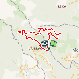
![](/images/other/stat-length.png)
![Tour Mountainbike Le Tech - Espace VTT FFC Haut Vallespir - circuit n° 8 - La Chapelle Saint Guillem - Photo](https://media.geolcdn.com/t/1900/400/ext.pjpeg?maxdim=2&url=https%3A%2F%2Fservices.sitytrail.com%2FGeolivesWS%2FDownloadMedia.ashx%3FTrailID%3D104349%26Media%3D7589_2.jpg)
Espace VTT FFC Haut Vallespir - circuit n° 8 - La Chapelle Saint Guillem
tracegps
Benutzer
![Länge](/images/other/stat-length.png)
![Maximale Höhe](https://static1.geolcdn.com/siteimages/upload/files/1508320355ic_sort_altitude_max_24dp.png)
![Positive Höhendifferenz](https://static1.geolcdn.com/siteimages/upload/files/1508320355ic_sort_den_pos_24dp.png)
![Km-Effort](/images/other/stat-length.png)
![Min. Höhe](https://static1.geolcdn.com/siteimages/upload/files/1508320355ic_sort_altitude_min_24dp.png)
![Negative Höhendifferenz](https://static1.geolcdn.com/siteimages/upload/files/1508320355ic_sort_den_neg_24dp.png)
![Boucle](https://static1.geolcdn.com/siteimages/upload/files/16400158638029165_repeat_loop_refresh_sync_direction_icon.png)
![Mountainbike](https://static1.geolcdn.com/sitytour/trail-icons/202.png)
1h30
Schwierigkeit : Medium
![Scannen Sie diesen QR-Code, um die Tour in der SityTrail-Anwendung zu öffnen](https://capi.geolives.com/qq0zvz2zws4bq2lad0pu/sitytour/trails/104349/qr.png?size=200)
Kostenlosegpshiking-Anwendung
Über SityTrail
Tour Mountainbike von 14,1 km verfügbar auf Okzitanien, Ostpyrenäen, Le Tech. Diese Tour wird von tracegps vorgeschlagen.
Beschreibung
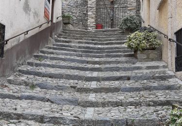
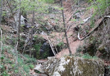
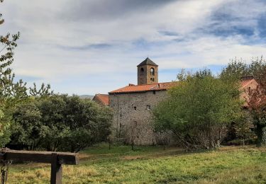
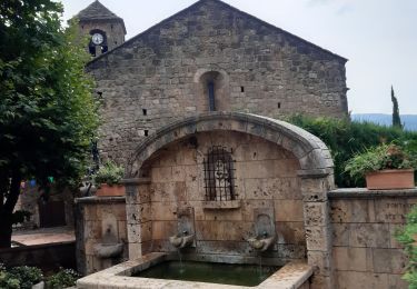
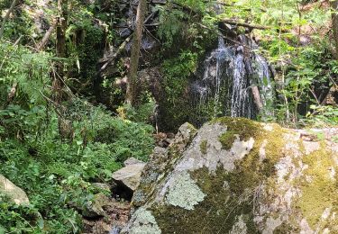
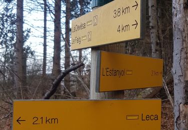
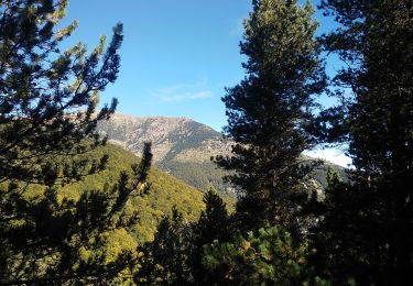
Espace VTT FFC Haut Vallespir - circuit n° 8 - La Chapelle Saint Guillem Circuit officiel labellisé par la Fédération Française de Cyclisme. Ce circuit est conçu pour les amateurs désirant expérimenter une première approche du VTT en montagne. Avec un dénivelé raisonnable et du cheminement sans aucune difficulté technique, sur de larges pistes cette balade peut même être réalisée tranquillement sur la journée. Cette randonnée dans la vallée de la Coumelade vous comblera avec un parcours riche en couleur en période automnale. Ne manquez pas l’arborétum du Haut Vallespir au pied l’ermitage de Sant Guillem de Combret. Cette halte est une priorité pour son atmosphère particulière et sa vue, avant l’ascension qui vous conduira vers la Font del Brigader. Dès lors, un retour de choix vous attend. Plongez sur la commune de Le Tech et ne manquez pas cette halte pittoresque où vous pourrez goûter à la cuisine locale chez Jeanne.
Ort
Kommentare
Touren in der Umgebung
![Tour Wandern Prats-de-Mollo-la-Preste - Parts de Mollo - Photo](https://media.geolcdn.com/t/375/260/a323d879-2e3b-49e8-a319-14cd0114ee0f.jpg&format=jpg&maxdim=2)
![Wandern Wandern](https://static1.geolcdn.com/sitytour/trail-icons/101.png)
Wandern
![](/images/other/stat-length.png)
![](https://static1.geolcdn.com/siteimages/upload/files/16400158638029165_repeat_loop_refresh_sync_direction_icon.png)
![Tour Wandern Montferrer - montferrer . El castel . Puiq de volafort .. retour par la piste - Photo](https://media.geolcdn.com/t/375/260/0038a41d-1b8d-49b6-87ad-9d0340b81119.jpg&format=jpg&maxdim=2)
![Wandern Wandern](https://static1.geolcdn.com/sitytour/trail-icons/101.png)
Wandern
![](/images/other/stat-length.png)
![](https://static1.geolcdn.com/siteimages/upload/files/16400158638029165_repeat_loop_refresh_sync_direction_icon.png)
![Tour Wandern Prats-de-Mollo-la-Preste - col du miracle a pratiquement de mollo - Photo](https://media.geolcdn.com/t/375/260/7083b552-6fd4-47f6-9fb0-9d75c7868b46.jpg&format=jpg&maxdim=2)
![Wandern Wandern](https://static1.geolcdn.com/sitytour/trail-icons/101.png)
Wandern
![](/images/other/stat-length.png)
![](https://static1.geolcdn.com/siteimages/upload/files/16400158638029165_repeat_loop_refresh_sync_direction_icon.png)
![Tour Wandern Le Tech - l,allau st guillem - Photo](https://media.geolcdn.com/t/375/260/1ac98370-8db2-4dc4-9697-e55bb3dbae72.jpg&format=jpg&maxdim=2)
![Wandern Wandern](https://static1.geolcdn.com/sitytour/trail-icons/101.png)
Wandern
![](/images/other/stat-length.png)
![](https://static1.geolcdn.com/siteimages/upload/files/16400158638029165_repeat_loop_refresh_sync_direction_icon.png)
![Tour Wandern Montferrer - montferer - Photo](https://media.geolcdn.com/t/375/260/c8bf2bfd-54cc-4016-8546-91889da7514e.jpg&format=jpg&maxdim=2)
![Wandern Wandern](https://static1.geolcdn.com/sitytour/trail-icons/101.png)
Wandern
![](/images/other/stat-length.png)
![](https://static1.geolcdn.com/siteimages/upload/files/16400158638029165_repeat_loop_refresh_sync_direction_icon.png)
![Tour Wandern Montferrer - Montferrer . El Castel . Puig de Vilafort - retour par la piste - Photo](https://media.geolcdn.com/t/375/260/42383815-0ae2-4167-8591-fc1dd32f5296.jpg&format=jpg&maxdim=2)
![Wandern Wandern](https://static1.geolcdn.com/sitytour/trail-icons/101.png)
Wandern
![](/images/other/stat-length.png)
![](https://static1.geolcdn.com/siteimages/upload/files/16400158638029165_repeat_loop_refresh_sync_direction_icon.png)
![Tour Wandern Le Tech - 3 - Photo](https://media.geolcdn.com/t/375/260/5a4186bc-56e6-4a8f-a98c-1862d1fc224e.jpg&format=jpg&maxdim=2)
![Wandern Wandern](https://static1.geolcdn.com/sitytour/trail-icons/101.png)
![Tour Wandern Corsavy - leca cabanes del faig14km 871m 4h45 - Photo](https://media.geolcdn.com/t/375/260/fa6fd1c5-d850-4de5-aa2f-243b4a5f6506.jpg&format=jpg&maxdim=2)
![Wandern Wandern](https://static1.geolcdn.com/sitytour/trail-icons/101.png)
Wandern
![](/images/other/stat-length.png)
![](https://static1.geolcdn.com/siteimages/upload/files/16400158638029165_repeat_loop_refresh_sync_direction_icon.png)
![Tour Wandern Corsavy - CORSAVY](https://media.geolcdn.com/t/375/260/35889437-1441-4d58-87b6-316e465eaf6c.jpg&format=jpg&maxdim=2)
![Wandern Wandern](https://static1.geolcdn.com/sitytour/trail-icons/101.png)
Wandern
![](/images/other/stat-length.png)
![](https://static1.geolcdn.com/siteimages/upload/files/16400158638029165_repeat_loop_refresh_sync_direction_icon.png)