![](/images/other/stat-length.png)
![Tour Wandern Wittes - La Melde - Wittes - Photo](https://media.geolcdn.com/t/1900/400/ext.pjpeg?maxdim=2&url=https%3A%2F%2Fservices.sitytrail.com%2FGeolivesWS%2FDownloadMedia.ashx%3FTrailID%3D104308%26Media%3D7536_4.jpg)
La Melde - Wittes
tracegps
Benutzer
![Länge](/images/other/stat-length.png)
Länge
9,4 km
![Maximale Höhe](https://static1.geolcdn.com/siteimages/upload/files/1508320355ic_sort_altitude_max_24dp.png)
Maximale Höhe
36 m
![Positive Höhendifferenz](https://static1.geolcdn.com/siteimages/upload/files/1508320355ic_sort_den_pos_24dp.png)
Positive Höhendifferenz
54 m
![Km-Effort](/images/other/stat-length.png)
Km-Effort
10,1 km
![Min. Höhe](https://static1.geolcdn.com/siteimages/upload/files/1508320355ic_sort_altitude_min_24dp.png)
Min. Höhe
16 m
![Negative Höhendifferenz](https://static1.geolcdn.com/siteimages/upload/files/1508320355ic_sort_den_neg_24dp.png)
Negative Höhendifferenz
51 m
![Boucle](https://static1.geolcdn.com/siteimages/upload/files/16400158638029165_repeat_loop_refresh_sync_direction_icon.png)
Boucle
Ja
Erstellungsdatum :
2014-12-10 00:00:00.0
Letzte Änderung :
2014-12-10 00:00:00.0
![Wandern](https://static1.geolcdn.com/sitytour/trail-icons/101.png)
2h19
Schwierigkeit : Medium
![Scannen Sie diesen QR-Code, um die Tour in der SityTrail-Anwendung zu öffnen](https://capi.geolives.com/qq0zvz2zws4bq2lad0pu/sitytour/trails/104308/qr.png?size=200)
Kostenlosegpshiking-Anwendung
Über SityTrail
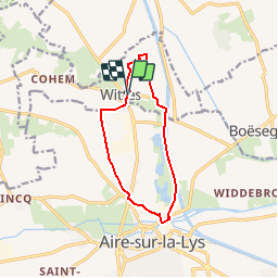
Tour Wandern von 9,4 km verfügbar auf Nordfrankreich, Pas-de-Calais, Wittes. Diese Tour wird von tracegps vorgeschlagen.
Beschreibung
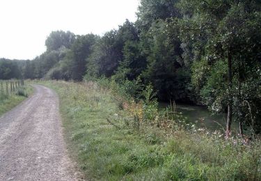
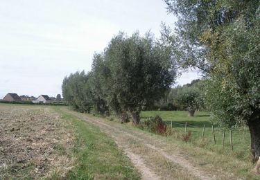
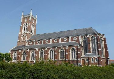
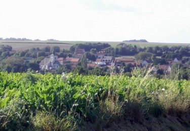
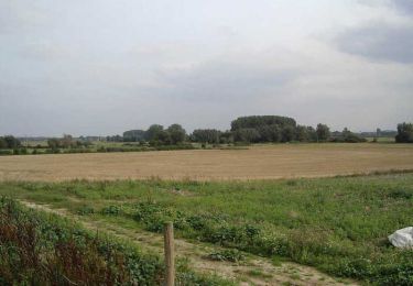
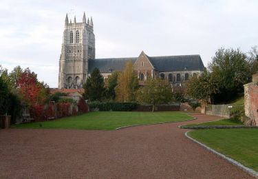
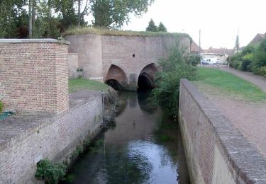
Circuit proposé par l'office de tourisme d'Aire-sur-la-Lys. Départ de la salle Louis Vicart, rue de l’église à Wittes. Retrouvez le circuit sur le site de l'office de Tourisme.
Ort
Land:
France
Region :
Nordfrankreich
Abteilung/Provinz :
Pas-de-Calais
Kommune :
Wittes
Standort:
Unknown
Gehen Sie:(Dec)
Gehen Sie:(UTM)
457092 ; 5613198 (31U) N.
Kommentare
Touren in der Umgebung
![Tour Wandern Aire-sur-la-Lys - Sentier entre Lys et Canal - Aire-sur-la-Lys - Photo](https://media.geolcdn.com/t/375/260/ext.jpg?maxdim=2&url=https%3A%2F%2Fservices.sitytrail.com%2FGeolivesWS%2FDownloadMedia.ashx%3FTrailID%3D317028%26Media%3D16170_4.jpg)
![Wandern Wandern](https://static1.geolcdn.com/sitytour/trail-icons/101.png)
Sentier entre Lys et Canal - Aire-sur-la-Lys
Wandern
Medium
(1)
Aire-sur-la-Lys,
Nordfrankreich,
Pas-de-Calais,
France
![](/images/other/stat-length.png)
10,5 km | 11,2 km-effort
2h 40min
![](https://static1.geolcdn.com/siteimages/upload/files/16400158638029165_repeat_loop_refresh_sync_direction_icon.png)
Ja
![Tour Wandern Racquinghem - Sentier d'Hugo - Racquinghem - Photo](https://media.geolcdn.com/t/375/260/ext.jpg?maxdim=2&url=https%3A%2F%2Fservices.sitytrail.com%2FGeolivesWS%2FDownloadMedia.ashx%3FTrailID%3D317013%26Media%3D16154_5.jpg)
![Wandern Wandern](https://static1.geolcdn.com/sitytour/trail-icons/101.png)
Sentier d'Hugo - Racquinghem
Wandern
Medium
Racquinghem,
Nordfrankreich,
Pas-de-Calais,
France
![](/images/other/stat-length.png)
10,4 km | 11,6 km-effort
2h 40min
![](https://static1.geolcdn.com/siteimages/upload/files/16400158638029165_repeat_loop_refresh_sync_direction_icon.png)
Ja
![Tour Wandern Aire-sur-la-Lys - Sentier du Bruveau - Aire sur la Lys - Photo](https://media.geolcdn.com/t/375/260/ext.jpg?maxdim=2&url=https%3A%2F%2Fservices.sitytrail.com%2FGeolivesWS%2FDownloadMedia.ashx%3FTrailID%3D317009%26Media%3D16148_6.jpg)
![Wandern Wandern](https://static1.geolcdn.com/sitytour/trail-icons/101.png)
Sentier du Bruveau - Aire sur la Lys
Wandern
Medium
Aire-sur-la-Lys,
Nordfrankreich,
Pas-de-Calais,
France
![](/images/other/stat-length.png)
10,8 km | 11,7 km-effort
2h 40min
![](https://static1.geolcdn.com/siteimages/upload/files/16400158638029165_repeat_loop_refresh_sync_direction_icon.png)
Ja
![Tour Wandern Roquetoire - Sentier des Héringaux - Roquetoire - Photo](https://media.geolcdn.com/t/375/260/ext.jpg?maxdim=2&url=https%3A%2F%2Fservices.sitytrail.com%2FGeolivesWS%2FDownloadMedia.ashx%3FTrailID%3D317005%26Media%3D16143_3.jpg)
![Wandern Wandern](https://static1.geolcdn.com/sitytour/trail-icons/101.png)
Sentier des Héringaux - Roquetoire
Wandern
Medium
Roquetoire,
Nordfrankreich,
Pas-de-Calais,
France
![](/images/other/stat-length.png)
13,6 km | 14,8 km-effort
3h 30min
![](https://static1.geolcdn.com/siteimages/upload/files/16400158638029165_repeat_loop_refresh_sync_direction_icon.png)
Ja
![Tour Wandern Roquetoire - Sentier de la vallée - Roquetoire - Photo](https://media.geolcdn.com/t/375/260/ext.jpg?maxdim=2&url=https%3A%2F%2Fservices.sitytrail.com%2FGeolivesWS%2FDownloadMedia.ashx%3FTrailID%3D316974%26Media%3D16097_4.jpg)
![Wandern Wandern](https://static1.geolcdn.com/sitytour/trail-icons/101.png)
Sentier de la vallée - Roquetoire
Wandern
Medium
Roquetoire,
Nordfrankreich,
Pas-de-Calais,
France
![](/images/other/stat-length.png)
10 km | 11,1 km-effort
2h 30min
![](https://static1.geolcdn.com/siteimages/upload/files/16400158638029165_repeat_loop_refresh_sync_direction_icon.png)
Ja
![Tour Wandern Racquinghem - Deux jours de randonnée autour d'Aire sur la Lys - Etape 1 - Photo](https://media.geolcdn.com/t/375/260/ext.jpg?maxdim=2&url=https%3A%2F%2Fservices.sitytrail.com%2FGeolivesWS%2FDownloadMedia.ashx%3FTrailID%3D172775%26Media%3D14198_6.jpg)
![Wandern Wandern](https://static1.geolcdn.com/sitytour/trail-icons/101.png)
Deux jours de randonnée autour d'Aire sur la Lys - Etape 1
Wandern
Schwierig
Racquinghem,
Nordfrankreich,
Pas-de-Calais,
France
![](/images/other/stat-length.png)
24 km | 26 km-effort
6h 0min
![](https://static1.geolcdn.com/siteimages/upload/files/16400158638029165_repeat_loop_refresh_sync_direction_icon.png)
Nein
![Tour Wandern Boëseghem - Circuit de la tête de Flandre (Boëseghem) - Photo](https://media.geolcdn.com/t/375/260/ext.jpg?maxdim=2&url=https%3A%2F%2Fservices.sitytrail.com%2FGeolivesWS%2FDownloadMedia.ashx%3FTrailID%3D109551%26Media%3D4132_6.jpg)
![Wandern Wandern](https://static1.geolcdn.com/sitytour/trail-icons/101.png)
Circuit de la tête de Flandre (Boëseghem)
Wandern
Medium
Boëseghem,
Nordfrankreich,
Nord,
France
![](/images/other/stat-length.png)
11,6 km | 12,6 km-effort
2h 45min
![](https://static1.geolcdn.com/siteimages/upload/files/16400158638029165_repeat_loop_refresh_sync_direction_icon.png)
Ja
![Tour Wandern Aire-sur-la-Lys - Le marais - Aire-sur-la-Lys - Photo](https://media.geolcdn.com/t/375/260/ext.jpg?maxdim=2&url=https%3A%2F%2Fservices.sitytrail.com%2FGeolivesWS%2FDownloadMedia.ashx%3FTrailID%3D104307%26Media%3D7535_6.jpg)
![Wandern Wandern](https://static1.geolcdn.com/sitytour/trail-icons/101.png)
Le marais - Aire-sur-la-Lys
Wandern
Medium
Aire-sur-la-Lys,
Nordfrankreich,
Pas-de-Calais,
France
![](/images/other/stat-length.png)
9,4 km | 9,9 km-effort
2h 19min
![](https://static1.geolcdn.com/siteimages/upload/files/16400158638029165_repeat_loop_refresh_sync_direction_icon.png)
Ja
![Tour Wandern Aire-sur-la-Lys - Promenade «à livres ouverts» à Aire sur la Lys - Photo](https://media.geolcdn.com/t/375/260/ext.jpg?maxdim=2&url=https%3A%2F%2Fservices.sitytrail.com%2FGeolivesWS%2FDownloadMedia.ashx%3FTrailID%3D172759%26Media%3D14171_6.jpg)
![Wandern Wandern](https://static1.geolcdn.com/sitytour/trail-icons/101.png)
Promenade «à livres ouverts» à Aire sur la Lys
Wandern
Einfach
Aire-sur-la-Lys,
Nordfrankreich,
Pas-de-Calais,
France
![](/images/other/stat-length.png)
2,8 km | 3 km-effort
1h 30min
![](https://static1.geolcdn.com/siteimages/upload/files/16400158638029165_repeat_loop_refresh_sync_direction_icon.png)
Ja