


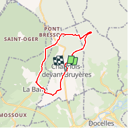

15,1 km | 18,6 km-effort

Benutzer


Kostenlosegpshiking-Anwendung
 SityTrail
IGN / Geografische Institute
SityTrail World
Die Welt öffnet sich für Sie
Tour Mountainbike von 10,5 km verfügbar auf Großer Osten, Vogesen, Charmois-devant-Bruyères. Diese Tour wird von tracegps vorgeschlagen.
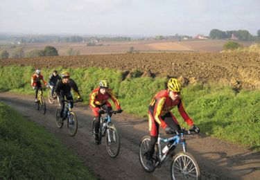
Espace VTT FFC Chemins du Cœur des Vosges - circuit n°69 - Le Montet. Circuit officiel labellisé par la Fédération Française de Cyclisme. Parcours difficile à travers la forêt de Faîte (Ban de Vaudicourt).

Zu Fuß
Hybrid-Bike
Wandern
Hybrid-Bike
Schneeschuhwandern
Wandern
Wandern
Mountainbike
Mountainbike