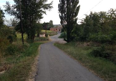
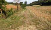
Tour Wandern Raissac-sur-Lampy - Raissac to Villelongue via La Combe Belle - Photo

Raissac to Villelongue via La Combe Belle

 livfoss
livfoss

Benutzer

© OpenStreetMap contributors
Länge
Länge
13,4 km
Maximale Höhe
Maximale Höhe
254 m
Positive Höhendifferenz
259 m
Km-Effort
Km-Effort  
16,9 km
Min. Höhe
Min. Höhe
131 m
Negative Höhendifferenz
259 m
Boucle
Boucle
Ja
Erstellungsdatum :
2019-01-15 16:29:27.609
Letzte Änderung :
2019-01-15 16:29:27.609

(0 Nachricht)

Wandern
Wandern
3h38
Schwierigkeit : Medium

Scannen Sie diesen QR-Code, um die Tour in der SityTrail-Anwendung zu öffnen

Kostenlosegpshiking-Anwendung

Logo SityTrail SityTrail

IGN / Geografische Institute

SityTrail aus dem App Store herunterladen SityTrail von Google Play herunterladen

Logo SityTrail SityTrail World

Die Welt öffnet sich für Sie

SityTrail aus dem App Store herunterladen SityTrail von Google Play herunterladen SityTrail auf Huawei AppGallery herunterladen

Über SityTrail

Tour Wandern von 13,4 km verfügbar auf Okzitanien, Aude, Raissac-sur-Lampy. Diese Tour wird von livfoss vorgeschlagen.

Beschreibung

A variation on the Raissac -> La Migance -> Villelongue route. Plenty of height. Unusually this walk is in the anticlockwise direction.

Höhenprofil

Foto-Galerie

POIs

POI Raissac-sur-Lampy - Raissac Church - Photo
livfoss
RAISSAC-SUR-LAMPY 
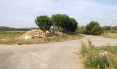
POI Raissac-sur-Lampy - Turn right at the pile of stones - Photo
livfoss
POI Raissac-sur-Lampy - Hut with Saint - Photo
livfoss
RAISSAC-SUR-LAMPY 
POI Alzonne - Cattle above La Migance - Photo
livfoss
POI Alzonne - Ford over Vernassonne - Photo
livfoss
POI Alzonne - La Migance Farm - Photo
livfoss
POI Alzonne - Leaving the road - Photo
livfoss
POI Alzonne - Top of the hill - Photo
livfoss
POI Saint-Martin-le-Vieil - Beehives - Photo
livfoss
SAINT-MARTIN-LE-VIEIL 
POI Saint-Martin-le-Vieil - Starting descent - Photo
livfoss
SAINT-MARTIN-LE-VIEIL 
POI Saint-Martin-le-Vieil - Towards Villelongue - Photo
livfoss
SAINT-MARTIN-LE-VIEIL 
POI Saint-Martin-le-Vieil - Crossroads - Photo
livfoss
SAINT-MARTIN-LE-VIEIL 
POI Saint-Martin-le-Vieil - Abbaye de Villelongue - Photo
livfoss
SAINT-MARTIN-LE-VIEIL 
POI Saint-Martin-le-Vieil - Low route towards St Martin - Photo
livfoss
SAINT-MARTIN-LE-VIEIL 
POI Saint-Martin-le-Vieil - Aude valley panorama - Photo
livfoss
SAINT-MARTIN-LE-VIEIL 
POI Saint-Martin-le-Vieil - Raissac in the distance? - Photo
livfoss
SAINT-MARTIN-LE-VIEIL 
POI Raissac-sur-Lampy - La Piousou - Photo
livfoss
RAISSAC-SUR-LAMPY 

Ort

Land:
France
Region :
Okzitanien
Abteilung/Provinz :
Aude
Kommune :
Raissac-sur-Lampy
Standort:
Unknown
Gehen Sie:(Dec)
Gehen Sie:(UTM)
431835 ; 4791904 (31T) N.

Touren in der Umgebung

Tour Wandern Montolieu - Montolieu Moulins de la Dure - Photo
Wandern
dufland

Wandern

Einfach
(1)
Montolieu, Okzitanien, Aude, France
6,6 km | 8,7 km-effort
2h 0min
Ja
Tour Wandern Saint-Martin-le-Vieil - 11_Saint Martin le Vieil - Photo
Wandern
jab31

Wandern

Medium
(1)
Saint-Martin-le-Vieil, Okzitanien, Aude, France
17,6 km | 23 km-effort
4h 31min
Ja

Tour Wandern Saint-Martin-le-Vieil - le sentier de St Martin  - Photo
Wandern
bernardbelmas

Wandern

Einfach
Saint-Martin-le-Vieil, Okzitanien, Aude, France
31 km | 38 km-effort
3h 35min
Nein
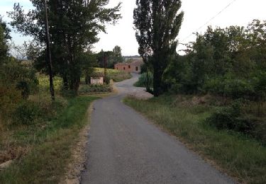
Tour Wandern Raissac-sur-Lampy - Raissac to Villelongue via La Combe Belle - Photo
Wandern
livfoss

Wandern

Medium
Raissac-sur-Lampy, Okzitanien, Aude, France
13,4 km | 16,8 km-effort
3h 38min
Ja
Tour Wandern Raissac-sur-Lampy - Raissac to Villelongue via La Combe Belle - Photo
Wandern
livfoss

Wandern

Medium
Raissac-sur-Lampy, Okzitanien, Aude, France
13,4 km | 16,9 km-effort
3h 38min
Ja
Tour Wandern Raissac-sur-Lampy - Pacerpoles First Outing - Photo
Wandern
livfoss

Wandern

Einfach
(1)
Raissac-sur-Lampy, Okzitanien, Aude, France
11,2 km | 13,5 km-effort
2h 57min
Ja

Tour Elektrofahrrad Bram - 2024_07_20_bram_Trebes - Photo
Elektrofahrrad
jpborto

Elektrofahrrad

Sehr leicht
Bram, Okzitanien, Aude, France
40 km | 43 km-effort
Unbekannt
Nein
Tour Wandern Villespy - Villespy - Photo
Wandern
jpp2caunes

Wandern

Sehr leicht
Villespy, Okzitanien, Aude, France
13,8 km | 16,9 km-effort
6h 56min
Ja
Tour Wandern Montolieu - Cap de Pic - Photo
Wandern
Mascart

Wandern

Medium
Montolieu, Okzitanien, Aude, France
11,1 km | 14 km-effort
3h 16min
Ja


Schließen
Meine Abonnements