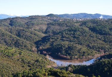
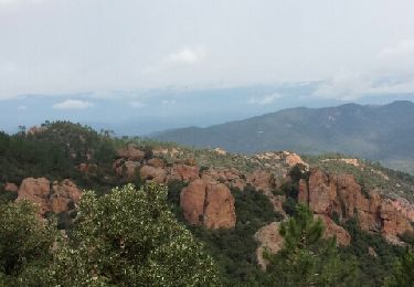
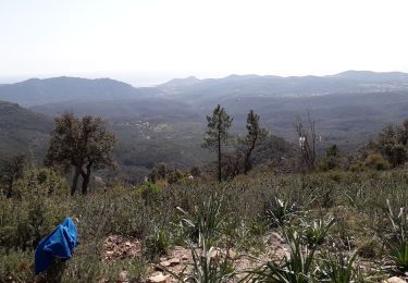
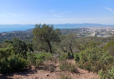
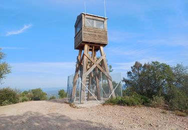
Tour Fahrrad Fréjus - Tour de l'Esterel - Saint Raphael - Photo

Tour de l'Esterel - Saint Raphael

 tracegps
tracegps

Benutzer

© OpenStreetMap contributors
Länge
Länge
56 km
Maximale Höhe
Maximale Höhe
333 m
Positive Höhendifferenz
1089 m
Km-Effort
Km-Effort  
70 km
Min. Höhe
Min. Höhe
0 m
Negative Höhendifferenz
1108 m
Boucle
Boucle
Nein
Erstellungsdatum :
2014-12-10 00:00:00.0
Letzte Änderung :
2014-12-10 00:00:00.0

(1 Nachricht)

Fahrrad
Fahrrad
2h15
Schwierigkeit : Medium

Scannen Sie diesen QR-Code, um die Tour in der SityTrail-Anwendung zu öffnen

Kostenlosegpshiking-Anwendung

Logo SityTrail SityTrail

IGN / Geografische Institute

SityTrail aus dem App Store herunterladen SityTrail von Google Play herunterladen

Logo SityTrail SityTrail World

Die Welt öffnet sich für Sie

SityTrail aus dem App Store herunterladen SityTrail von Google Play herunterladen SityTrail auf Huawei AppGallery herunterladen

Über SityTrail

Tour Fahrrad von 56 km verfügbar auf Provence-Alpes-Côte d'Azur, Var, Fréjus. Diese Tour wird von tracegps vorgeschlagen.

Beschreibung

Tour de la forêt domaniale de l'Estérel au départ de St Raphaël.

Höhenprofil

POIs

POI Crazannes - 001 - Photo
tracegps
CRAZANNES 
POI Vichy - 1 bis etape Vi - Photo
tracegps
POI Vichy - 1 etape Vichy - Photo
tracegps
POI Buxières-sous-Montaigut - 2 etape Vichy - Photo
tracegps
BUXIÈRES-SOUS-MONTAIGUT 
POI Chénérailles - 3 etape Vich 1 - Photo
tracegps
CHÉNÉRAILLES 
POI Chénérailles - 3 etape Vichy - Photo
tracegps
CHÉNÉRAILLES 
POI Bessines-sur-Gartempe - 4bis etape Vic - Photo
tracegps
BESSINES-SUR-GARTEMPE 
POI Confolens - 5 etape Vich 1 - Photo
tracegps
CONFOLENS 
POI Confolens - 5 etape Vichy - Photo
tracegps
CONFOLENS 
POI Marcillac-Lanville - 6 etape Vichy - Photo
tracegps
MARCILLAC-LANVILLE 
POI Plassay - 7 etape Vichy - Photo
tracegps
PLASSAY 
POI Grenoble - aller Mo 4.455 - Photo
tracegps
GRENOBLE 
POI Ambérac - amberac - Photo
tracegps
AMBÉRAC 
POI Blond - belleix - Photo
tracegps
BLOND 
POI Blond - blond - Photo
tracegps
BLOND 
POI Val-d'Auge - bonneville - Photo
tracegps
VAL-D'AUGE 
POI Brie-sous-Matha - brie sous mart - Photo
tracegps
BRIE-SOUS-MATHA 
POI Cellefrouin - cellefrouin - Photo
tracegps
CELLEFROUIN 
POI Cellettes - cellettes - Photo
tracegps
CELLETTES 
POI Champagne - champagne - Photo
tracegps
CHAMPAGNE 
POI Charavines - charavines - Photo
tracegps
CHARAVINES 
POI Châteauponsac - chateau ponsac - Photo
tracegps
CHÂTEAUPONSAC 
POI Chirens - Chirens - Photo
tracegps
CHIRENS 
POI Merlas - Col 1000 marty - Photo
tracegps
POI Coublevie - Croix Bayard - Photo
tracegps
COUBLEVIE 
POI Saint-Sulpice-d'Arnoult - D18 - Photo
tracegps
SAINT-SULPICE-D'ARNOULT 
POI Villars-les-Bois - D731 - Photo
tracegps
VILLARS-LES-BOIS 
POI Marcillac-Lanville - D736 - Photo
tracegps
MARCILLAC-LANVILLE 
POI Saint-Geoire-en-Valdaine - D82 - Photo
tracegps
SAINT-GEOIRE-EN-VALDAINE 
POI Écoyeux - ecoyeux - Photo
tracegps
ÉCOYEUX 
POI Engins - engins1 - Photo
tracegps
ENGINS 
POI Voreppe - Fin piste - Photo
tracegps
VOREPPE 
POI Lans-en-Vercors - jaume - Photo
tracegps
LANS-EN-VERCORS 
POI Bresdon - la revetizon - Photo
tracegps
BRESDON 
POI Montrol-Sénard - la valette - Photo
tracegps
MONTROL-SÉNARD 
POI Sonnac - les vignes - Photo
tracegps
SONNAC 
POI Migron - migron - Photo
tracegps
MIGRON 
POI Voreppe - mille martyrs - Photo
tracegps
VOREPPE 
POI Miribel-les-Échelles - Miribel - Photo
tracegps
MIRIBEL-LES-ÉCHELLES 
POI Mons - monsz - Photo
tracegps
MONS 
POI Montferrat - Montferrat - Photo
tracegps
MONTFERRAT 
POI Val-d'Auge - montigne - Photo
tracegps
VAL-D'AUGE 
POI Sassenage - piedmontee - Photo
tracegps
SASSENAGE 
POI Port-d'Envaux - pont d'enveaux - Photo
tracegps
PORT-D'ENVAUX 
POI Pont-l'Abbé-d'Arnoult - pont l'abbe d' - Photo
tracegps
PONT-L'ABBÉ-D'ARNOULT 
POI Saint-Front - romefort - Photo
tracegps
SAINT-FRONT 
POI Saint-Pardoux-le-Lac - roussac - Photo
tracegps
SAINT-PARDOUX-LE-LAC 
POI Siecq - siecq - Photo
tracegps
SIECQ 
POI Saint-Claud - st claude - Photo
tracegps
SAINT-CLAUD 
POI Saint-Christophe - st crhistophe - Photo
tracegps
SAINT-CHRISTOPHE 
POI Port-d'Envaux - st james - Photo
tracegps
PORT-D'ENVAUX 
POI Saint-Jean-d'Angle - st jean d'angl - Photo
tracegps
SAINT-JEAN-D'ANGLE 
POI Saint-Junien-les-Combes - st junien les - Photo
tracegps
SAINT-JUNIEN-LES-COMBES 
POI Saint-Just-Luzac - st just luzac - Photo
tracegps
SAINT-JUST-LUZAC 
POI Saint-Laurent-du-Pont - St laurent G - Photo
tracegps
SAINT-LAURENT-DU-PONT 
POI Saint-Porchaire - st porchaire - Photo
tracegps
SAINT-PORCHAIRE 
POI Grenoble - vercors et dio - Photo
tracegps
GRENOBLE 
POI Villard-de-Lans - villard 1 - Photo
tracegps
VILLARD-DE-LANS 
POI Villognon - villognon - Photo
tracegps
VILLOGNON 

Ort

Land:
France
Region :
Provence-Alpes-Côte d'Azur
Abteilung/Provinz :
Var
Kommune :
Fréjus
Standort:
Unknown
Gehen Sie:(Dec)
Gehen Sie:(UTM)
319250 ; 4813097 (32T) N.

Kommentare

Bitte melden Sie sich an, um einen Kommentar oder eine Bewertung zu hinterlassen


Touren in der Umgebung

Tour Wandern Fréjus - Lac de l'Avelan au départ du col d'Auriasque - Photo
Wandern
LtZIP

Wandern

Einfach
(2)
Fréjus, Provence-Alpes-Côte d'Azur, Var, France
16,6 km | 23 km-effort
5h 39min
Ja
Tour Mountainbike Fréjus - grand tour esterel par belles pistes larges - Photo
Mountainbike
Margaide

Mountainbike

Einfach
(2)
Fréjus, Provence-Alpes-Côte d'Azur, Var, France
31 km | 40 km-effort
3h 17min
Ja
Tour Wandern Fréjus - Mont Vinaigre par Colle Douce - Photo
Wandern

Wandern

Sehr schwierig
(1)
Fréjus, Provence-Alpes-Côte d'Azur, Var, France
22 km | 33 km-effort
6h 1min
Ja
Tour Wandern Fréjus - Sortie du lundi 8 janvier aprés-midi - Photo
Wandern
OB83700

Wandern

Medium
(1)
Fréjus, Provence-Alpes-Côte d'Azur, Var, France
7,4 km | 10,7 km-effort
2h 50min
Ja
Tour Zu Fuß Saint-Raphaël - St RAPHAEL-Les lacs- l Essuyadou le Vallon du Cabre-DRI - Photo
Zu Fuß

Zu Fuß

Einfach
(1)
Saint-Raphaël, Provence-Alpes-Côte d'Azur, Var, France
10,2 km | 13,1 km-effort
2h 58min
Ja
Tour Wandern Saint-Raphaël - Peïre Sarade à Ancienne Carrière de Dramont - Photo
Wandern
LtZIP

Wandern

Sehr leicht
(1)
Saint-Raphaël, Provence-Alpes-Côte d'Azur, Var, France
13,6 km | 19,5 km-effort
4h 4min
Ja
Tour Mountainbike Fréjus - Roc Odyssée 2015 - Photo
Mountainbike
Dominick

Mountainbike

Medium
(1)
Fréjus, Provence-Alpes-Côte d'Azur, Var, France
37 km | 47 km-effort
3h 55min
Nein
Tour Mountainbike Fréjus - Tour des Petites Maures - Photo
Mountainbike
barberou

Mountainbike

Sehr leicht
(2)
Fréjus, Provence-Alpes-Côte d'Azur, Var, France
40 km | 52 km-effort
Unbekannt
Ja
Tour Wandern Saint-Raphaël - Rando Light (A) depuis le Parcours Sportif St Raphaël - Photo
Wandern
donda

Wandern

Sehr leicht
Saint-Raphaël, Provence-Alpes-Côte d'Azur, Var, France
10,4 km | 13,5 km-effort
3h 3min
Ja


Schließen
Meine Abonnements