


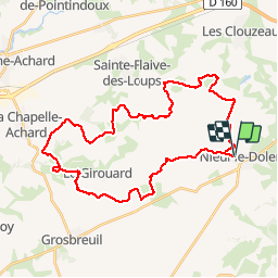

22 km | 25 km-effort


Benutzer


Kostenlosegpshiking-Anwendung
 SityTrail
IGN / Geografische Institute
SityTrail World
Die Welt öffnet sich für Sie
Tour Mountainbike von 37 km verfügbar auf Pays de la Loire, Vendée, Nieul-le-Dolent. Diese Tour wird von tracegps vorgeschlagen.
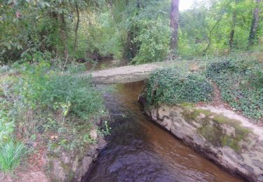
Circuit perso. Beaucoup de bonheur. Attention, quelques passages de gué très humides (passerelles possibles). Essayez le !


Wandern
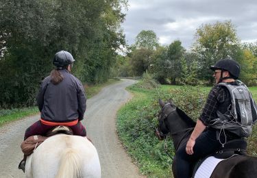
Reiten

Wandern

Zu Fuß

Mountainbike
Wandern
Wandern
Zu Fuß

