


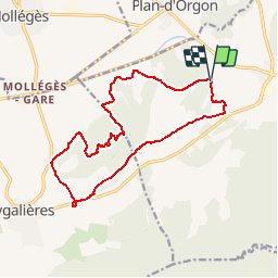


16,3 km | 21 km-effort

Benutzer


Kostenlosegpshiking-Anwendung
 SityTrail
IGN / Geografische Institute
SityTrail World
Die Welt öffnet sich für Sie
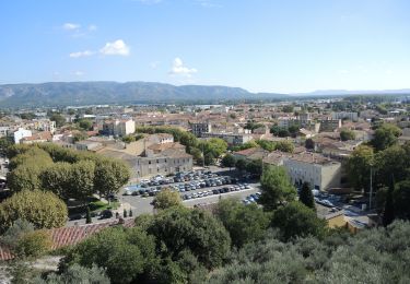
Tour Wandern von 15,7 km verfügbar auf Provence-Alpes-Côte d'Azur, Bouches-du-Rhône, Orgon. Diese Tour wird von tracegps vorgeschlagen.
Parcours assez facile prés des Alpilles au beau milieu de la Provence (superbe). Le parcours convient à des enfants à partir de 10/12 ans


Wandern

Fahrrad

Fahrrad

Fahrrad

Wandern
Wandern
Wandern

Wandern
Wandern