![](/images/other/stat-length.png)
![Tour Laufen Lalinde - Lalinde - Baneuil - Photo](https://media.geolcdn.com/t/1900/400/ext.pjpeg?maxdim=2&url=https%3A%2F%2Fstatic1.geolcdn.com%2Fsiteimages%2Fupload%2Ffiles%2F1524743154running.jpg)
Lalinde - Baneuil
tracegps
Benutzer
![Länge](/images/other/stat-length.png)
![Maximale Höhe](https://static1.geolcdn.com/siteimages/upload/files/1508320355ic_sort_altitude_max_24dp.png)
![Positive Höhendifferenz](https://static1.geolcdn.com/siteimages/upload/files/1508320355ic_sort_den_pos_24dp.png)
![Km-Effort](/images/other/stat-length.png)
![Min. Höhe](https://static1.geolcdn.com/siteimages/upload/files/1508320355ic_sort_altitude_min_24dp.png)
![Negative Höhendifferenz](https://static1.geolcdn.com/siteimages/upload/files/1508320355ic_sort_den_neg_24dp.png)
![Boucle](https://static1.geolcdn.com/siteimages/upload/files/16400158638029165_repeat_loop_refresh_sync_direction_icon.png)
![Laufen](https://static1.geolcdn.com/sitytour/trail-icons/103.png)
1h30
Schwierigkeit : Schwierig
![Scannen Sie diesen QR-Code, um die Tour in der SityTrail-Anwendung zu öffnen](https://capi.geolives.com/qq0zvz2zws4bq2lad0pu/sitytour/trails/102941/qr.png?size=200)
Kostenlosegpshiking-Anwendung
Über SityTrail
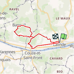
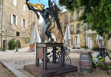
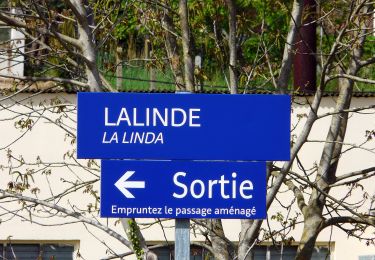
Tour Laufen von 12,8 km verfügbar auf Neu-Aquitanien, Dordogne, Lalinde. Diese Tour wird von tracegps vorgeschlagen.
Beschreibung
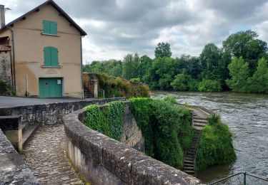
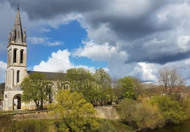
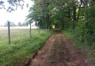
Parcours d'entraînement à difficulté variable. Échauffement sur 3,5km de plat avant côte de St Sulpice. A Les Magnacs, chemin GR en forêt jusqu'à Baneuil. Puis retour sur route jusqu'au Bailleries. Forêt avec côte jusqu'au Magnacs puis route jusqu'à Chemin Rouge. Final en forêt avec passages étriqués caillouteux. Forte montée avant redescente sur Lalinde.
Ort
Kommentare
Touren in der Umgebung
![Tour Zu Fuß Bayac - Boucle du rocher du corbeau - Photo](https://media.geolcdn.com/t/375/260/a01af072-2115-4f76-b70a-38b560fb26f8.jpeg&format=jpg&maxdim=2)
![Zu Fuß Zu Fuß](https://static1.geolcdn.com/sitytour/trail-icons/100.png)
Zu Fuß
![](/images/other/stat-length.png)
![](https://static1.geolcdn.com/siteimages/upload/files/16400158638029165_repeat_loop_refresh_sync_direction_icon.png)
![Tour Rennrad Lalinde - J5 Montpazier - Photo](https://media.geolcdn.com/t/375/260/fb9d0b69-e2e2-4675-8d66-fb9a6bacc3d8.jpg&format=jpg&maxdim=2)
![Rennrad Rennrad](https://static1.geolcdn.com/sitytour/trail-icons/201.png)
Rennrad
![](/images/other/stat-length.png)
![](https://static1.geolcdn.com/siteimages/upload/files/16400158638029165_repeat_loop_refresh_sync_direction_icon.png)
![Tour Rennrad Lalinde - J4 La Vézère Les Eyzies - Photo](https://media.geolcdn.com/t/375/260/d56817ab-ff5e-4eb7-9859-4a4ae1248a9d.jpg&format=jpg&maxdim=2)
![Rennrad Rennrad](https://static1.geolcdn.com/sitytour/trail-icons/201.png)
Rennrad
![](/images/other/stat-length.png)
![](https://static1.geolcdn.com/siteimages/upload/files/16400158638029165_repeat_loop_refresh_sync_direction_icon.png)
![Tour Rennrad Lalinde - J3 Rives Dordogne Bergerac - Photo](https://media.geolcdn.com/t/375/260/c8141807-4c11-44f2-beef-7451f05db207.jpg&format=jpg&maxdim=2)
![Rennrad Rennrad](https://static1.geolcdn.com/sitytour/trail-icons/201.png)
Rennrad
![](/images/other/stat-length.png)
![](https://static1.geolcdn.com/siteimages/upload/files/16400158638029165_repeat_loop_refresh_sync_direction_icon.png)
![Tour Rennrad Lalinde - J2 Bergerac et Montbazillac - Photo](https://media.geolcdn.com/t/375/260/8c3c065b-e426-4bd0-b47e-b913070b649b.jpg&format=jpg&maxdim=2)
![Rennrad Rennrad](https://static1.geolcdn.com/sitytour/trail-icons/201.png)
Rennrad
![](/images/other/stat-length.png)
![](https://static1.geolcdn.com/siteimages/upload/files/16400158638029165_repeat_loop_refresh_sync_direction_icon.png)
![Tour Zu Fuß Couze-et-Saint-Front - Boucle de Saint-Front - Photo](https://media.geolcdn.com/t/375/260/68d660a2-8ed7-45f4-8c15-04cab9323f1e.jpeg&format=jpg&maxdim=2)
![Zu Fuß Zu Fuß](https://static1.geolcdn.com/sitytour/trail-icons/100.png)
Zu Fuß
![](/images/other/stat-length.png)
![](https://static1.geolcdn.com/siteimages/upload/files/16400158638029165_repeat_loop_refresh_sync_direction_icon.png)
![Tour Wandern Lalinde - Boucle de Pontour(modifiée) - Photo](https://media.geolcdn.com/t/375/260/dfd1470c-f46a-429d-81a7-c0de5e51c4f9.jpg&format=jpg&maxdim=2)
![Wandern Wandern](https://static1.geolcdn.com/sitytour/trail-icons/101.png)
Wandern
![](/images/other/stat-length.png)
![](https://static1.geolcdn.com/siteimages/upload/files/16400158638029165_repeat_loop_refresh_sync_direction_icon.png)
![Tour Wandern Beaumontois en Périgord - boucle bannes - Photo](https://media.geolcdn.com/t/375/260/ext.jpg?maxdim=2&url=https%3A%2F%2Fservices.sitytrail.com%2FGeolivesWS%2FDownloadMedia.ashx%3FTrailID%3D332998%26Media%3Dfix__20140810111605.jpg)
![Wandern Wandern](https://static1.geolcdn.com/sitytour/trail-icons/101.png)
Wandern
![](/images/other/stat-length.png)
![](https://static1.geolcdn.com/siteimages/upload/files/16400158638029165_repeat_loop_refresh_sync_direction_icon.png)
![Tour Wandern Badefols-sur-Dordogne - Badefols Tremola Limeuil - Photo](https://media.geolcdn.com/t/375/260/ext.jpg?maxdim=2&url=https%3A%2F%2Fservices.sitytrail.com%2FGeolivesWS%2FDownloadMedia.ashx%3FTrailID%3D268029%26Media%3D20120812110708.jpeg)
![Wandern Wandern](https://static1.geolcdn.com/sitytour/trail-icons/101.png)
Wandern
![](/images/other/stat-length.png)
![](https://static1.geolcdn.com/siteimages/upload/files/16400158638029165_repeat_loop_refresh_sync_direction_icon.png)