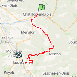
![](/images/other/stat-length.png)
![Tour Mountainbike Châtillon-en-Diois - Grande Traversée des PréAlpes à VTT : Châtillon en Diois - Luc en Diois - Photo](https://media.geolcdn.com/t/1900/400/ext.pjpeg?maxdim=2&url=https%3A%2F%2Fservices.sitytrail.com%2FGeolivesWS%2FDownloadMedia.ashx%3FTrailID%3D102140%26Media%3D2530_2.jpg)
Grande Traversée des PréAlpes à VTT : Châtillon en Diois - Luc en Diois
tracegps
Benutzer
![Länge](/images/other/stat-length.png)
![Maximale Höhe](https://static1.geolcdn.com/siteimages/upload/files/1508320355ic_sort_altitude_max_24dp.png)
![Positive Höhendifferenz](https://static1.geolcdn.com/siteimages/upload/files/1508320355ic_sort_den_pos_24dp.png)
![Km-Effort](/images/other/stat-length.png)
![Min. Höhe](https://static1.geolcdn.com/siteimages/upload/files/1508320355ic_sort_altitude_min_24dp.png)
![Negative Höhendifferenz](https://static1.geolcdn.com/siteimages/upload/files/1508320355ic_sort_den_neg_24dp.png)
![Boucle](https://static1.geolcdn.com/siteimages/upload/files/16400158638029165_repeat_loop_refresh_sync_direction_icon.png)
![Mountainbike](https://static1.geolcdn.com/sitytour/trail-icons/202.png)
2h45
Schwierigkeit : Schwierig
![Scannen Sie diesen QR-Code, um die Tour in der SityTrail-Anwendung zu öffnen](https://capi.geolives.com/qq0zvz2zws4bq2lad0pu/sitytour/trails/102140/qr.png?size=200)
Kostenlosegpshiking-Anwendung
Über SityTrail
Tour Mountainbike von 22 km verfügbar auf Auvergne-Rhone-Alpen, Drôme, Châtillon-en-Diois. Diese Tour wird von tracegps vorgeschlagen.
Beschreibung
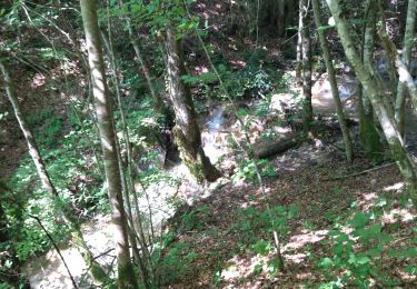
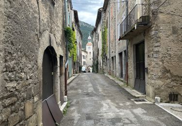
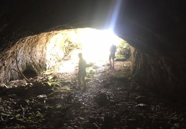
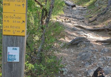
Grande Traversée des Préalpes, les Chemins du Soleil. Parcours officiel labellisé par la Fédération Française de Cyclisme. Parcours Grenoble Sisteron – Tronçon n° 9 Niveau: difficile dans l'ensemble, avec notamment l'ascension du col du Pinet (1196m). Mesure de prudence: passage exposé et dangereux avant le tunnel (point 4). Portage sur sentier avec main courante. La variante et plus facile et moins dangereuse. Consultez toutes les informations sur les hébergements et les services associés sur la fiche du tronçon. Retrouvez cette traversée dans l’indispensable topo Guide Chamina Grande Traversée des Préalpes
Ort
Kommentare
Touren in der Umgebung
![Tour Wandern Châtillon-en-Diois - chatillon en Diois, GR91 - Photo](https://media.geolcdn.com/t/375/260/ext.jpg?maxdim=2&url=https%3A%2F%2Fstatic1.geolcdn.com%2Fsiteimages%2Fupload%2Ffiles%2F1553511878bg_sport_marche.png)
![Wandern Wandern](https://static1.geolcdn.com/sitytour/trail-icons/101.png)
Wandern
![](/images/other/stat-length.png)
![](https://static1.geolcdn.com/siteimages/upload/files/16400158638029165_repeat_loop_refresh_sync_direction_icon.png)
![Tour Wandern Châtillon-en-Diois - Pas des CLots - Photo](https://media.geolcdn.com/t/375/260/ext.jpg?maxdim=2&url=https%3A%2F%2Fstatic1.geolcdn.com%2Fsiteimages%2Fupload%2Ffiles%2F1553511878bg_sport_marche.png)
![Wandern Wandern](https://static1.geolcdn.com/sitytour/trail-icons/101.png)
Wandern
![](/images/other/stat-length.png)
![](https://static1.geolcdn.com/siteimages/upload/files/16400158638029165_repeat_loop_refresh_sync_direction_icon.png)
![Tour Wandern Châtillon-en-Diois - glandasse par chatillon - Photo](https://media.geolcdn.com/t/375/260/ext.jpg?maxdim=2&url=https%3A%2F%2Fstatic1.geolcdn.com%2Fsiteimages%2Fupload%2Ffiles%2F1553511878bg_sport_marche.png)
![Wandern Wandern](https://static1.geolcdn.com/sitytour/trail-icons/101.png)
Wandern
![](/images/other/stat-length.png)
![](https://static1.geolcdn.com/siteimages/upload/files/16400158638029165_repeat_loop_refresh_sync_direction_icon.png)
![Tour Wandern Châtillon-en-Diois - 26 grotte pellebit en traversee zel - Photo](https://media.geolcdn.com/t/375/260/d6c0b607-c5a4-4107-b67d-2ad35a261578.jpg&format=jpg&maxdim=2)
![Wandern Wandern](https://static1.geolcdn.com/sitytour/trail-icons/101.png)
Wandern
![](/images/other/stat-length.png)
![](https://static1.geolcdn.com/siteimages/upload/files/16400158638029165_repeat_loop_refresh_sync_direction_icon.png)
![Tour sport Châtillon-en-Diois - Châtillon en Diois col de Caux - Photo](https://media.geolcdn.com/t/375/260/c2c24153-915d-4a7e-8317-09a44e8b139f.jpg&format=jpg&maxdim=2)
sport
![](/images/other/stat-length.png)
![](https://static1.geolcdn.com/siteimages/upload/files/16400158638029165_repeat_loop_refresh_sync_direction_icon.png)
![Wandern Wandern](https://static1.geolcdn.com/sitytour/trail-icons/101.png)
Wandern
![](/images/other/stat-length.png)
![](https://static1.geolcdn.com/siteimages/upload/files/16400158638029165_repeat_loop_refresh_sync_direction_icon.png)
![Tour Wandern Châtillon-en-Diois - Cabane de Chatillon - Photo](https://media.geolcdn.com/t/375/260/ea94f18f-fca1-490f-aab1-2356b5263731.jpg&format=jpg&maxdim=2)
![Wandern Wandern](https://static1.geolcdn.com/sitytour/trail-icons/101.png)
Wandern
![](/images/other/stat-length.png)
![](https://static1.geolcdn.com/siteimages/upload/files/16400158638029165_repeat_loop_refresh_sync_direction_icon.png)
![Tour Wandern Châtillon-en-Diois - chatillon en Diois. les oursieres - Photo](https://media.geolcdn.com/t/375/260/ace35cbf-82be-45d6-acf9-562fc9f92be7.jpg&format=jpg&maxdim=2)
![Wandern Wandern](https://static1.geolcdn.com/sitytour/trail-icons/101.png)
Wandern
![](/images/other/stat-length.png)
![](https://static1.geolcdn.com/siteimages/upload/files/16400158638029165_repeat_loop_refresh_sync_direction_icon.png)
![Tour Wandern Châtillon-en-Diois - Chatillon en Diois la cabane - Photo](https://media.geolcdn.com/t/375/260/b72ec95b-4be8-438a-b0bc-6acf148e2da5.jpg&format=jpg&maxdim=2)
![Wandern Wandern](https://static1.geolcdn.com/sitytour/trail-icons/101.png)
Wandern
![](/images/other/stat-length.png)
![](https://static1.geolcdn.com/siteimages/upload/files/16400158638029165_repeat_loop_refresh_sync_direction_icon.png)